Summer 2005
Summer 2005 |
|||||||
|
|
|||||||
Version 2005: Additional Services, Enhanced Response Time
New Version of ArcWeb Services Allows Users to Customize Services |
|||
|
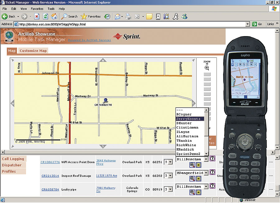
ArcWeb Services 2005 will significantly extend the ability to create GIS applications on the Web. Highlights of this release include the enhanced ability to customize maps for specific needs and the ability to track mobile phones using emerging location-based services.
ArcWeb Services let users and developers create geocentric applications as well as quickly and easily add mapping and spatial functionality to any Web-based application. Examples of how ArcWeb Services can be used include data geovisualization, locators, tracking, and business intelligence. With ArcWeb Services 2005, subscribers can create, manage, and publish custom services. This means that ArcWeb Services subscribers can upload their own point, line, and polygon data to ArcWeb Services; perform custom rendering; then share these with others. End users can perform spatial queries on the uploaded data, such as point-in-polygon queries and find nearest facility. New services available in ArcWeb Services 2005 include the Location service for companies needing to track their mobile assets. The Location service enables subscribing companies to locate and track their cellular phones and send SMS messages. A GPS-enabled phone is not needed to use this service, which is made possible through partnerships with Sprint and Bell Mobility. ArcWeb Services 2005 also allow turn-by-turn maps for routing; routing around barriers, including live traffic; and drive-time polygons. The ArcWeb Services 2005 enhancements are available via a new online portal. This portal includes a Builder for uploading and storing custom points, lines, and polygons. The Builder can then create custom layers and services using combinations of a customer's own data and Esri's data. The portal also includes a Content Library that will make it easy to discover available content and account administration tools that allow users to see how they've used their credits and enable group administrators to manage groups of users. Esri has also made several improvements in the performance of ArcWeb Services. For example, users will experience up to a 60 percent reduction in the time it takes to service street map image requests. Maps will also be available through SVG and Flash for improved performance. In addition, as part of Esri's ongoing commitment to expanding the range of data available via ArcWeb Services, customers can expect several new data sources to become available soon. These data sources include
For more information on ArcWeb Services or to get a 30-day evaluation, visit www.esri.com/arcweb or call Esri at 1-800-447-9778. Outside the United States, contact your local Esri distributor. |