Summer 2006
Summer 2006 |
|||||||
|
|
|||||||
Dynamically Process and Serve Imagery with Esri Image Server |
|||
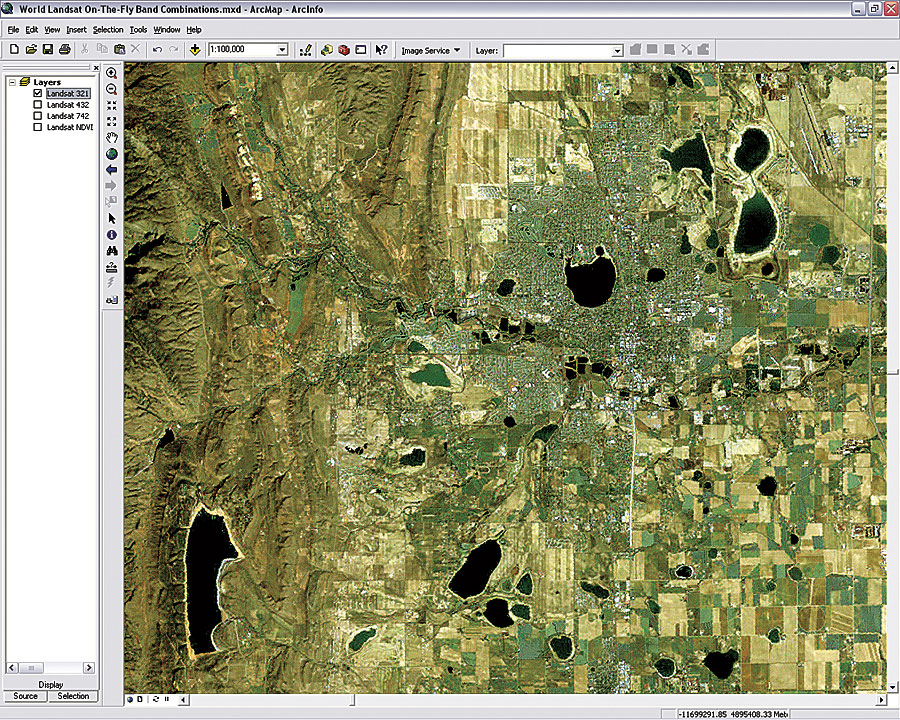
As the volume of imagery increases, GIS organizations are pressured to find solutions to provide this data to their users as quickly as possible. Often the same source data is copied and processed several ways to produce different representations or "image products" (for instance, multiple band combinations, enhancements, or vegetative indexes). Esri Image Server gives GIS organizations the ability to easily publish the latest imagery, without complex data loading or preprocessing. Esri Image Server also gives GIS organizations the power to easily deploy multiple image products to many users while maintaining a single version of the source imagery. Users can employ any of their existing imagery sources, including raster files on disks or rasters stored in the DBMS. The large collection of raster formats used by ArcGIS is directly supported. In addition, Esri Image Server provides extended support for the image metadata available from some imagery sources (QuickBird, Landsat, and many others), allowing important details, such as the date and time of acquisition, to be easily available. Esri Image Server not only serves imagery to remote clients, but it can also dynamically process the imagery. When administrators author a new service, they can define additional processes, such as pan-sharpening; band algebra; band combinations; stretching; sharpening; and terrain calculations, such as slope, aspect, and hillshading. Because each process is performed on the requested scale and extent, Esri Image Server can do complex calculations in subseconds. This on-the-fly processing enables only one copy of the source data to be stored on the server, and the multiple representations of that imagery can be shared dynamically. Users can, from within their applications, modify properties of the image services, such as the compression to be used for transmission of the imagery, sampling method, and mosaic order for overlapping imagery. These features further extend the users of imagery. The value of imagery is greatest when it is used by many people across an organization. Esri Image Server allows imagery to be used not only by the wealth of Esri GIS clients (ArcInfo, ArcEditor, ArcView, ArcIMS, ArcGIS Server, and ArcGIS Engine) but by non-Esri clients as well (Autodesk's AutoCAD, Bentley's MicroStation, Open Geospatial Consortium's Web Map Service, and others). This open access to Esri Image Server allows an organization to leverage its investment in raster data. Esri Image Server has two optional extensions that provide focused image processing capabilities. The Orthorectification extension allows Esri Image Server to dynamically orthorectify raw imagery using image properties and a terrain surface. The accuracy of this orthorectification can be updated at any time as photogrammetrists supply updated orientation parameters. This allows organizations to quickly publish imagery when speed and accessibility are critical and refine the accuracy and enhancements over time. The Seamline extension for Esri Image Server provides the ability to define and edit the irregular seamlines for overlapping image mosaics and specify a feathering that will be used along that seamline. Esri Image Server will be immediately useful for most GIS organizations, as it makes it easier to share raster data with a wide audience. Key features of Esri Image Server include
More InformationEsri Image Server is supported on Microsoft Windows servers and is expected to be available in the fall of 2006. For more information, visit www.esri.com/imageserver. |