Summer 2006
Summer 2006 |
|||||||
|
|
|||||||
USDA Develops Field Data Recorder Software for Describing Soils
Optimizing PDAs for Field Collection |
|||||||||||||
|
By Alan Price, Soil Scientist, Natural Resources Conservation Service, Fort Collins, Colorado
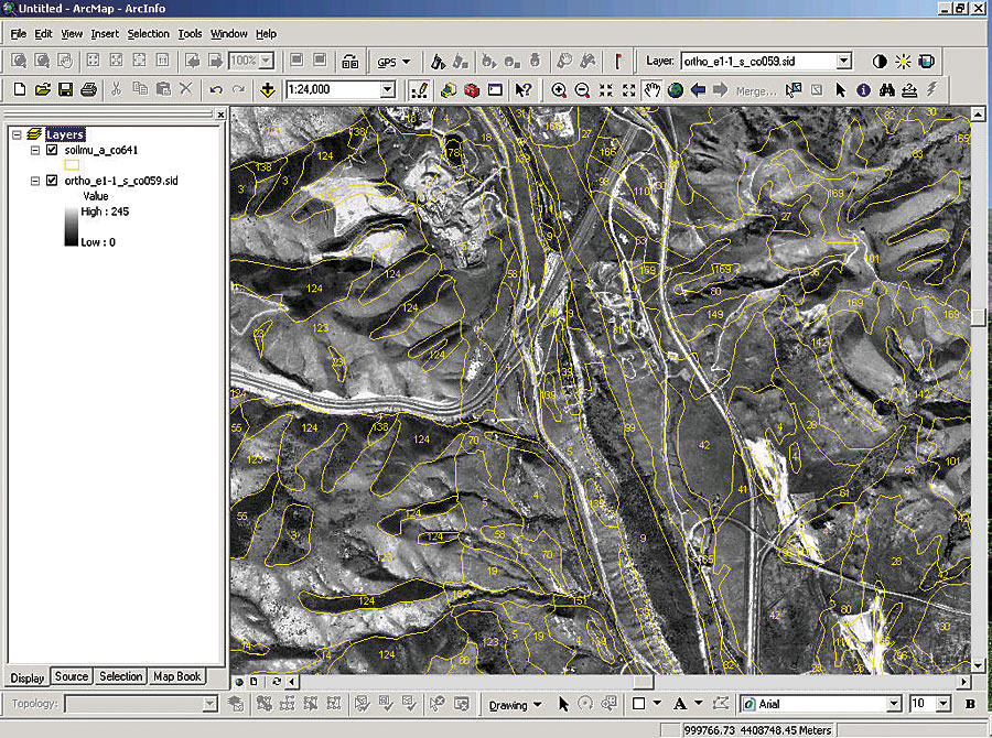
The ambitious task of inventorying all the soils of the United States began more than 100 years ago. Many tools have been developed over the years that help the field soil scientist collect both tabular and spatial data. The National Soil Information System (NASIS), a centralized relational computer database, was developed using GIS to store, evaluate, interpret, and report soil information for users of soil surveys. Nevertheless, detailed soil profile descriptions (also known as pedon descriptions) had until recently been collected in the field on paper forms, and after the completion of a soil survey area, these forms were filed; stored; and, sadly, often lost or inadvertently destroyed. Even if the locations of these descriptions were known, access to this data had been limited or inconvenient to access.
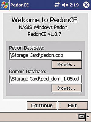
The Natural Resources Conservation Service (NRCS), an agency of the United States Department of Agriculture (USDA), the lead federal agency of the National Cooperative Soil Survey, has invested significant resources to capture both historical and new soil descriptions in NASIS to prevent the loss of this valuable data. Soil descriptions on paper forms are manually keyed in to NASIS, which is a tedious, expensive, and redundant process prone to transcription errors. Although there is no way to automate the data entry of existing soil descriptions on paper, a new application, PedonCE, is now available to collect new detailed soil descriptions electronically in the field. The data collected is imported into NASIS without the need to key this information manually. PedonCE was created with assistance from Esri's Professional Services Division. Esri was selected to aid in the development of this ArcPad software-based application because Esri demonstrated its ability to program in this environment and because the staff was interested in developing additional applications within the Pocket PC operating system.
Personal digital assistants (PDAs) using Microsoft's Pocket PC operating system, Pocket Access, and PedonCE connected to a Windows XP PC complete the local hardware configuration. Data files containing detailed soil descriptions on the PDA are transferred to the PC via Microsoft's ActiveSync software then imported into NASIS. There are many advantages to using PedonCE to collect soil descriptions in the field versus the traditional paper forms:
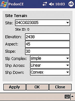
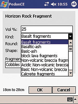
Data entry occurs in four steps to collect information about
The choice lists within the software are national in scope, and therefore may contain many more choices than needed within a local geographic area. These choice lists can be locally modified so that only choices applicable to a soil scientist's area of interest are displayed. This customization of choice lists can drastically increase the speed of the application as well as data entry. Summary
PedonCE provides the field soil scientist with a tool to record quality soil descriptions electronically in the field. Collected field descriptions can then be seamlessly imported into the NASIS database and shared with all NASIS users for analysis, evaluation, and report generation. Since the release of the software in August 2005, hundreds of pedons have been entered on PDAs and successfully imported into NASIS. More InformationFor more information, contact Alan Price, NRCS, USDA (e-mail: alan.price@lin.usda.gov), or Alex Muleh, Esri Professional Services (e-mail: amuleh@esri.com; tel.: 303-449-7779, ext. 8257). |