Summer 2007
Summer 2007 |
|||||||
|
|
|||||||
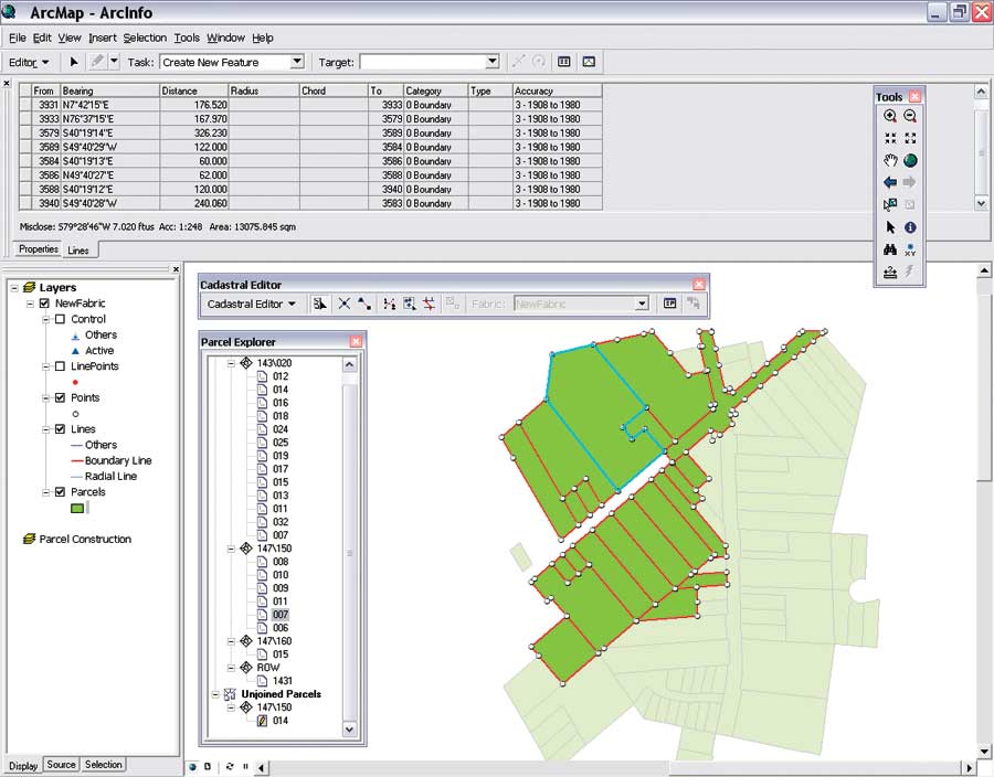
New Workflow Helps Improve Data Accuracy
ArcGIS Survey Analyst 9.2 Now Includes Cadastral Editor |
|||
New parcel editing tools make the latest version of ArcGIS Survey Analyst with Cadastral Editor the most comprehensive release yet. The application's new capabilities enable users to record and maintain survey data and continuous parcel layers as elements that are part of an integrated dataset and data model called the cadastral fabric. ArcGIS Survey Analyst enables surveyors and GIS professionals to create and maintain survey and cadastral data in ArcGIS. With this application, surveyors can centrally locate, process, and manage their data, enabling them to work more efficiently. GIS professionals use ArcGIS Survey Analyst to manage and continually enhance the accuracy of their data using existing survey methodologies. With the latest release, record data can be held in a continuous database, supporting a GIS system for complete spatial data management and analysis. With ArcGIS Survey Analyst 9.2, users can
More InformationThese new features and capabilities for ArcGIS Survey Analyst 9.2 are released as part of ArcGIS 9.2 Service Pack 3, which can be downloaded from the Esri Support Web site at www.esri.com/SAdownload. To learn more about ArcGIS Survey Analyst or to evaluate, visit www.esri.com/surveyanalyst. GIS and survey solution information is available at www.esri.com/surveying. |