Summer 2007
Summer 2007 |
|||||||
|
|
|||||||
Hartford, Connecticut, GIS Crime Analysis Evolves
Police Department Mapping Success |
|||
Highlights
The patch on the shoulder of every Hartford, Connecticut, police officer is adorned with the Latin phrase Post Nubila Phoebus interpreted as "After the clouds, the sun." This being said, the sun is clearly shining on the Hartford Police Department these days, and the implementation of a robust GIS system has played a major role in helping burn off the cloud cover.
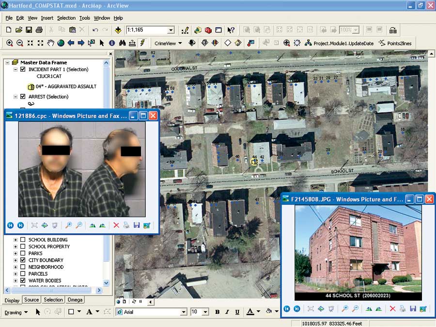
The city of Hartford, capital of Connecticut, has a population of 124,000 according to the 2000 census; however, the daytime population swells to nearly 400,000. The Police Department records an average of 350,000 calls for service each year, and between 1995 and 2005, the city averaged nearly 12,000 Part 1 crimes per year. Part 1 crimes are those crimes considered most serious. These include the offenses of murder, rape, robbery, aggravated assault, burglary, larceny, and motor vehicle theft. At the turn of the millennium, like many other U.S. cities in the more than 100,000 population category, crime was in the headlines. At the same time, due to budgetary cutbacks, the Police Department was witnessing a dramatic reduction in the number of available sworn officers. Also during this time period, the Crime Analysis Unit had very limited mapping capability. Recognizing the need to utilize crime mapping as a tool for crime analysis, the Hartford Police Department set out on a path that would lead it to GIS empowerment. Funded through the awards of several grants, primarily the Community Oriented Policing Services Grant, the consulting firm of Esri Business Partner Fuss & O'Neill (Manchester, Connecticut) was selected and contracted to build and implement an enterprise GIS solution for the Police Department. Since that time, GIS has provided an invaluable means for better crime analysis, decision making, and communication, which has brought great success to the department. The initial step of implementation was an overall GIS needs assessment for the city. The findings and recommendations of this report ultimately led to the development of a comprehensive implementation plan. This GIS "road map" provided an outline for the data, hardware, staffing, and software required to implement a successful GIS enterprise solution. This system included a combination of Esri software, principally ArcView, ArcEditor, ArcSDE, ArcIMS, and the ArcGIS Spatial Analyst extension, coupled with the crime analysis software CrimeView and CrimeView Web from Esri Business Partner the Omega Group (San Diego, California). To truly appreciate the impact of GIS at the Hartford Police Department, Fuss & O'Neill needed to look at the trend forward from 2004. After the third consecutive year of increases in total Part 1 crimes and the number of sworn police officers at a near record low, the need for a change in policing style was clearly evident. "Through the implementation of GIS technology and the analysis tools made available to our officers," says Daryl K. Roberts, chief of police, "the department has been able to effectively change, in a positive manner, the department's community policing policies at the neighborhood level." Chief Roberts was one of the driving forces in developing the city's new Neighborhood Policing Plan. Initially, the Crime Analysis Unit was tasked with performing a geographic workload analysis for the department. Making use of the GIS tools available within the newly implemented GIS system, the city was divided into four geographic districts, each made up of two smaller geographic zones. Each district is commanded by a police captain and each zone by a police lieutenant. The project was a long and difficult one, but the final product, coupled with an aggressive crime mapping approach to target problematic areas, would change the way police work was done within the city of Hartford and successfully drive crime from the streets of every neighborhood in the city. One of the most dramatic impacts of this new crime mapping approach was the decrease in auto theft crimes. "Trace" maps, which show the link between the locations where a vehicle was stolen and then recovered, made trend or pattern identification much easier. This allowed investigators to more effectively attack target locations, resulting in a stunning 35 percent drop in the number of auto thefts in the city over two years. Burglaries have also decreased by 34 percent since 2004. The creation of weekly and 28-day burglary maps illustrating burglary time of day and day of week allowed for better trend recognition and more effective placement of personnel, which has effected the decrease. "Hot spot" maps of street robberies have helped to decrease robberies 23 percent within one year when combined with the Police Department's persons data. This data is an inventory of suspects with a history of robbery and physical descriptions matching described perpetrators. Late in 2003, the city of Hartford won the competitive Universal Police Hiring Program Grant from the U.S. Department of Justice. The hot spot map of gun violence clearly showed the need for additional police resources within specific neighborhoods. The city of Hartford received funding for nearly 20 additional police officers. GIS has played a significant role in the mapping and analysis of National Integrated Ballistic Information Network (NIBIN) hits supplied by the U.S. Bureau of Alcohol, Tobacco, Firearms and Explosives, as well as a successful examination and solution to a plague of motor vehicle license plates being stolen for the attached registration sticker. The department has worked closely with the state Forensic Science Laboratory in cases involving shootings to map the link between gun-related incidents and the ballistics of bullet casings found at the different crime scenes. They were able to link particular guns to the crime scenes and, ultimately, to arrest individuals found in possession of those guns. The maps have been used as evidence in court. The mapped results of the city's stolen license plate analysis were brought to the attention of the governor, who subsequently issued an executive order to change the placement of vehicle registration stickers to the inside front windshield. Since this law went into effect, the department has seen a decrease of 28.5 percent for this type of incident. Sergeant Andrew Jaffee, the department's information technology manager, notes, "The map presented to the governor was instrumental in changing state regulations governing vehicle registration." Future initiatives outlined by the department include
More InformationFor more information, contact Lieutenant William Schwarz III, Crime Analysis Unit, Hartford Police Department (tel.: 860-757-4175, ext. 5716; e-mail: schww001@hartford.gov), or Stephen Biancardi, GISP, GIS project leader, Hartford Police Department (tel.: 860-757-4178, e-mail: sbiancardi@hartford.gov). |