Summer 2008
Summer 2008 |
|||||||
|
|
|||||||
High-School Teacher Paul Tweed Uses GIS to Encourage Higher-Level Thinking |
|||
|
Paul Tweed has spent his career in the field exploring the natural world. Once he finished graduate school at the University of Iowa, he began teaching field ecology courses at his alma mater. The courses took him and his students out of the classroom and into the natural landscapes of states such as "I thought, 'Wow, look at all the things I could do with the field biology topic if I could make these quick maps and analyze data!'" Tweed remarks. He began gathering information on GIS and learning techniques that would allow him to incorporate GIS into his lesson plans. Eventually, Tweed and a fellow teacher, Jeff Hadorn, began a summer school science research program at Augusta High School that was designed to have students work on research-based field projects. That program evolved into a two- to three-hour-a-day field research course Tweed offered to high school students during the regular school year. GIS was a significant part of the course, as it was used for tracking, mapping, and analyzing data. Tracking Black BearsOne of the projects for the research course was done in cooperation with the Wisconsin Department of Natural Resources (DNR) and spanned a seven-year period. DNR was raising orphaned black bear cubs in captivity, then releasing them into the wild. With radio telemetry, the students tracked the bears and analyzed their locations with GIS. Students looked at how far the bears travelled, their habitat choices through the seasons, and which animals became problem bears. When the cubs were in captivity, the DNR staff had been driving up to the bears' cages to drop food off, then driving away. When the bears were released, the radio telemetry showed that they would often appear around or in running vehicles. "They had been trained to eat when they heard a car," Tweed relates. "Fishermen would leave their cars running during cold spring months while they prepared their tackle, and the bears would come out of the woods and sit on their hoods. "One of the teachers I was working with to track the bears got out of his car, left it running with the door open for a moment, and found that he was getting a very close read on a nearby bear," Tweed continues. "When he turned around, the bear was in his car." The information from this study improved the way DNR raised orphaned bear cubs, including a more hands-off approach to delivering food. When released into the wild, these bears stayed away from people.
"Kids love to be in the field," Tweed says. "They have an interest in animals, so projects like this allow us to teach many concepts related to GIS and GPS, as well as things related to habitats, behavior, and wildlife management. It becomes a much larger focus than just putting dots on a map." Three years ago, this field research course evolved into the Wildlands School, a charter school dedicated to science and fieldwork in a project-based format. Learning in the FieldThe students at Wildlands (grades 7�12) participate in various large-group, small-group, and individual research projects each year. All of the students at Wildlands have used GIS to build data files and collect and visualize data. Tweed estimates that 80 percent use it in their independent projects. Recently, two seniors conducted their final research project, mapping nearby Lake Eau Claire. Community members suggested this project to the school because they didn't have enough accurate volumetric and depth data to make informed management decisions. The two students teamed up with the Lake Eau Claire Association, members of which volunteered to take the students out on the 860-acre lake to collect more than 90,000 data points during a seven-week period. Six thousand copies of the bathymetric map of Lake Eau Claire have been printed and shared with the community. "Being an impounded lake, it's fed by the river that comes down and carries nutrient load and sediment load that gets deposited in the lake," says Marlo Orth, former president of the Lake Eau Claire Association. "Now we will be able to see where it is being deposited, so when we do a vision project, we can ascertain where we need to dredge. We also need this kind of data so that when we go to DNR, we have accurate information to show what's taking place and how the lake is changing over the years." Looking at the Big PictureWildlands School was built with two goals in mind. One is helping students understand the way the natural world operates; this focus runs throughout all learning experiences, including writing and math. The second is providing technology that will allow the students to spend much of their time analyzing data and critically examining their observations. Technology allows them to see the big picture and ask questions about why things are happening and how they relate to one another instead of spending all their time manually collecting data. "When I was in school, it took a long time to do things by hand," Tweed says. "Now we have the tools, especially through ArcGIS software, that allow us to look at data and ask larger-scope questions. The big shift I see is we now have the tools that allow students to be higher-order thinkers instead of just technique learners." Tweed likened the school to a small engineering or consulting firm for the community. "We use the projects for learning and skill building for the students," he points out. "But it has an outcome that is tied in with community interest." More InformationFor more information on Wildlands School, contact Paul Tweed, director, at tweedpau@augusta.k12.wi.us. |
 This article is part of an ongoing series honoring individuals who have made a difference in the world by applying a GIS solution to challenges or needs within conservation or their communities. Since these unique individuals have been selected for their innovations or special achievements in a particular field, the series is appropriately named GIS Heroes. Esri recognizes Paul Tweed as a GIS hero.
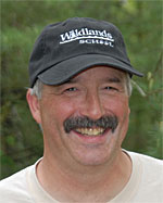 Wisconsin and Colorado. Then Tweed decided to teach biology at the high school level in Wisconsin's Augusta Area School District. One day in the early 1990s, he made a discovery that would dramatically influence the rest of his career and enrich the lives of the students he would teach. It was a fortuitous moment at a convention for the National Science Teachers Association when he learned about GIS technology.