Summer 2009
Summer 2009 |
|||||||
|
|
|||||||
Global Doorway to Understanding the Earth
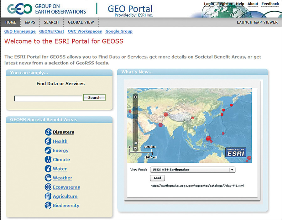
GEOSS GEO Portal |
|||
|
To achieve its task, GEO began constructing a Global Earth Observation System of Systems (GEOSS) in 2005. Based on a 10-year implementation plan that will be finalized in 2015, GEOSS will yield a broad range of "societal benefit areas" that address many major challenges facing our world. Among these societal benefits, which require precise geospatial awareness to address, are reducing deaths and loss of property from natural and human-caused disasters, understanding and improving environmental factors harmful to human health and biodiversity, and improving the management of energy resources. Of the many goals for GEOSS, one is to eliminate key obstacles to data access. GEO recognizes the need for full and open exchange of observations, guaranteed data access and usability, and a solid regulatory framework for earth observations.
Soon after GEOSS was proposed, GEO contracted with Esri Professional Services to build the GEOSS GEO Portal using Esri's ArcGIS Server Geoportal extension (formerly the GIS Portal Toolkit). The GEOSS GEO Portal offers a single Internet access point for data, imagery, and analytic software packages relevant to all parts of the globe. It connects users to existing databases and portals and provides reliable, up-to-date, and user-friendly information, vital for the work of decision makers, planners, and emergency managers. The ArcGIS Server Geoportal extension is a standards-based platform for building geospatial portals, spatial data infrastructures, and metadata catalogs. It gives GEO partners the capability to organize and publish the locations of geospatial datasets, applications, and Web resources while providing users with the ability to discover those resources and facilitating access to them (see "ArcGIS Server Geoportal Extension Manages Geospatial Resources Enterprise-wide"). ConclusionToday, the GEOSS GEO Portal provides scientists with easy access to a wealth of earth observation data and Web mapping services. It is a global doorway to increasing our understanding of the earth and helping participants move from principles to action. More InformationTo learn more about GEO, visit www.earthobservations.org. To use the GEO Portal, visit geoss.esri.com/geoportal. |