Summer 2009
Summer 2009 |
|||||||
|
|
|||||||
Romanian Civil Aeronautical Authority Creates and Edits High-Quality Data |
|||
Highlights
In 1910, Romanian scientist Henri Coanda built the world's first jet engine, and the country has been on the forefront of aviation ever since. Today, Romania has a well-developed airport infrastructure, including 17 commercial airports, with most open for international traffic. To ensure aviation operations are safe, secure, and efficient, the Romanian Civil Aeronautical Authority (RCAA) was created. RCAA regulates all civil aviation activities in the country, including licensing pilots, registering aircraft, and certifying that aircraft and engine designs are safe for use. RCAA is coordinated with all other civil aviation authorities around the world by the United Nations' International Civil Aviation Organization (ICAO).
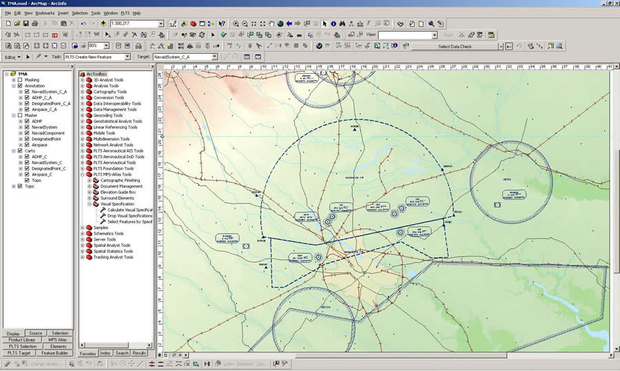
As with other aviation authorities, RCAA is faced with doing more with less and with the limited funds of a public organization. Historically, it used computer-aided design and drafting software for creating maps and charts. Three years ago, RCAA looked for a solution that would allow it to efficiently create the products required to do its job, as well as share data with ICAO in the best way possible. After looking at many solutions, RCAA chose ArcGIS because the software provides a standards-based platform for the spatial analysis, data management, and mapping the organization was required to perform. "RCAA now has the ability to efficiently create and edit cartographic products that support our aviation operations," says Mihai Necula, head of the Air Navigation and Aeronautical Information System (AIS) Department, RCAA. RCAA uses ArcGIS for data management and mapping and viewing spatial data. "We saw the benefits of centrally managing our aeronautical data with GIS once we started using the software," says Necula. "Upgrading our implementation means we will be further integrated into our AIS and capable of doing more spatial data viewing and analysis, including creating 3D representations, which is very important when managing airspace." RCAA upgraded its current ArcGIS solution to include the specialized extensions ArcGIS Data Interoperability, Production Line Tool Set (PLTS) for ArcGIS—Aeronautical Solution, and ArcGIS 3D Analyst. The ArcGIS Data Interoperability software extension makes data importing easier for RCAA by eliminating barriers to data sharing through state-of-the-art direct data access, complex data transformation, and import/export capabilities. The RCAA production lines also utilized FME 2008 from Esri Canada Limited Business Partner (Surrey, British Columbia) Safe Software Inc. FME 2008 extends ArcGIS software's data translation and integration. Once data is imported, PLTS for ArcGIS—Aeronautical Solution allows RCAA to efficiently manage its aeronautical information and produce high-quality charts. "We now have a robust editing environment in a map-based visual editing workspace," says Iuliana Radu, aeronautical inspector, RCAA. "This gives me precise control of feature parameters, one-touch data maintenance, and the ability to make a change to a feature once in the database that is reflected on all related products automatically. The software is very efficient and allows me to produce data and chart products faster with better quality." ArcGIS 3D Analyst allows RCAA to effectively visualize and analyze surface data from many viewpoints, query a surface, and determine what is visible from various locations. More InformationFor more information, contact Iuliana Radu (e-mail: iuliana.radu@aisro.ro) or Bogdan Cheveresan, project manager, Esri Romania S.R.L. (e-mail: bcheveresan@geosystems.ro). |