Summer 2010
Summer 2010 |
|||||||
|
|
|||||||
Austria's Geographic Data Conforms to INSPIRE |
|||||
|
By Mariana Belgiu, Research Assistant, Austrian Academy of Sciences, Institute for Geographic Information Science Highlights
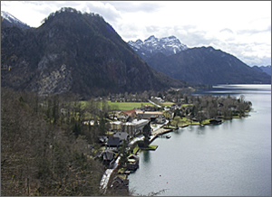
Austria encompasses much of the mountainous territory of the eastern Alps, which contains many snowfields, glaciers, and snowcapped peaks. Nestled in valleys near idyllic farms and hidden among the forests and woodlands that cover almost half the land lie glistening palaces and gabled houses.
To protect the beauty and splendor of its natural resources, Austria has used GIS for the past 25 years. The Federal Office for Metrology and Surveying maintains geoinformation on a national level. However, Austria consists of nine independent federal states, each with its own provincial government, which has led to the creation and management of geographic resources being scattered across many organizations. Having disparate data sources makes it difficult to use the information to make more informed decisions on social and environmental issues. To solve this problem, it is necessary to develop a coordinated spatial information system capable of data sharing and reuse on national, regional, and cross-sector scales. The system is a geoportal based on ArcGIS Server and the Geoportal extension. The geoportal gives the states and regions a collaborative approach to developing a coordinated, comprehensive, and sustained information system. The Austrian umbrella organization for geographic information, AGEO, strongly supported the development of the geoportal as it clearly demonstrates the practical use and value of a metadata management system. Coordination Across AustriaAGEO was formed in 1998 to make it easier to access geographic data throughout the country. The organization brings together national and municipal administrations, universities, and many different professional associations, representing the interests of the Austrian geographic information community at both the national and international levels. In the last few years, this umbrella organization has focused its activities on supporting and promoting the development of a national spatial data infrastructure within the framework of a European geographic information-sharing community. "The AGEO organization is concentrating its activity not only on public administration of geographic data but also on business; academic; and, of course, general public interests," says Prof. Dr. Josef Strobl, the current chair of AGEO. At the European level, the European Commission, the Council of the European Union, and the European Parliament set up the legal framework for developing the Infrastructure for Spatial Information in Europe, the INSPIRE Directive. This directive (Directive 2007/2/EC) came into force in May 2007 and aims to integrate islands of geographic information of varying standards and quality throughout Europe. Austria incorporated the INSPIRE Directive into its national legislation, taking a first step toward implementing the requirements of the directive in the country. The next step involves the creation of communication mechanisms between producers and users of the geographic information. Metadata Makes Sharing Geographic Information EasierOne of the main difficulties with sharing data in Austria is that the available spatial datasets and services lack comprehensible documentation. This can be solved by accompanying the spatial data with metadata, which is structured information that describes the datasets. Unfortunately, many data producers do not understand the benefits of creating metadata and treat the task as boring, time consuming, and therefore unnecessary.
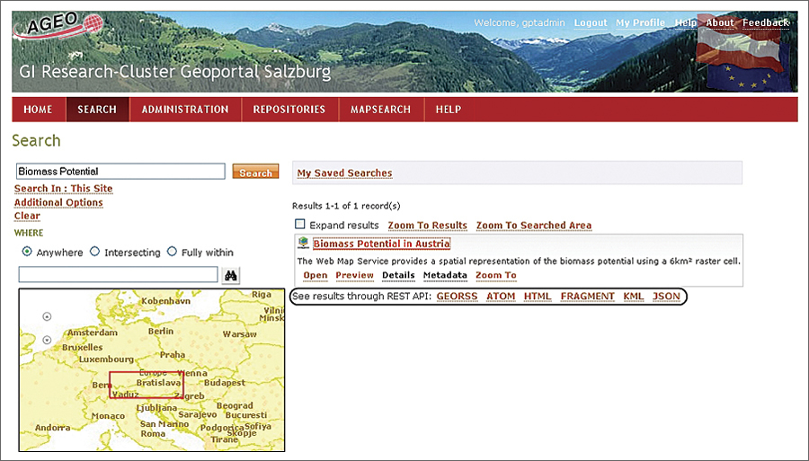
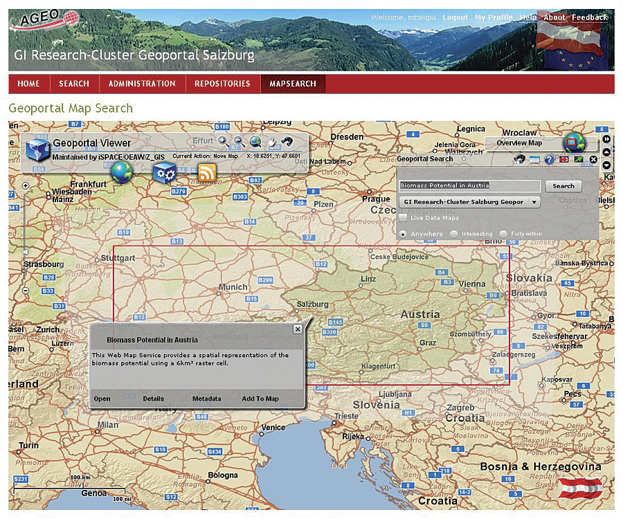
The Geoportal extension provides data publishers with an online metadata editor that makes it easy for them to publish metadata about geographic resources in conformance with the Austrian Metadata Profile. The Geoportal extension was chosen because it provides the technological keys for sharing and reusing resources across applications, enterprises, and community boundaries and facilitates development of a metadata editor that conforms to a specific metadata profile. The Geoportal extension also includes a metadata editor tool, discovery tools, a data visualization application, and metadata harvesting tool that enable automated acquisition of metadata from other repositories. Bridging Data Producers and UsersThe geoportal represents the bridge between data producers and users. The producers create data and services for their own business needs and publish corresponding metadata to the geoportal. Users formulate queries and evaluate the returned metadata records to decide whether the discovered data accomplishes their requirements.
The geoportal's metadata editor makes geographic resources discoverable in a straightforward manner. The publisher logs in to the geoportal and chooses either the spatial datasets or spatial services schema that conforms to the specifications of the Austrian Metadata Profile. Then, using the metadata editor, the user fills in information about the data or services to create its metadata. If the user needs assistance, hints provide more information about what values should be input in each field. The generated metadata is then added to a metadata repository that is comparable to a library catalog. Users can search and find information about the availability of a particular dataset or service, which includes information about content, author, year of publication, and more. The available geoportal and the online customized metadata editor represent an important step toward shaping a national spatial data infrastructure and a milestone toward achieving the goals of the INSPIRE Directive. About the AuthorMariana Belgiu is research assistant at the Austrian Academy of Sciences, Institute for Geographic Information Science, Salzburg, Austria. She received her M.Sc. degree in GIS at the University of Salzburg, Austria (2009), and she is now in the initial stages of her Ph.D. work with a focus on ontologies within the spatial data infrastructure framework. More InformationFor more information, contact Mariana Belgiu (e-mail: mariana.belgiu@oeaw.ac.at) or Prof. Dr. Josef Strobl, director, Institute for Geographic Information Science, Austrian Academy of Sciences (e-mail: josef.strobl@oeaw.ac.at), or visit the Web site (www.oeaw-giscience.org). |
 To address this problem, Austria prepared a national metadata profile combining specifications of international standards, INSPIRE's Metadata Implementing Rule, and existing regulations in the country. This profile, the Austrian Metadata Profile (profil.AT), ensures a consistent approach to geographic information throughout the country. It specifies the metadata elements needed to increase the lifetime and value of spatial data and services. These elements include identification information; use restrictions; spatial and temporal extent; geographic resource maintenance information; spatial representation and reference; quality; and the distribution of geographic resources, such as access policies.