Summer 2010
Summer 2010 |
|||||||
|
|
|||||||
Croatia Simplifies Landownership Process with a National Geoportal
Economic Growth Strategy Transformed Through a Spatial Data Infrastructure |
|||||||
Highlights
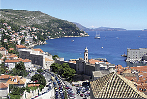
The Republic of Croatia, roughly the size of West Virginia, is home to more than 4.4 million people. Ranked as the 18th most popular tourist destination in the world, sightseers visit its beautiful national parks, the high peaks of the Dinaric Alps, and more than 1,000 islands in the temperate Adriatic Sea. A successor state of the former Yugoslavia, the country declared its independence in 1991, which the European Union (EU) and the United Nations recognized in 1992. Building itself up from virtually nothing, the country is now governed by a forward-thinking parliamentary republic, which is adopting new laws to promote economic growth and help its candidacy for EU membership. Making countrywide geographic data available throughout the nation with a spatial data infrastructure (SDI) is one way the country continues to grow. An online geoportal created with GIS technology makes this possible. The geoportal makes it easier for citizens, government, and private-sector users to find and access vast quantities of geographic information and related services. The geoportal is the first phase of a Croatian national SDI and has already shown its value by reducing the time it takes to register land within the country by 90 percent. Enabling Property Rights in CroatiaTen years ago, a simple land title transaction took an average of 400 days to carry out. Most information was stored and managed in paper-based files, making it difficult to share. Agencies, such as the State Geodetic Administration (SGA) in charge of the country's official maps and cadastre, and the Ministry of Justice, responsible for land registers issued at municipal courts, could not easily exchange data.
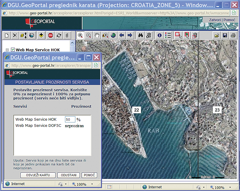
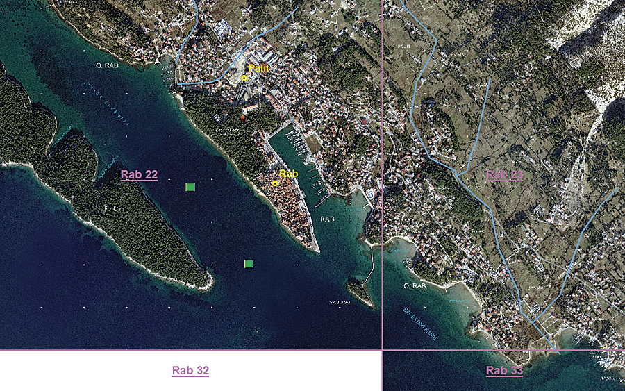
In 2000, the Croatian Parliament adopted a State Survey and Real Property Cadastre Program to transform the existing registers into digital format. This involved topographic surveys as well as resurveying 5 percent of the existing cadastre focusing on areas of special interest, such as towns, coastlines, islands, nonregulated state agricultural land, and infrastructure corridors. The datasets were cofinanced by federal institutions and interested local governing bodies. For example, orthophoto production was completed through 30 different agreements between local and state governments. Over a 10-year period, 21 counties produced topographic data and resurveyed each cadastre. By the end of 2010, 56,000 cadastral maps will be digitized and verified. Once created, the data is gathered and housed in the Real Property Registration and Cadastre Joint Information System (JIS). The JIS unites the cadastral data managed by SGA and legal information from the Ministry of Justice. Having consistent and shareable data across the country via the ArcGIS Server Geoportal extension is improving the processes of implementing land reform because documents can be issued from both cadastre and land registers. The average time for processing changes to land titles has dropped from a 400-day average to less than 37 days. Online Data Access Through GeoportalAs the first step toward an SDI, the cadastral data managed by SGA is now available for browsing, searching, and purchasing via an online data catalog found at www.geo-portal.hr/Portal. To develop the geoportal, the state selected Esri's distributor in Croatia, GISDATA d.o.o., and con terra GmbH, the professional services arm of Esri Deutschland GmbH, Esri's distributor in Germany and Switzerland. The companies established an action plan to develop a national SDI. They chose ArcGIS Server and the ArcGIS Server Geoportal extension to provide the platform for the state's ministries to quickly access geospatial resources regardless of location or type. Based on the EU's Infrastructure for Spatial Information in Europe (INSPIRE) directives for sharing geographic information across Europe, Croatia's national SDI will provide a more open, transparent, and efficient use of spatial information, as seen through the improved land registration.
SGA registers data with the geoportal by using metadata, which follows the ISO standards required by INSPIRE. Only the metadata is uploaded to the geoportal, while SGA's sensitive data remains securely housed within its own servers. Through the ArcGIS Server Geoportal extension, registered data includes digital orthophotos, 1:5,000-scale basemap information, raster cadastral maps, administrative units through the Central Registry of Spatial Units, and land survey information from the Registry of Geodetic Points. The First Step to a National SDIBy the end of the year, more agencies within Croatia will register their data with the geoportal, using the SGA data as a guide for resolution and standards. The Ministry of Defense; the Ministry of Culture; and the Ministry of Agriculture, Fisheries, and Rural Development will all provide spatial data. By creating a comprehensive SDI, Croatia expects to continue to see improvements in the reduction of time when producing and accessing data. Geospatial data and service producers in the government will be easily connected to the consumers who need the data. Data integrity will be maintained, and the users can more easily share the authoritative version of data. Dr. Zeljko Bacic, director general of SGA, says, "Simple access to geospatial data is the key prerequisite for an efficient and economically prosperous society. A geoportal in operation means that other governmental organizations can use SGA data but also make their data accessible. This is the first step to the establishment of a Croatian national geoportal as part of a national SDI. I am convinced we shall do this soon, as we have a clear direction from the Croatian government and sufficient knowledge and capacity to do this." The SGA geoportal has revealed opportunities in local and regional government for GIS users in nature protection, urban planning, agriculture, public safety, and more. "The SGA geoportal is the first of its kind in southeastern Europe," says Andrej Loncaric, director of GISDATA in Croatia and the southeastern region. "Croatian GIS users now have access to vast quantities of geospatial data that will make their everyday work much easier." More InformationFor more information, contact Zeljko Bacic, director general, State Geodetic Administration, Republic of Croatia (e-mail: zeljko.bacic@dgu.hr). |