Summer 2010
Summer 2010 |
|||||||
|
|
|||||||
Geospatial Responses to Disasters: The Role of Cyberspace |
|
|
By Melinda Laituri, Warner College of Natural Resources
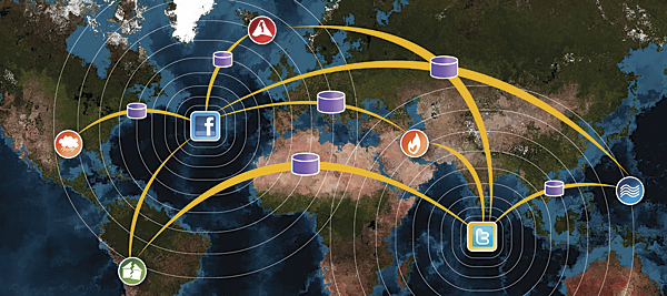
Disasters reveal the need for integrated solutions that include on-the-ground emergency response informed by geospatial technologies and digital databases. Visualization and spatial applications are critical in pre-, during, and in postdisaster management and response. Increasingly, cyberspace plays a role in geospatial responses to disaster in the following ways: (1) revealing the role of virtual communities in disseminating information via new and innovative means (e.g., mobile phones, mashups, crowdsourcing); (2) illuminating the need for interdisciplinary approaches to address disasters where geospatial approaches and technologies are at the forefront; (3) identifying efforts to improve communication through spatial data; and (4) developing long-term strategies for recovery efforts, risk reduction, restoration, and monitoring programs. Steven Johnson's book entitled The Ghost Map: The Story of London's Most Terrifying Epidemic and How It Changed Science, Cities, and the Modern World (published by Riverhead Books in 2006) recounts the story of John Snow's map of cholera deaths in 1854. Johnson emphasizes the role of local knowledge and multidisciplinary approaches in creating a bird's-eye view of the spread of the disease from a central water pump in industrializing London. Once scientific opinion accepted the waterborne theory of cholera, Snow's map became an important demonstration of the integration of science and local knowledge, linking an artifact of the built environment to a pattern of disease and disaster. In 1883, Krakatoa, a Pacific island, vanished in a volcanic eruption. Simon Winchester recounts the disastrous aftermath of this event in Krakatoa: The Day the World Exploded: August 27, 1883 (published by Perennial in 2003). This was one of the first events to have nearly instantaneous global coverage due to the technology of the time: telegraphy, underwater cables, and news agencies. This sharing of knowledge of place and disaster is one of the main characteristics of the global village. Marshall McLuhan coined this phrase in 1960, referring to the contraction of the world due to electronic media. Disasters bring us closer via the Internet (the underwater cables of the Krakatoa era) and the World Wide Web (telegraphy and news agencies). Online disaster communities, made up of the victims and their families, governments, news outlets, nongovernmental organizations, humanitarian aid groups, and an interested public, form in response to cataclysmic events. The online disaster community is global in that it transcends national boundaries in virtual space; solicits aid and intervention; and provides multiple lines of communication and information dissemination via chat rooms, blogs, and help lines. Virtual scales are not measured in terms of distance but by one's relationship to the event: friend, family, disaster responder, aid provider, or government official. However, the disaster occurs in an explicit geographic location with measurable results that are photographed, recorded, and placed online—where the physical environment intersects with virtual space. Effective disaster management and response demand rapid utilization of information and data from many sources. The ability to seamlessly integrate and distribute digital data into spatially explicit forms for rapid assessment and analysis during and after a disaster remains a challenging undertaking. Specialized data, data networks, and information processing methods and technologies are needed in a highly dynamic situation fraught with uncertainty and unpredictability. However, during and post-disaster activities reveal high levels of access to and pooling and sharing of digital resources, skills, and capabilities through the creation of novel and innovative sociotechnological networks. Researchers have done considerable work in addressing the role of geospatial technologies in disaster response and management. This research includes GIS and public safety; GIScience; and applications for emergency response, disaster recovery networks, vulnerability mapping, and local responses to disaster using GIS. The integration of the Internet with GIS applications has been applied to such areas as 3D real-time emergency response, serving maps on the Internet for emergency escape routes, and mobile GIS and digital video for urban disaster management. Geospatial modeling has been used for such things as determining evacuation routes, tracking hurricanes, and ascertaining refugee populations. The conceptual basis for disaster prediction and planning is undergoing a shift as evidenced by Susan Cutter et al. in a 2008 paper entitled "A Place-Based Model for Understanding Community Resilience to Natural Disasters." Cutter et al. highlight the need to focus on resilience and adaptability rather than risk and vulnerability. The January 2010 Cartography and Geographic Information Science is a special issue that focuses on temporal and spatial scales of hazards and disasters, monitoring of long-term recovery, and methods to improve communicating knowledge of these events using spatial data. A suite of research has considered the role of local communities in integrating local knowledge into disaster management activities. The notion of "people as sensors"—people collecting information, often spatial information, to aid in the recovery process and posting this information on the Internet for broad dissemination outside the established traditional channels of emergency response—is yet another aspect of the intersection of disaster, place, and technology. In 2007, the National Research Council (NRC) published Successful Response Starts with a Map: Improving Geospatial Support for Disaster Management, written by the Mapping Science Committee. This report describes the state of the art of geospatial data and tools for emergency management and emphasizes the need for improvement on how this data and the tools are used. Mechanisms to increase data sharing, use of satellite images, and Internet services for data provision are among the critical needs to enhance the use of geospatial technologies. The Indonesian tsunami and Hurricane Katrina reveal important advances that occurred via the use of the Internet and GIS. For example, the disaster of the Indonesian tsunami demonstrated the ability to quickly provide remotely sensed images both before and after the event that showed the extent of damage. This occurred through partnerships between software vendors, Internet service providers, and remote-sensing companies. The failure of governmental agencies in the aftermath of Hurricane Katrina resulted in numerous individuals responding via creating maps of donation and emergency aid sites. Creating data-sharing mechanisms in times of emergency response is needed; however, the report cites security as one of the main In 2009, the United Nations Foundation and Vodafone published a report, New Technologies in Emergencies and Conflicts: The Role of Information and Social Networks, that describes the new technologies and innovative uses of existing technologies to address crises. The mobile phone; the growth of broadband; and emerging telecommunications, computing, and multimedia are having a profound impact on how, when, and where people communicate. One of the observations reported is the shift to "many to many" forms of communication, such as social networking, from the traditional "one to many" type of communication in the form of radio and television. These communication changes will impact dissemination and delivery of information, as well as develop people-centered approaches focusing on local needs and emergency planning efforts. Geospatial trends are viewed as either top down, where high-resolution satellite images are used to assess infrastructure damage after disasters, or bottom up, where crowdsourcing techniques integrate cell phone broadcasting, social networking, and online maps to pinpoint local crisis conditions. When disasters have occurred, there has been an informal development of technology and communication that has self-organized during the event to provide coherent, relevant information outside the traditional information providers. The spontaneous response to disaster was particularly acute after Hurricane Katrina in the United States, coupled with Internet and mobile applications outside the traditional structure of information dissemination and emergency management. These events reinforce emergency management as a community activity that is local yet linked to national-level priorities. However, the issues of appropriate data protocols and validity and authentication of information are not insignificant. Collaboration and coordination between government agencies, humanitarian organizations, and private companies remain problematic due to conflicting missions, data security issues, and inadequate funding of emergency response technologies. There is an international need for a regulatory framework for geospatial tools and communication techniques similar to the call by the NRC for the NSDI. The integration of mapping, Global Positioning Systems, satellite imagery, and interactive geographic information systems provides important opportunities for developing and sharing information and techniques. "Technological gift giving" during disaster events has resulted in special licensing arrangements, innovative data sharing, and new applications. Mashups—the mixing of hybrid Web applications from multiple sources—combine satellite imagery with maps and geospatial data to provide local data. This activity capitalizes on researchers' observations about the need for data collection at finer spatial scales, such as neighborhoods and subneighborhoods, to create better disaster management plans. Disasters create space for the establishment of new networks, opportunities for collaboration, and information exchange. Maps and, increasingly, satellite images are ubiquitous throughout the online disaster landscape. Global and regional consortiums provide technical advice about disaster response, training opportunities for GIS disaster applications, direct access to satellite imagery, technical help in processing digital data, and links to other information portals. Often, the latest satellite images and maps of a recent disaster can be found on these sites. For example, United Nations Institute for Training and Research (UNITAR) Operational Satellite Applications Programme (UNOSAT) provides the international community with geographic information and aims to universalize access to satellite imagery. The Radio and Internet for the Communication of Hydro-meteorological Information for Rural Development (RANET) project uses Internet technology to disseminate early warning information, satellite imagery, weather, and climate data to rural areas. The application of appropriate or best-fit technologies is a critical aspect of GIS and Internet applications due to factors such as bandwidth, literacy levels, and data availability. Cell phone and wireless technology are key factors in countries with inadequate wired infrastructure where interactive maps can be accessed on cell phone screens. In 2005, Paul Currion wrote about the "first responders of the wired world" in reference to the innovative uses of blogs, message boards, pinpoint maps, mashups, and Web portals by technically savvy Internet users to share local information about disasters. While emergencies vary widely in scale, severity, and duration, they are inherently local. Oftentimes, information required from a GIS for immediate emergency response is seemingly simple, not requiring complex analytic procedures but reliable and adequate data. These activities attempt to distribute appropriate, accurate information in a timely fashion and, in some instances, in real time. Multiple disasters have facilitated the formation of volunteer organizations that provide hands-on expertise to develop location-specific GIS applications. These organizations respond to disaster events by developing a list of volunteers and soliciting assistance in response to disasters. For example, GISCorps coordinates short-term, volunteer GIS services to underprivileged communities worldwide. Immediately after the Haitian earthquake, MapAction had a team on the ground to assist in relief coordination through developing maps of relief deliveries. We have learned several important lessons in novel uses of satellite imagery, GIS, and Internet technology in translating disaster information to other audiences:
These lessons suggest a promising future based on a strong technological imperative. However, several challenges exist:
There are several actions that the geospatial community can take to address issues associated with disasters. These include
Solutions have been implemented that include technological innovation and creative public-private partnerships. However, solutions must go beyond technology and tools and address long-term, foundational change through interdisciplinary approaches and long-term strategies building on the innate creativity of individuals. In 1997, Susan Hanson edited 10 Geographic Ideas that Changed the World (published by Rutgers University Press), which discusses three ideas that directly relate to the issues of disaster management. The "idea of the map" is arguably the most powerful of geographic ideas in its ability to convey information authoritatively. Coupled with digital technology, the map takes on new forms through the use of "geospatial technologies," broadening our perspective by creating the possibility of analyzing ever larger amounts of geographic data. Situating the interactive map within the context of "human adjustment and adaptation" heralded the emergence of analyzing coupled human and natural systems. We now find ourselves at the crossroads of the virtual and physical worlds where solutions to disaster management provide an important role for geography and geospatial tools. About the AuthorDr. Melinda Laituri is an associate professor in the Forest, Rangeland, and Watershed Stewardship Department, Warner College of Natural Resources, Colorado State University (CSU), Fort Collins, Colorado. She is the director of the Geospatial Centroid @ CSU Web site that provides information and communication about GIS across campus and community. Laituri teaches graduate courses in GIS. Her research focuses on the intersection of science and culture using geospatial science. She has research projects in Mongolia, New Zealand, Ethiopia, Canada, Alaska, and China. Other research work focuses on the role of the Internet and geospatial technologies in disaster management and cross-cultural environmental histories of river basin management. More InformationFor more information, contact Melinda Laituri (e-mail: mell@cnr.colostate.edu). |
 The geospatial community can meet the challenge of disaster management. The Haitian earthquake, the Indonesian tsunami, Hurricane Katrina, the World Trade Center, Chernobyl, California wildfires, Danube flooding, Three Mile Island—multiple, large-scale disastrous events continually occur, and the magnitude and frequency of disasters appear to be increasing. Disasters represent the intersection of human communities with natural events where the built environment may actually exacerbate the outcomes of these events as in the case of Hurricane Katrina. Other disasters are the result of human activities and conflict that impact local communities with long-term and far-reaching outcomes as in the case of Chernobyl and the World Trade Center tragedy. Extreme events impact both the industrialized and developing worlds. However, the results of disasters are felt disproportionately in low-income countries where population growth, inadequate infrastructure, environmental degradation, and poverty create conditions of vulnerability. Disasters become "teaching moments" to better understand the human relationship to the natural world (through events such as earthquakes, tsunamis, and volcanic eruptions) and how the constructed environment of cities, rerouted rivers, and overgrown forests aggravate extreme events.
 reasons for the lack of data sharing and for failure in providing data for emergency response. The recommendation by the Mapping Science Committee is to strengthen the National Spatial Data Infrastructure (NSDI) of standard development and clearinghouse construction and to provide the framework for emergency management data needs and coordination.