From Urban California to Rural Kenya
Applying the UPlan Model
By Karen Beardsley, Managing Director, Information Center for the Environment, University of California, Davis
Highlights
- Researchers used the UPlan urban growth model to model and visualize land-use issues facing the Maasai in Kenya.
- UPlan has been instrumental in helping planners see what California's future might look like.
- ArcGIS can be designed to predict multiple potential outcomes for a rural region experiencing rapid land-use change.
![]() After centuries of a pastoral way of life, with livestock providing the basis for sustenance, many Maasai pastoralists in southern Kenya have been transitioning from communal land tenure to individual parcel ownership. The introduction of private landholdings frequently leads to a more sedentary, crop-based livelihood, and the land is often demarcated with fences. Effects of land subdivision go beyond the direct changes to people's landownership to include landscape-scale habitat fragmentation, reduced resistance to drought, and a decrease in wildlife populations. Some of the group ranches in southern Kenya have completely converted from communal lands to individual landownership, while others still have a choice in setting their land-use policies but are struggling with decisions about the future of landownership, subdivided or not.
After centuries of a pastoral way of life, with livestock providing the basis for sustenance, many Maasai pastoralists in southern Kenya have been transitioning from communal land tenure to individual parcel ownership. The introduction of private landholdings frequently leads to a more sedentary, crop-based livelihood, and the land is often demarcated with fences. Effects of land subdivision go beyond the direct changes to people's landownership to include landscape-scale habitat fragmentation, reduced resistance to drought, and a decrease in wildlife populations. Some of the group ranches in southern Kenya have completely converted from communal lands to individual landownership, while others still have a choice in setting their land-use policies but are struggling with decisions about the future of landownership, subdivided or not.
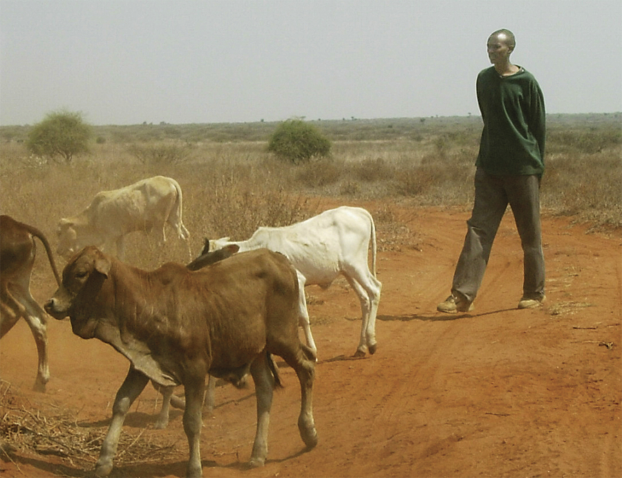
A Maasai herdsman.
There have been few if any systematic methods for estimating longer-term impacts of differing land-use scenarios on wildlife and other environmental resources in Africa. At the University of California, Davis, Information Center for the Environment (ICE), researchers endeavored to model and visualize some of the land-use issues facing the Maasai in Kenya with UPlan, an urban growth GIS modeling tool (see "How UPlan Works in California"). UPlan was developed to simulate growing urban areas of California and is widely used for long-range planning in rapidly growing cities. This would, at first glance, seem to have nothing in common with sparsely populated pastoral lands in East Africa. But the author, one of the ICE researchers, had been a Peace Corps volunteer in Kenya 20 years earlier and has connections (through the Society for Conservation GIS) with the African Conservation Centre (ACC) based in Nairobi, Kenya.
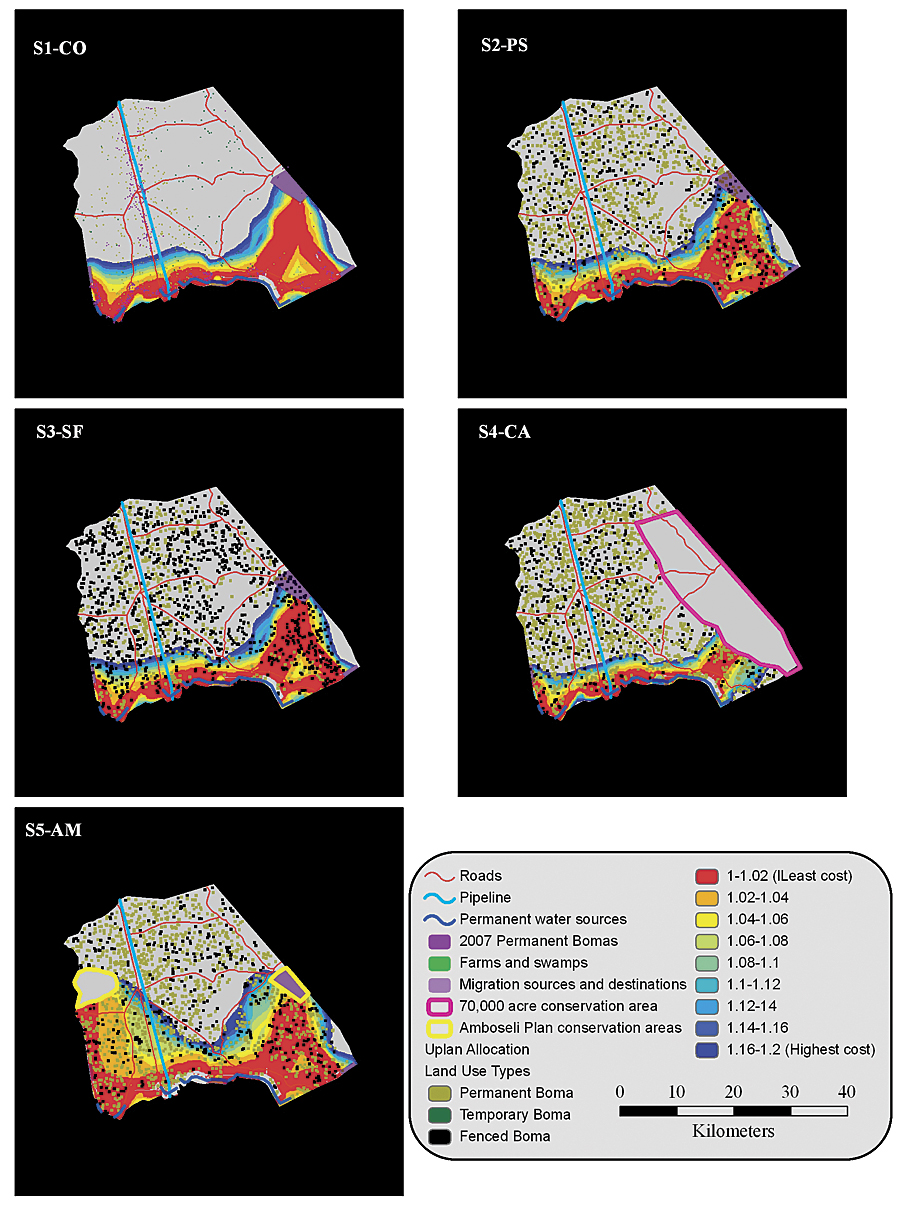
UPlan's output from five different Mbirikani scenarios, based on past trends, various degrees of fencing, and different management plans involving Mbirikani, will assist researchers and ultimately local ranch members with land subdivision decisions.
In summer 2007, the author spent three weeks in Kenya working with scientists at ACC visiting areas outside park boundaries, where ACC focuses most of its conservation efforts, and learning more about the issues facing the historically pastoralist communities. Potential land-use conflicts included a complex and interacting mix of livestock grazing lands, wildlife corridors, agricultural lands, and human settlements. Combining her knowledge of UPlan and ArcGIS with her interest and experience living in Kenya, she and ACC developed a plan for this collaborative work, adapting UPlan for use in a rural setting far away from its traditional applications in the cities of California.
In general, people prefer pictures or maps over reams of numbers to help them understand the world now and in the future. Geographic tools, such as ArcGIS, provide a visual framework within which to view the future or, better yet, a variety of possible futures. When dealing with the past or the present, scientists typically seek complete, unbiased data at the maximum resolution practical. This is not so when looking into an unknowable future. The UPlan urban growth model is an appealingly simple and easy-to-understand tool, built in ArcGIS, that has been far more instrumental in helping planners see what California's future might look like than similar, but more complex, models. The application of UPlan to rural Kenya explores some of the ways that ArcGIS can be designed to peer into the future at a low resolution and with multiple potential outcomes for a rural region experiencing rapid land-use change.
ICE researchers gathered existing data from many sources, including ACC, the United Nations Environment Programme in Nairobi, and several other researchers working in this part of Kenya. With very minor modifications to the urban version of the model, ICE scientists adapted UPlan to model different land-use choices in rural areas of southeastern Kenya. They modified UPlan to work within the Kenyan policy framework by developing five land-use scenarios for the Mbirikani Group Ranch in the Amboseli ecosystem in Kajiado District, Kenya. California projections use urban variables, such as general plan boundaries, distance to freeways and major arterials, residential/commercial/industrial land uses, and employment statistics. UPlan for the Mbirikani region includes temporary/permanent/fenced bomas (living areas), distance from water sources and villages, suitability of habitat types for farming and grazing, and proposed locations of new conservation areas.
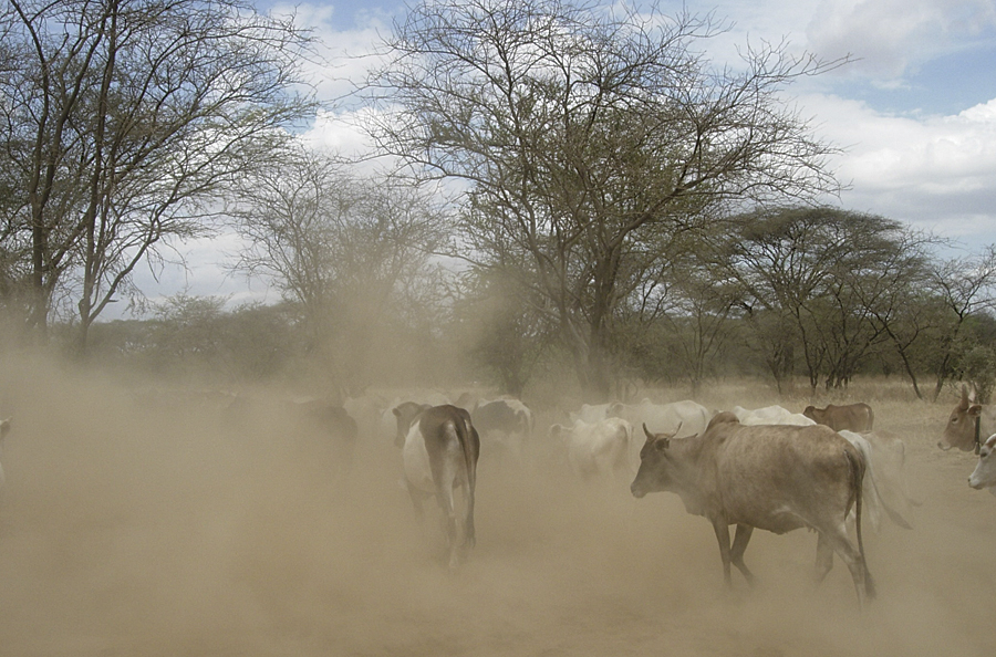
Maasai cattle raising dust in the South Rift region of Kenya. (Photos: Karen Beardsley)
The output from five different Mbirikani scenarios, based on past trends, various degrees of fencing, and different management plans involving Mbirikani, will assist researchers and ultimately local ranch members with land subdivision decisions. Taking this one step further, ICE researchers combined the pattern of human settlement from each scenario with possible wildlife migratory routes modeled across Mbirikani. Not surprisingly, the results pointed to the scenario with the highest level of subdivision and fencing having the most detrimental effects on migratory patterns of zebra and wildebeest in a landscape connecting some of the world's best-known wildlife areas.
Californian city and county planners and Maasai group ranch leaders are not as different as one might think when it comes to interpreting maps and developing and evaluating alternative future scenarios. When applied to rural locations, such as southeastern Kenya, overlaying potential wildlife corridors with modeled future human habitation patterns using ArcGIS is a powerful method that can facilitate decision making in ways not previously envisioned. This study demonstrated the applicability of the UPlan model to rural Kenya and provided an example of how the model and its output can be used to evaluate different land-use options. Principal wildlife management stakeholders, including the local community, private conservancies, nongovernmental organizations, and the government, could work collaboratively (despite potentially opposing planning priorities) to determine a mutually agreeable way to plan for future uses of the land.
The goal in conducting this research was to develop the ideas and test the methods for applying UPlan in rural, group-managed lands in Kenya, recognizing all along that these methods and results should be taken back to the local people for their full value to be realized. The expectation is not that ArcGIS applications like UPlan be placed in the hands of Maasai herdsmen. Rather, local support organizations such as the ACC would manage the technical aspects of the process and work with local stakeholders to visualize and evaluate model results. ACC could operate the models, produce maps, and work directly with the local people using the Swahili or Maasai languages instead of English. An iterative process of developing alternatives, observing potential outcomes, and modifying parameters as needed to develop and evaluate new alternatives (following the geodesign paradigm) would keep people involved and engaged at all levels of the process. ACC has expressed a keen interest in moving forward with this work. The main obstacles, as is so often the case with international collaborations, have been time and funding.
It will be an informative experiment to take the next steps and make these methods and results available locally and see how they are used to support Maasai group ranch subdivision decisions.
About the Author
Karen Beardsley, PhD, GISP, has worked for the Information Center for the Environment, Department of Environmental Science and Policy, at the University of California, Davis, since its inception in 1994 and is currently the codirector of ICE together with professor James F. Quinn. She has a master's degree in geography from the University of California, Santa Barbara, and a PhD in geography from the University of California, Davis.
For more information, contact Karen Beardsley (e-mail: kbeardsley@ucdavis.edu) or Lucy Waruingi, head of Programmes, GIS and Information Science, African Conservation Centre (e-mail: lucy.waruingi@gmail.com), or visit www.conservationafrica.org.
See also "How UPlan Works in California."