URISA at 50
An Interview with Jack Dangermond

Jack Dangermond
URISA—the Urban and Regional Information Systems Association—will celebrate its 50th anniversary at the 2012 GIS-Pro Conference in Portland, Oregon, September 30-October 4. Here, Jack Dangermond shares memories of URISA's early years, as well as thoughts about its future. Dangermond earned URISA's Horwood Distinguished Service Award in 1988.
URISA: How and why did you get involved with URISA?
Dangermond: I was a young graduate of the Harvard Lab when Alan Schmidt advised me to attend the 1969 URISA meeting in Los Angeles. I wasn't really sure what URISA was, but I traveled to the meetings for three days and met many interesting people. It was there I first met Ed Horwood, Tom Palmerlee, Bob Aangenbrug, Bob Dial, and other people who introduced me to early concepts of urban information systems.
At that time, there were a lot of innovative people and organizations thinking about urban information systems in the Los Angeles area, and many of them showed up at the URISA meeting, for example, the Community Analysis Bureau (CAB) in the city and the Southern California Regional Information Study (SCRIS), an outgrowth of the Census Use Study activities sponsored by the Census Bureau in New Haven, Connecticut. People I remember meeting were Caby Smith, Matt Jaro, Ross Hall, Lee Johnson, Al Evans, Ken Duecker, and Mike Kevany. They were playing around with everything from the first generation of ADMATCH address geocoding and census DIME files to transportation modeling. I realized this was a special meeting where public-sector people, private consultants, and entrepreneurs were mixing and sharing ideas about applications of computers and information systems within local government.
I discovered that URISA wasn't just another academic conference. It was a place where professional relationships were established and new concepts were discussed. In those days, the atmosphere of the meetings was highly charged and competitive. People were actively trying to forward their vision, create business, and get business. At least a third of the participants were consultants like me, who talked about their offerings and wares in various sessions.
I got one small computer mapping job for the 1970 election campaign for George Leyland, with whom I'd worked at Harvard and who later became head of the Federal Emergency Management Agency.
URISA: How did URISA evolve as the GIS industry matured?
Dangermond: I liked URISA because it provided a forum of colleagues where a young professional and entrepreneur like me could share my work. People were genuinely interested and would give me feedback. We talked about technology and approaches to the kinds of problem solving that eventually became known as urban GIS. This kind of open culture of sharing and learning flourished, especially during the 1970s and early 1980s. Around 1982 or 1983, URISA decided to invite vendors to exhibit at the annual meeting. At that point, the complexion of URISA began to change.
By the late 1980s, URISA had become identified with local government GIS. The membership grew dramatically into the thousands. But at the same time, the association took on a more commercial aura with a strong trade show emphasis. And as the GIS industry began to shake out, the trade show business fell off, and attendance also declined. Discussions shifted to planning, organization, implementation, and policy issues. Likewise, the original core people who had founded or nurtured URISA as a venue for sharing ideas and best practices continued to come and dialog. I liked this. URISA gradually became one of the homes where GIS professionals could get together and discuss issues.
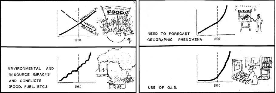
Jack Dangermond produced these drawings by hand for the 1979 URISA conference. Here he looked into the future with 1980 as a near-future milestone.
URISA: Which URISA people come to mind who really made a difference in the GIS field?
Dangermond: URISA's founder, Horwood, was a big influence on me. He was also a really fun guy. Horwood liked the idea of using computational methods for doing transportation planning. He especially liked getting people together to share their experiences in urban information systems.
Dial was another key visionary and influencer. He pushed some of the early thinking about urban information systems. His thinking, writing, and presentations led to a Housing and Urban Development program that funded experiments in implementing automated methods within cities around the country. This got the private sector interested in selling hardware, software, and services to build these experimental systems.
Dial was one of the first to envision how the multiple fiefdoms in cities could share common databases. I grabbed that notion personally to drive some of the concepts of urban GIS in the early days of ArcInfo, and it really worked. I credit Scott Morehouse for listening to my rants and systematically implementing a toolbox of tools that could be customized (using ARC Macro Language) to build application views to a common, shared database. We saw eager adoption—by planning departments, public works, land records organizations, and environmental agencies—of this vision of sharing a common GIS database.
Duane Marble was another early leader. Marble brought in systematic user needs assessment methodology and later the whole concept of doing geographic and GIS research in the academy. All this activity eventually led to the National Center for Geographic Information Analysis at Santa Barbara, California; Buffalo, New York; and Maine. Marble's research thinking, together with that of Aangenbrug and Roger Tomlinson, and others, helped balance out the somewhat aggressive commercial forces that were pushing URISA along.
URISA: Why did URISA gravitate to GIS?
Dangermond: URISA was, in a sense, one of the birthplaces of information system technology for local governments. This was a hot topic at the time—kind of like social networking is today. Remember that the best computers we had were huge, very expensive mainframes, and there really wasn't much of a database management technology at all. IMS [IBM's mainframe system] was a hierarchical data structure and considered the best of breed. This technology was designed primarily for accounting systems and financial back-office work. In those days, if you put simple things like property records into a database and could get lists of them, it was rocket science. So there was a need for a forum where people could come together and share, because computers and information systems were so new. Only a few people in transportation and urban planning were interested in computational approaches and database approaches. URISA brought these people together.
When GIS began to emerge as a commercial product in the late 1970s and early 1980s, it attracted more people from more organizations. They were excited to discover that GIS was a real information system just like an accounting system or a financial system or a permitting system, all of which had already been commercialized. So the introduction of a commercial off-the-shelf platform for sale from multiple vendors caused a stir and a lot of common interest. People and organizations wanted to buy these products because they saw their value, and there was lots of competition during the 1980s and 1990s for brands from different vendors.
URISA: Do you think Esri's User Conference has affected URISA?
Dangermond: Perhaps. As more organizations purchased and implemented this software, some of those who attended URISA to help select a platform now attend our conference because of its strong emphasis on supporting users with technology refreshers and training. What the User Conference does not replace is a forum for discussion of data policies, professional standards, new methods, new approaches—the kinds of conversations that URISA was known for.
URISA: Looking ahead, URISA has proposed a new emphasis on GIS management. What's your perspective on this potential new role?
Dangermond: Today, GIS is maturing as a technology and as a profession, and GIS operations within organizations are maturing as well. There's a need for a forum to bring together the professionals who are responsible for managing large, complex GIS operations. URISA is the logical place where managers come together to talk about how to use new technology and new methods to make cities better places.
I have, year after year, supported URISA because I believe it's one of the best places where local government professionals can get together and discuss their common interests with respect to information system technology. It was certainly one of the birthplaces of urban GIS and continues to have much to offer its members.
During URISA's first two or three decades, there was perhaps a greater spirit of excitement when the meetings were held. URISA's number-one asset was its ability to get people together to share ideas, renew old friendships, have a chance to share their work, get acknowledgment from friends, network, and also have a great party. These were the magical ingredients that kept URISA alive through thick and thin. Reengaging that spirit is what's needed. And the 50th anniversary conference in Portland this October is a good time and place to start.
See also "URISA's 50th Anniversary."