Winter 2001/2002
Winter 2001/2002 |
|||||||
|
|
|||||||
Adding Spatial Capabilities to a Land Database
Land Information New Zealand Creates Online Title and Land Survey Database |
|||
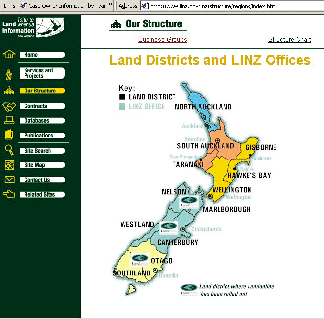
By Kevin P. Corbley As the sole government organization responsible for maintaining property records, Land Information New Zealand (LINZ) wanted to create a single database of title and land survey documents for the entire country that could be accessed online by government personnel or members of the public at any of its 12 regional offices. LINZ designed its automated system, called LandOnline, to benefit the public as much as it would LINZ employees. Currently, a citizen involved in a property transaction must travel to the specific regional LINZ office where title documents are filed to get copies. And a LINZ employee can only process title work for property within the region covered by his or her office. "LandOnline will give property owners and attorneys direct access to records pertaining to land anywhere in New Zealand," says Terry Jackson, LandOnline project manager. "When real estate Business is booming in one part of New Zealand, we can use LandOnline to shift the workload among our regional offices so that no one office gets overloaded." To the best of LINZ staff members' knowledge, a nationwide property database had never before been created; the task was huge. More than 100 years worth of paper records--title documents and survey maps--had to be digitized. And since New Zealand was in the process of developing a new geodetic control layer, the property data would have to be tied to the new data. Digitizing seven million paper files notwithstanding, LINZ faced a challenge that has stymied database developers since the era of GIS technology began. They had to figure out how to efficiently store the relational land title data along with the survey maps and geodetic control, which are both geospatial data, in the database so that queries could be conducted spatially and their results displayed on-screen. LINZ had earlier awarded a prime contract to PricewaterhouseCoopers (PwC) to determine user requirements and manage process integration, design, and construction. In addition, PwC was tasked with selecting LandOnline technology. PwC and LINZ staged a competitive tender involving development of database prototypes capable of handling relational and spatial data. The team comprising Informix Software, Inc., an Esri Business Partner, of Menlo Park, California, and Esri won this subcontract. This team proposed to use the Informix Dynamic Server system to store and manage New Zealand land information and serve it online. At the heart of the Informix database system is the Spatial DataBlade, a modular technology developed jointly by Informix and Esri to manage spatial data directly within the database. Scott Abbott, senior consultant for Informix, formerly senior technical architect for the LandOnline project team, explains that the main advantage of preserving the relationships between tabular and geospatial data in LandOnline is the ability to conduct queries based on spatial parameters as well as relational keys. For example, a spatial query can retrieve all title records with easements located within 10 meters of a specific street. A relational query can only search based on an index or keyword. Using LandOnlineInformix and LINZ technicians selected Esri's MapObjects 2 to build an explorer-style interface for LandOnline. With minimal training, any LINZ employee can log into the system via a wide area network to view, search, display, and print information. For features with a spatial component, MapObjects gives the ability to browse maps and layers dynamically. Up to 64 layers of maps and related information can be turned on or off, and various features can be selected and highlighted in the display. LINZ is completing data conversion and implementing LandOnline in one district office at a time. The first came online in August 2000 with the other 11 to be activated by 2003. After the system is accessible via the WAN at all district offices, LINZ plans to allow public access to the system through the Internet. "Once LandOnline is fully operational, we believe it will be the only nationwide automated land survey and title service that includes cadastral geodetic as well as cadastral survey information that is accessible online," says Abbott. For more information, contact Informix Software, Inc., 300 Lakeside Drive, #2700, Oakland, California 94612 (tel.: 510-627-7642 ) or Esri's New Zealand distributor (Wellington), Mr. Peng Aik Lim, Eagle Technology Group, 150-154 Willis Street, P.O. Box 1403, Wellington, New Zealand (tel.: 64-4-802-1400, fax: 64-4-802-1410, e-mail: peng_aik_lim@eagle.co.nz, Web: www.gisuser.co.nz). Kevin Corbley writes on GIS subjects. |