|
As knowledge of the power of online mapping spreads, the number of interactive mapping sites grows. Each issue of ArcNews discusses some of the latest Internet locations that use Esri software. To have your site featured in this column, send a description of the mapping site and the URL to Esri (www.esri.com/imsregistry). Links to these and other Web sites powered by Esri technology are found at www.esri.com/imssites.
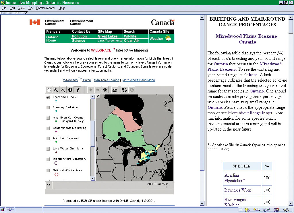
 Wildspace Wildspace
wildspace.ec.gc.ca/spaces-e.html
The Wildspace Web site gives users information about research projects and wildlife surveys conducted by the Canadian Wildlife Service. The site, powered by ArcView
Internet Map Server (IMS), focuses on data about bird species and their habitats in Canada.
Shelby County, Iowa, GIS
maps.shco.org/pmc
Using the ArcIMS solution, ProMap Corporation, an Esri Business Partner, developed a real estate/land assessment site for Shelby County, Iowa. County data sets are now easier to use and maintain, and visitors to the Web site can access assessment and tax reports as well as data layers in the County GIS such as rights-of-way and parcel maps, corn suitability rating maps, etc.
MEEN FEEN
www.etamima.com/gis/gis.html
Developed by the Regional Observation Center with ArcIMS, MEEN FEEN is the first services locator in Egypt. Visitors to the site can use it to locate banks, restaurants, hotels, doctors, embassies, and addresses in greater Cairo.
|