Winter 2002/2003
Winter 2002/2003 |
|||||||
|
|
|||||||
Bridging the Technology Gap Between Surveying and GIS
ArcGIS Survey Analyst |
|||
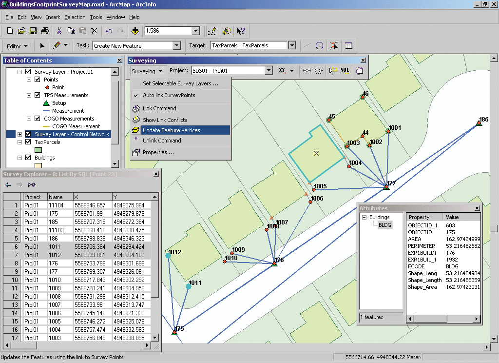
ArcGIS Survey Analyst is an extension to ArcGIS Desktop (ArcView, ArcEditor, and ArcInfo) that manages survey data in a geodatabase and represents survey measurements and observations on a map. This revolutionary technology allows survey measurements to be stored in a GIS database for the first time. Moreover, the Survey Analyst extension performs survey computations and adjustments on the measurements to determine the GIS coordinates of survey points. New GIS features can be added to the GIS layers using the survey-computed locations, and existing GIS features can be linked and snapped to the surveyed points. In either case, Survey Analyst allows users to improve the spatial quality of their data sets. ArcGIS Survey Analyst will transform how surveyors interact with GIS professionals and how GIS professionals embrace a surveyor's work. With Survey Analyst, surveyors and GIS technicians will be able to do the following:
ArcGIS Survey Analyst is the only application environment on the market that maintains survey data in an integrated database that supports the reduction of survey measurements and observations using survey computations and adjustments (such as traverse and least squares adjustments) and allows GIS feature linking and adjustment. As a result, it supports incremental improvement in the survey database and GIS features data set. Measurements normally collected in electronic or paper field books can now be imported and held in a database within a survey project. Bearings and distances along boundaries, angles and lengths along circular curves, and measurements acquired in field sketches can be stored as measurements in the survey data set using coordinate geometry (COGO) computations. Esri developed ArcGIS Survey Analyst in partnership with Esri Business Partner Leica Geosystems. This joint venture between the innovators of GIS software and survey technology has led to a comprehensive solution that bridges the gap between mapping databases and modern surveying systems. ArcGIS Survey Analyst will first become available at the release of ArcGIS 8.3 and operates with ArcView 8.3, ArcEditor 8.3, and ArcInfo 8.3. For more information on ArcGIS Survey Analyst, visit www.esri.com/surveyanalyst. |