Winter 2002/2003
Winter 2002/2003 |
|||||||
|
|
|||||||
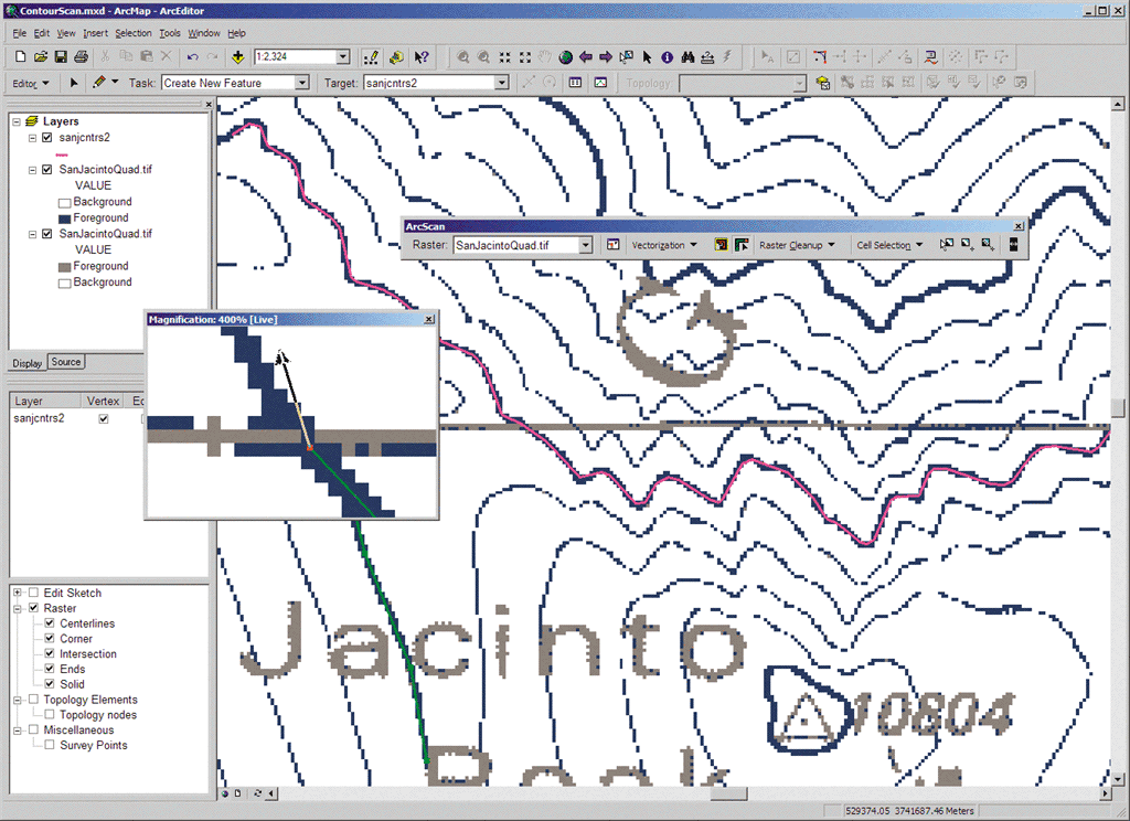
Raster to Vector Conversion for ArcInfo, ArcEditor, ArcView
ArcScan for ArcGIS |
|||
Newly available with the 8.3 release of ArcGIS, ArcScan for ArcGIS allows users to convert images into vector shapefiles or geodatabase feature classes. This process, referred to as vectorization, can be performed interactively or in an automated fashion. ArcScan for ArcGIS also supports tools to help with the preparation of raster data for vectorization. These include tools for selecting and editing raster cells to help define the scope of the raster to vector conversion. ArcScan does raster editing, raster copying, interactive/semiautomatic line following, and batch vectorization. ArcScan for ArcGIS operates as an extension to ArcEditor 8.3, ArcInfo 8.3, and ArcView 8.3. ArcScan is scheduled to be available concurrent with the ArcGIS 8.3 release. Existing ArcScan users on maintenance will automatically receive ArcScan for ArcGIS. To learn more, visit www.esri.com/arcscan, call Esri at 1-800-447-9778, call your Esri regional office, or contact your local reseller. Outside the United States, please contact your local Esri distributor. |