Winter 2002/2003
Winter 2002/2003 |
|||||||
|
|
|||||||
In Lewiston, Idaho, GIS Students Solve a "Grave" Problem |
|||||||||
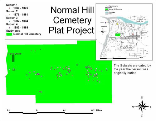
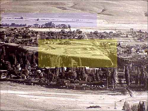
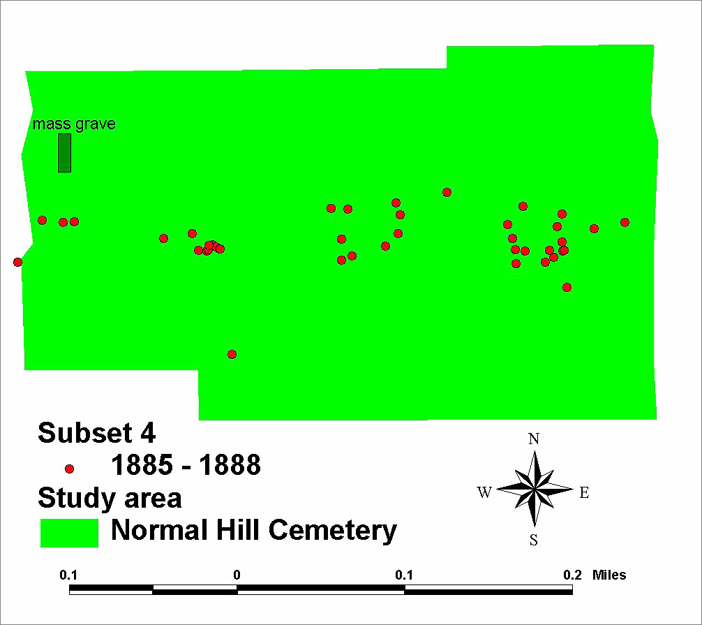
Graveyards are supposed to be permanent resting places. For one reason or another, however, some need to be unearthed and moved. One hundred fourteen years ago, in 1888, the city of Lewiston, Idaho, found itself in a quandary: The town was beginning to grow, and the cemetery dating from the 1860s was in the way of "progress." And, quite frankly, it was filling up. After several plans were considered and discarded by the city fathers, a new site was finally selected in an area then thought to be well out of any projected realm of the city. Exhumations began for those graves that could be found. Platting records were far from complete. Cows had long roamed the cemetery and knocked over the numerous wooden grave markers from earlier decades. By 1890 the old cemetery was cleared, and as shown in a 1903 photograph, the new cemetery was well-established to the south of Lewiston State Normal School, which gave its name to the area. For Jenifer Junior High School's GIS I students taught by Steven Branting, a cartographer with the Lewis and Clark Rediscovery Project, this old cemetery proved to be a puzzle ripe for an ArcView solution. The school's course includes units in traditional celestial navigation, GPS fundamentals and applications, digital photography, the digital atlas of Idaho, a complete working study of the major features of ArcView, and a comprehensive introduction into ArcView Image Analysis in one semester, all focused on solution-finding skills and problem-based scenarios. Their special cemetery problem had two geospatial questions needing answers: (1) In what sequence did the city exhume the graves? and (2) In what pattern were the remains reinterred?
To begin, Branting's students, all gifted seventh graders, created a database of every grave in the Normal Hill Cemetery dating from before 1889 by searching through the more than 17,000 grave sites now located on the grounds. Using Garmin 12 GPS units, each grave was fixed with exact latitude and longitude coordinates (way points) and uploaded into ArcView 3 using Waypoint software (www.tapr.org/~kh2z/Waypoint) .txt files that could be sorted and displayed as separate themes to discern spatial patterns. This created a data set of points that could be traced as a route if one wanted to follow it. More than 120 graves were found for the period 1867-1888. When projected onto a TIGER data centerline plan for Lewiston, the answer to the second research question led to the answer for the first. It was clear that the most ordered patterning of re-interments occurred with graves dating from the latest period: 1885-1888. This unmistakable finding led the class to determine that the original cemetery had been exhumed from the latest to the oldest graves, confirming a suspicion as to the location of the entrance to the city cemetery, an entrance that had not been discovered from photographic evidence. The only extant photographs of the cemetery are far too indistinct to show particular details.
In georeferencing the reburials, a secondary study is now focusing on the remains of those individuals who could not be identified during the re-interment process of 1889-1890. The exact position of a series of unmarked grave sites was determined for upcoming study using ground penetrating radar (GPR) to answer three main questions.
One final question remains to be answered: What was the exact nature and procedures of the reburials? To answer that question, protocols are now being negotiated to exhume one or more sites identified by the GPR scans. Officials are involved from the city of Lewiston, the Idaho State Historical Society, Lewis-Clark State College, and the National Park Service.
Today, Lewiston has surrounded Normal Hill Cemetery. The original cemetery was converted into a popular park area by 1904, replete with a new Carnegie Library, an Idaho Supreme Court building, and a new hospital nearby. Normal Hill had become a respected residential community. As one consequence of this GIS study, the Lewiston Cemetery Board has recommended that a commemorative marker be placed at the site of the mass grave with the inscription: "Dedicated to the Pioneers of Lewiston, Buried Here Unknown But Not Forgotten by Its Children." For more information, contact Steven D. Branting, Jenifer Junior High School, consultant, Gifted & Innovative Programs (e-mail: sbranting@lewiston.k12.id.us, tel.: 208-748-3351, fax: 208-748-3349). |