Winter 2003/2004
Winter 2003/2004 |
|||||||
|
|
|||||||
Revolutionary 3D GIS
ArcGIS 3D Analyst 9 With ArcGlobe |
|||||
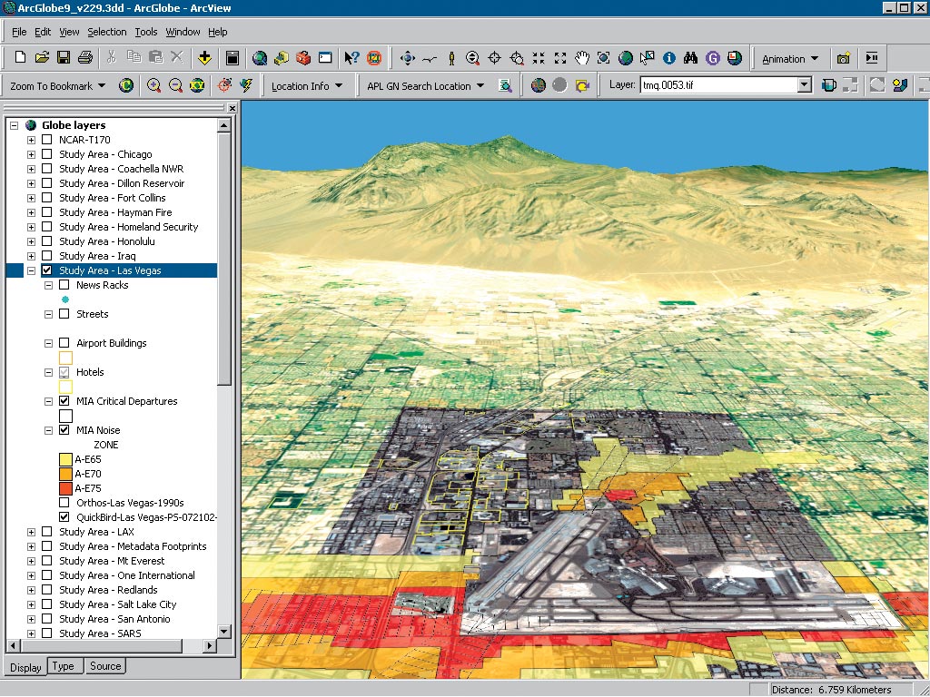
Esri's ArcGIS 3D Analyst extension introduces a revolutionary technology at release 9 that enables users to manage and visualize, from a local or global perspective, extremely large sets of three-dimensional geographic data. These capabilities are available as part of ArcGIS 3D Analyst 9 in a new desktop application called ArcGlobe. ArcGlobe provides the capability to seamlessly interact with any geographic information as data layers on a three-dimensional globe. Leveraging extremely efficient and highly optimized data retrieval and display techniques, ArcGlobe provides seamless and fast access to virtually unlimited volumes of geographic information. These breakthrough capabilities mean that ArcGlobe can easily and intelligently handle raster, vector, and terrain data sets representing data from local to global scale with performance exceeding traditional two-dimensional mapping. As an extension to the ArcGIS Desktop products, ArcGIS 3D Analyst allows users to leverage the GIS analysis tools available in ArcView, ArcEditor, and ArcInfo to perform geoprocessing tasks in a 3D environment. Using standard interactive mapping tools, users can also pan, query, and analyze data at any scale, or they can zoom right into their local area and view very high-resolution spatial data, such as parcels or detailed aerial photographs, of their area of interest. With ArcGIS 3D Analyst 9 and ArcGlobe, users can
Extensive Data Support for Complete Global Visualization
ArcGlobe is a revolutionary technology that will change the way we view the world. Data is the key to this system, and ArcGlobe offers the following:
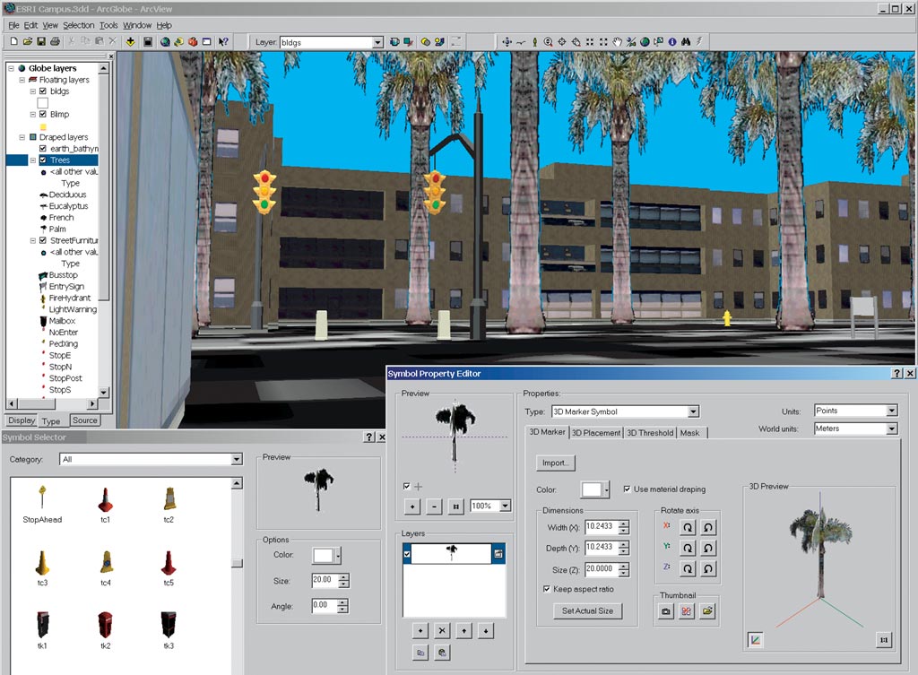
Three-Dimensional SymbologyArcGlobe is an application within ArcGIS 3D Analyst 9 similar to the ArcScene application. ArcGIS 3D Analyst 9 adds support for true three-dimensional symbology to enhance scientific visualization and real-world simulation. Style libraries are included with the release of ArcGIS 3D Analyst 9 to give users a variety of real-world symbols to choose from including houses, cars, street signs, structures, and plants. These symbols are available in both 3D Analyst applications, ArcScene and ArcGlobe. For more information on ArcGIS 3D Analyst and the ArcGlobe application, visit www.esri.com/3danalyst. Outside the United States, contact your local Esri distributor. |