Winter 2003/2004
Winter 2003/2004 |
|||||||
|
|
|||||||
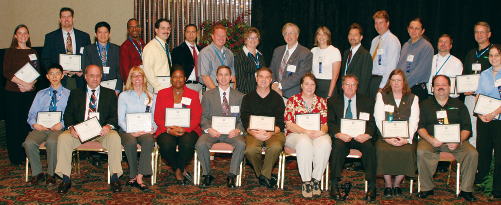
GIS Professional Certification Program Begins |
|||
On Monday, October 13, 2003, the first class of GIS professionals received their certificates from the GIS Certification Institute at the 2003 Urban and Regional Information Systems Association (URISA) Conference in Atlanta, Georgia. This group of 29 professionals has set a high standard of professional practice and ethical conduct. The first class was part of a pilot program involving the Georgia URISA Chapter. The GIS Certification Institute's Certification Committee selected them from 60 applicants on the basis of their applications followed by a critical review. The first class represented a cross section of GIS professionals including all ages, sexes, races, and backgrounds. The average age was 36, and one-third of the class was women. ApplicationOn January 1, 2004, the GIS Certification Program officially opened to all qualified GIS professionals. Candidates must complete the application and supply appropriate documentation along with a check for the certification fee (which is currently $250) to cover the application review process. A successful candidate will be certified for five years with no additional fee. A grandfathering provision will exist until 2009. It will recognize candidates who have worked many years with spatial data and will concentrate only on their professional experience. The documentation requirements include transcripts, a resum�, and an employer letter. GIS professionals who are interested in applying should begin to retain and collect items that validate all claims to provide the committee. Examples include invoices, name badges, certificates, and copies of articles. A detailed list of acceptable documentation is available on the GISCI Web site (www.gisci.org). Qualification ProceduresTo qualify for GIS professional certification, the applicants need to fully document their professional experience, educational achievements, and contributions to the profession to achieve a total of 150 certification points. A minimum of 60 professional experience points, 30 educational achievement points, and eight professional contribution points are required. Between 10 and 35 points can be attained annually through work experience depending on the nature of the experience. All certified GIS professionals need a minimum of four years of professional GIS-related experience to be considered for certification. Degrees and course work make up educational achievement points. A bachelor's degree is worth 20 points, and geospatial technology courses and conferences (including Esri training courses) are worth one point for 40 student activity hours. Finally, professional contribution points can be achieved by writing for publications and participating in GIS professional groups like URISA, Geospatial Information and Technology Association, your local GIS association, and others. Magazine and journal articles are worth three points, and association membership is worth one point. Active involvement in a GIS association as a committee member or workshop instructor is worth two to five points. By far the easiest way to achieve those points is through involvement and active participation in groups such as URISA. By attending the 2003 URISA Conference in Atlanta, participating in a workshop, and presenting a paper or poster, URISA members could obtain six education points and from one to five professional contribution points. More information on how to get more actively involved in URISA can be found at www.urisa.org. To obtain a complete point schedule and information on the application, contact Scott Grams, GISCI certification manager (e-mail: sgrams@gisci.org) or by visiting www.gisci.org. Code of EthicsThe last step for all accepted candidates is to sign the GISCI Code of Ethics. As described by GISCI: "This Code of Ethics is intended to provide guidelines for geographic information system professionals. It should help professionals make appropriate and ethical choices. It should provide a basis for evaluating their work from an ethical point of view. By heeding this code, GIS professionals will help to preserve and enhance public trust in the discipline." The complete GISCI Code of Ethics can be found at www.gisci.org. The GISCI Certification Program and Code of Ethics are the work of the URISA Certification Committee established in 1998 by the URISA Board of Directors. Although originated by URISA, GISCI is open to all professional associations interested in GIS certification. Thirty-nine members have participated in the committee under the leadership of Dr. William Huxhold, University of Wisconsin at Milwaukee, including Ann Johnson, Esri higher education solutions manager. The committee comprises senior GIS professionals from academia and the public and private sectors; five URISA past presidents; and representatives from the American Society for Photogrammetry and Remote Sensing, the American Congress on Surveying and Mapping, and the Federal Geographic Data Committee. For more information, visit www.gisci.org. |