Winter 2003/2004
Winter 2003/2004 |
|||||||
|
|
|||||||
Introducing Esri's GIS Portal Toolkit |
|||||
Esri's GIS Portal Toolkit is a technology and services solution for implementing local, regional, national, and global spatial data infrastructure (SDI) portals. GIS portals organize content and services such as directories, search tools, community information, support resources, data, and applications. They provide capabilities to query metadata records for relevant data and services and then link directly to the online sites that host content services. The content can be visualized as maps and used in geographic queries and analyses. Portals can also control commercial usage of services. Esri's GIS Portal Toolkit is the first and only product that provides all the tools and templates to create a GIS portal. Based on commercial off-the-shelf tried and tested server technology (ArcIMS and ArcSDE), this standards-based product is a cost-effective way to build a functional site quickly. The key elements of the GIS Portal Toolkit are
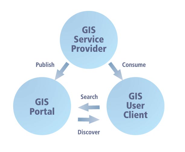
The GIS Portal Toolkit database is populated with documents that describe GIS services (geoservices) published by GIS service providers. Users can issue queries that search the database either from a lightweight Web client or a heavier-weight desktop GIS client, providing that they have an Internet connection. This allows users to discover which services are available on a particular topic for a particular geographic area. The services can then be directly used in client applications.
Metadata describing geoservices is loaded into the GIS Portal Toolkit from publisher systems (desktop-, server-, or Internet-based). This metadata is stored in a database management system (DBMS) as XML records and can be stored in several different standard formats. The GIS Portal Toolkit provides search, mapping, and management capabilities. The user views the front-end content of the GIS portal as a Web site with a collection of pages that describes content, search, and navigation instructions as well as information of general interest to the community of users. The GIS portal front end sits atop an Internet map server (ArcIMS) that provides metadata management, mapping, geocoding, and data download services. The geoservices data is held in a DBMS that is accessed via a database gateway (ArcSDE). Queries to the portal can come from both thin and thick (desktop) clients over HTTP-based Internet connections. In this way, both professional GIS desktop users and browser-based users can make use of the portal and fully distributed services over open Internet connections. The GIS Portal Toolkit is built using industry standards including TCP/IP and HTTP for accessing services and ISO 19115 for storing metadata. Data is stored in industry-standard database management systems and can be requested and served in all widely used GIS standards. For more information, visit www.esri.com/gisportal. |