|
| |
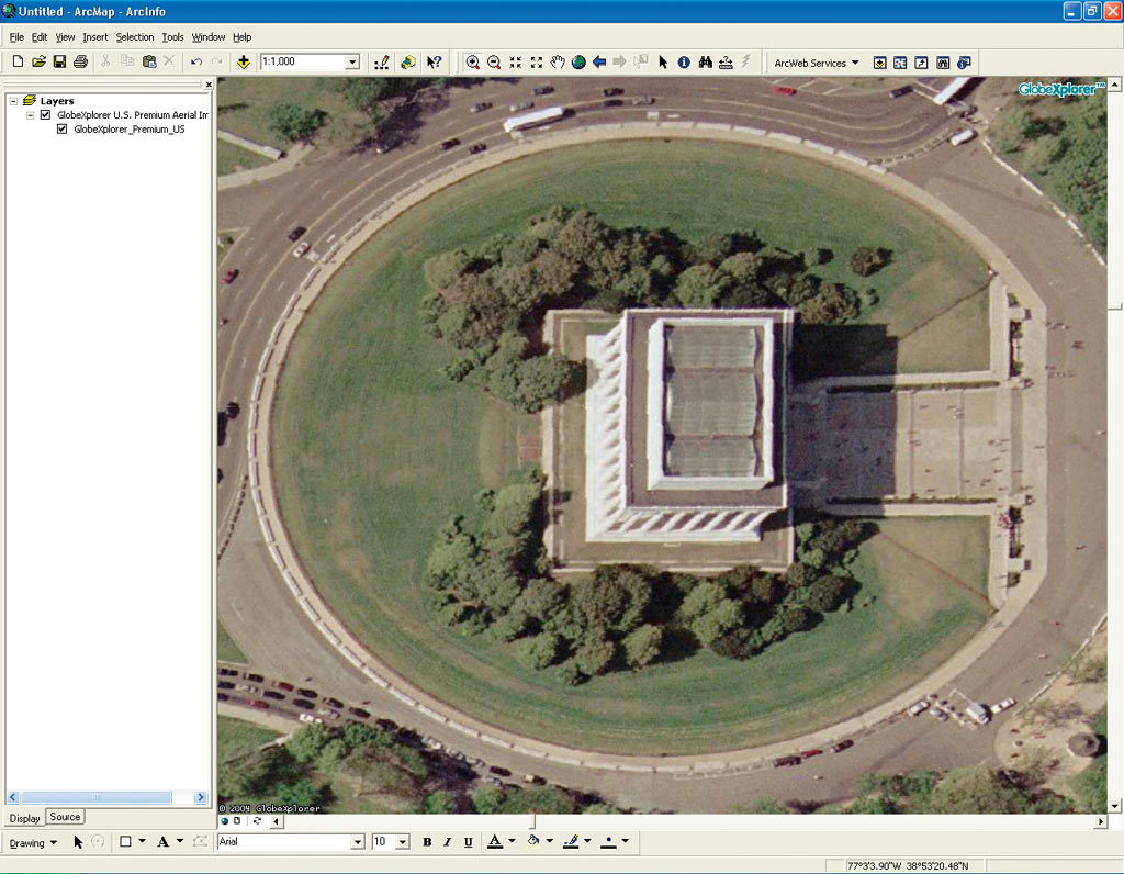
The GlobeXplorer Premium Aerial and Satellite Image Service that is now offered in ArcWeb Services ranges from one meter to three-inch pixel resolution. |
Esri has made significant additions to the data offered as part of ArcWeb Services. Highlights of this added data include premium imagery from Esri Business Partner GlobeXplorer, street data from NAVTEQ, detailed data for Australia from MapData Sciences, and Italian data from Esri Italia.
ArcWeb Services are GIS Web services that give users access to both geographic content and GIS capabilities—on demand when needed—and eliminate the overhead of purchasing and maintaining large data sets. With ArcWeb Services, data storage, maintenance, and updates are handled by Esri. ArcWeb Services can be used by developers to build or extend their applications, as well as by ArcGIS Desktop users to supplement their local data.
The following new data sources are now available to all ArcWeb Services subscribers:
- GlobeXplorer Premium Aerial and Satellite Image Service—This immense online data set is a collection of hundreds of terabytes of data from the United States' top providers of earth imagery—featuring data from AirPhoto USA, Cities Revealed, DigitalGlobe, EarthSat, i-cubed, United States Geological Survey, and many other partners from around the world. The most detailed imagery in this data set ranges from one meter to three-inch pixel resolution. The archive is continually updated with new imagery.
- NAVTEQ—ArcWeb Services now offer detailed road network data for North America from NAVTEQ with data for additional countries coming soon. NAVTEQ maps provide elevation contours to help drivers orient themselves when navigating in unfamiliar places. NAVTEQ maps can be used to create street network maps, find driving directions, geocode and reverse geocode, find places near other locations, and determine attributes of the road network.
- Australian data—This data is provided by MapData Sciences using the Public Sector Mapping Agencies Suburb and Localities data as a base. It includes a complete transportation network, including freeways, highways, main roads, suburban streets, paths, unsealed roads, and vehicular tracks. Other layers include airports, beaches, bridges, built-up areas, town points, contours, points of interest, leisure facilities, parks, national parks, aboriginal lands, railway lines and stations, rivers, lakes, sport venues, and state and regional boundaries, as well as other features identified by Australia Post as delivery areas. Users can perform geocoding and reverse geocoding on the Australian data.
- Italian data—This data includes Italian street maps based on layers customized by Esri Italia together with the Tele Atlas/TomTom Italian database. Maps are based on vector data sets simulating blocks in styles similar to the most popular Italian maps. Maps include many points of interest. The service includes geocoding and queries on the underlying data.
To sign up for a free ArcWeb Services evaluation, visit www.esri.com/arcweb or call 1-800-447-9778. Outside the United States, you can sign up online at www.esri.com/arcweb or contact your local Esri distributor.
|