Winter 2004/2005
Winter 2004/2005 |
|||||||
|
|
|||||||
GIS Day 2004—Around the World in Many Days |
|||
|
GIS Day 2004 was celebrated any number of ways—for example, by people attending an open house at their local government The GIS Day committee would like to send a sincere thank you to all the GIS Day 2004 event planners and participants for your dedication to fulfilling the mission of GIS Day by bringing geography and GIS awareness to the citizens of the world. Remember GIS Day can be any day and every day. We look forward to seeing you again next year for GIS Day 2005. Keep up the good work! Surprise for GIS Day Mentors in Houston, TexasGIS Day 2004 in Houston, Texas, brought excitement to area students at the Law Enforcement and Criminal Justice High School when their project was announced as the first place winner of the GIS Stealthily planning their own announcement, the students invited their unsuspecting mentors to attend a high school basketball game and surprised them on center court at half-time with the presentation of their award plaque. Criminal justice teacher Valgene Holmes presented the plaque to the volunteer mentors. Engraved on the plaque was the following message expressing sentiments of appreciation and thanks: "Your hard work, dedication, and mentoring allowed us not only to achieve but excel to heights beyond our wildest expectations. We salute you." GIS Day in Houston was planned and executed by the Houston–Galveston Area Council's Geographic Data Committee (HGAC–GDC) and held at the University of Houston, Downtown. New to this year's agenda was the mentorship program designed to link local GIS professionals with interested high school students. With help from their mentors, the students designed their own projects, working with data, computers, and GIS software to produce maps. Some of the maps created through the program included those showing the location of schools in Harris County and others showing where registered sex offenders live, including a layer that showed violations of registered sex offenders living within the 100-foot buffer zone of schools and parks. Commenting on the success of the various GIS Day activities, Max Sanfied, data services manager of HGAC-GDC, Carol Gaines, the information coordinator for the Harris County Information Technology Center, further attested, "I can personally tell you the excitement was really high among the students and mentors when they learned their project was chosen number one in the Houston area GIS Day mentorship program. The winning students did not have any previous GIS experience or training and were not involved in GIS classes before working with the mentors. The mentoring program really opened new doors for these students." High Spirits at the Rocky Mountain Mapping Center GIS Day, Denver, ColoradoUnited States Geological Survey (USGS) scientists and information specialists hosted a GIS Day/Geography Awareness Week event at the Rocky Mountain Mapping Center in Denver, Colorado, on November 9, 2004. Two separate events were held, one from 8:00 a.m.–3:00 p.m. for students, and another special event later in the evening was designed specifically for teachers. More than 900 students ranging in age from six to 30 (approximately 70 percent were middle school students) and 100 teachers participated in the program, representing a diverse mix of public and private schools, as well as alternative, university, The event was the largest GIS Day event that the Denver USGS facility has hosted to date. In previous years, GIS Day had up to 150 attendees, while this year more than 1,000 teachers, students, and GIS professionals attended from all over the Denver area. One of the highlights for the students was a visit to the National Ice Core Laboratory. Before going into "the freezer," the students heard expert explanations about why an ice core is a good recorder of climate change. They learned how an ice core is sampled, transported, and studied and what it tells researchers about ancient and current climate and rates of climate change. Hay Is for Horses and GIS Is, Too—in Norco, CaliforniaStriving to maintain its rural lifestyle amidst a growing urban population, Norco, California, known as Horse Town, USA, celebrated GIS Day 2004 with a World of Horses presentation for the Norco Horseman's Junior Association for 30 kids and parents. The children range in age from five to 17. A Horse Breeds of the World quiz was held, followed by a Horses of the World interactive presentation. It's not too late to submit your GIS Day 2004 photos and success stories. Visit the GIS Day Web site at www.gisday.com to submit yours today. GIS Day 2005 is scheduled for Wednesday, November 16. Be sure to mark it on your calendar today so you can celebrate again with us next year. Exploring Maps in Costa RicaGeoTecnologias in Costa Rica held its GIS Day 2004 event at the Universidad Estatal a Distancia. Several students made presentations at the Colegio Tecnico Profesional Industrial de Calle Blancos, which were designed to introduce ArcView technology to high school level students. Healthy Lifestyles With GIS in Boise, Idaho
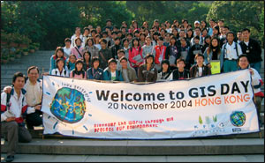
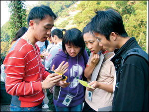
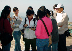
GIS Day in Hong Kong
Situated just below the northern slopes of the Tai Mo Shan mountains in Hong Kong, the Kadoorie Farm and Botanic Garden (KFBG) celebrated GIS Day 2004 by focusing on the ideas of conservation and environmental protection. Enclosed in a deep valley, KFBG spreads over 148 hectares and is home to several streams, woodland areas, orchards, and vegetable terraces. Among this diverse landscape, there also resides a state-of-the-art conservation education and training facility. What better place to celebrate GIS Day? Co-organized by Esri China (Hong Kong) Limited, KFBG's GIS Day 2004 event was a great success with more than 160 high school students and teachers attending. The event was divided into two sessions to explore and experience how GIS and other advanced technologies could be used for analyzing, monitoring, and protecting our precious environment. Dr. Gary Ades, senior manager, and Mr. Paul Crow, conservation officer of KFBG Fauna Conservation Department helped to explain how environmental scientists use different kinds of devices, such as bat detectors and radio telemetry to monitor wildlife. Cameras equipped with infrared motion detectors that trigger precisely timed photo snapshots were also demonstrated as important tools used to help monitor and map wildlife activities and changes. The GIS consultants of Esri China (Hong Kong) taught the students how to locate their position in longitude and latitude using handheld GPS devices and how to use tree measurement kits to input tree data using mobile devices running ArcPad software. The students were also introduced to the concept of using ArcGIS technology to analyze and determine the location for new buildings and construction in order to minimize any damaging impacts to the local wildlife and environment. The KFBG GIS Day team believes that GIS is a great tool to help understand the environment and that it should be integrated into conservation education whenever possible. The smiling faces of the enthusiastic students conveyed to the KFBG team that its GIS Day 2004 event was an overwhelming success. Proclaiming their excitement and dedication, the KFBG team shared, "The hard work of the organizing team has paid off, and we hope that GIS Day will be celebrated every year!" Solving Problems in Rural Africa
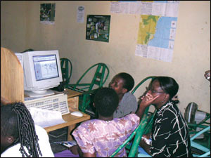
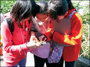
GIS enthusiasts gather at the community resource center in rural Kenya in a town called Ugunja, near the border with Uganda. Learning to use GIS to map their communities and solve local problems, the group was founded by local farmers who assembled at the library to discuss modern farming methods, including the recent addition of GIS technology to their computer resource lab.
|
 GIS department, or hosting an internal education event for adults at their GIS firm, or leading a group of eager students on a geocaching treasure hunt on the football field of their high school alma mater. GIS Day 2004 was definitely celebrated around the world and on many different days during the past year. More than 700 registered events were held on five continents and in 76 countries—Canada alone held more than 50 events. Private businesses, universities, nonprofit organizations, and government agencies, as well as teachers and students, worked diligently to plan original, educational, and sometimes even elaborate events within their local communities to help celebrate the sixth annual global GIS Day.
 Mentorship Program Contest. The mentors involved with the award winning project were Harris County Information Technology Center (ITC) GIS employees Ashli Prejean, John Wong, Randy Davidson, Travis Conner, and Gilbert Botello.
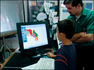
 and home school environments. These events, held in conjunction with the University Corporation for Atmospheric Research, the Geospatial Information Technology Association, the GLOBE project, and the Colorado Geographic Alliance, included demonstrations and tours of the USGS Rocky Mountain Mapping Center, the Rock Core Research Center, and the National Ice Core Laboratory. Activities for students included hands-on work with maps, aerial photographs, satellite imagery, GIS, Web mapping, and orienteering. Activities for teachers incorporated the above along with additional topics, including geography teaching methods, geoliteracy, organizing schoolwide geography bowls, etc.
 Presenters used the ArcGIS application ArcMap to show how to get from one location to another using streets, then by riding on a horse along horse trails only. The same presentation was such a success it is going to be presented to the Norco Horseman's Trail Committee and the city of Norco Streets and Trails Commission for use in adding, preserving, and repairing horse trails throughout the city.
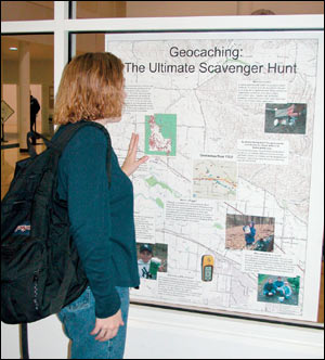 Women in GIS of Greater Boise conducted a weeklong map gallery to promote healthy lifestyles. Held at the YMCA, collages of maps created by Idaho Fish and Game and the U.S. Bureau of Land Management displayed wildlife viewing maps of 12 areas requiring hiking, bicycling, climbing, canoeing, snowshoeing, or skiing to access the site. Idaho Department of Health & Welfare, Boise State University, and the Ada County Assessor's Office also participated with maps depicting state vital statistics and geocaching activities. Activity sheets related to the maps were provided to the three day care centers within the YMCA. Adult YMCA members indicated that they read the posters mounted in front of the treadmill and cycling equipment while they exercised and found them very informative.
 Sara Simmons of Oakar Services, Ltd., Esri's distributor in Kenya, reports that students at St. Christopher's High School in Nairobi loved learning about geography and maps during their special GIS Day activities. They especially liked the GIS Day pencils and stickers.
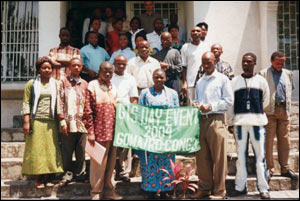
 GIS Day in Goma, East Democratic Republic of Congo, focused on the role of GIS in protected areas. Sponsored by the Dian Fossey Gorilla Fund International and the Union of Associations for Gorilla Conservation and Community Conservation in the East Democratic Republic of Congo, many conservationists and GIS specialists gathered to discuss the use of GIS for research and decision support in protected areas (10 percent of the Goma region and 25 percent of the area in Tanzania to the east of the Democratic Republic of Congo fall in the protected area category). The GIS Day 2004 celebration organized by Musumba Teso was the first of its kind in his country.