Winter 2004/2005
Winter 2004/2005 |
|||||||
|
|
|||||||
Help Is Already on the Way in Many States
More Accurate Elevation Data for Users of Geospatial Data |
|||||||||
|
By D. David Moyer, Honorary Fellow, University of Wisconsin, and Darin J. Henkel, Geodata Specialists
Location is the key in building, maintaining, and using systems that contain geospatial data. The locational reference system used in many geospatial systems is the geodetic reference system, the one recommended by the National Research Council in its 1980 report, Need for a Multipurpose Cadastre (also called the Multipurpose Land Information System). The geodetic reference system is a network of substantial, stable physical structures, each of which includes a disk that provides information on the agency that put the geodetic monument in place, the name of the monument, and sometimes the date the monument was set. These monuments are typically concrete pillars set in the ground or rods driven deep in the earth. More recently, some geodetic monuments have included a GPS antenna and receiver for collecting a continuous stream of data about the monuments' location. At the second annual Esri Survey and GIS Summit last summer, Charlie Challstrom, director of the National Geodetic Survey, stressed the importance of the geodetic control foundation to provide the interdependent linkage among GIS data layers. In the United States, the National Geodetic Survey (NGS) in the U.S. Department of Commerce is responsible for this national geodetic network, known as the National Spatial Reference System (NSRS). Since 1807, NGS and its predecessor agencies have been building and maintaining the NSRS. The NSRS database currently contains information on more than 850,000 geodetic monuments that make up the NSRS network.
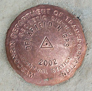
Information about each monument that is part of NSRS is contained in a "data sheet" that is available via the Web from the NGS database maintained in Silver Spring, Maryland (www.ngs.noaa.gov). To be included in NSRS, a monument must be a permanent, monumented, reusable, defined point that is precisely measured and adjusted (with other monuments in the network) in accordance with standards and specifications developed by the Federal Geodetic Control Subcommittee (FGCS). These standards assure that documentation and accuracy requirements are satisfied to serve multiple uses. Information on each data sheet includes a point identifier number; the location of the monument; how to locate the monument (i.e., directions to drive to, or otherwise reach, the monument); and a variety of other data, including the horizontal and vertical coordinates of the monument. In the last 20 years, GPS has replaced traditional horizontal surveying methods for many surveying tasks. Using the constellation of GPS satellites, surveyors can now regularly obtain horizontal coordinate location accuracies of 1 to 2 cm (.39 to .78 inch). However, until quite recently it has not been possible to obtain comparable accuracies for the vertical coordinate location of these monuments. In 1998, to address the shortcomings of the vertical geodetic network, Congress requested the National Geodetic Survey to "conduct a National Height Modernization Study to demonstrate the effectiveness of this work in California and in western North Carolina." The study results further documented the need to modernize the vertical component of NSRS and demonstrated how GPS might be used to accomplish the modernization effort with significant cost savings. Based on these study findings, NGS has been working with several states, including Alabama, California, Louisiana, Mississippi, North Carolina, South Carolina, and Wisconsin, to develop the most effective techniques for using GPS and other related technologies to improve the accuracy of the vertical coordinates. Wisconsin's Approach to Height ModernizationThe Wisconsin Height Modernization Program (WI–HMP) is based on a comprehensive plan that was developed jointly by the Wisconsin Department of Transportation and the National Geodetic Survey. The Wisconsin program has an estimated cost of $16 million, with completion scheduled for 2008.
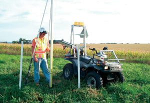
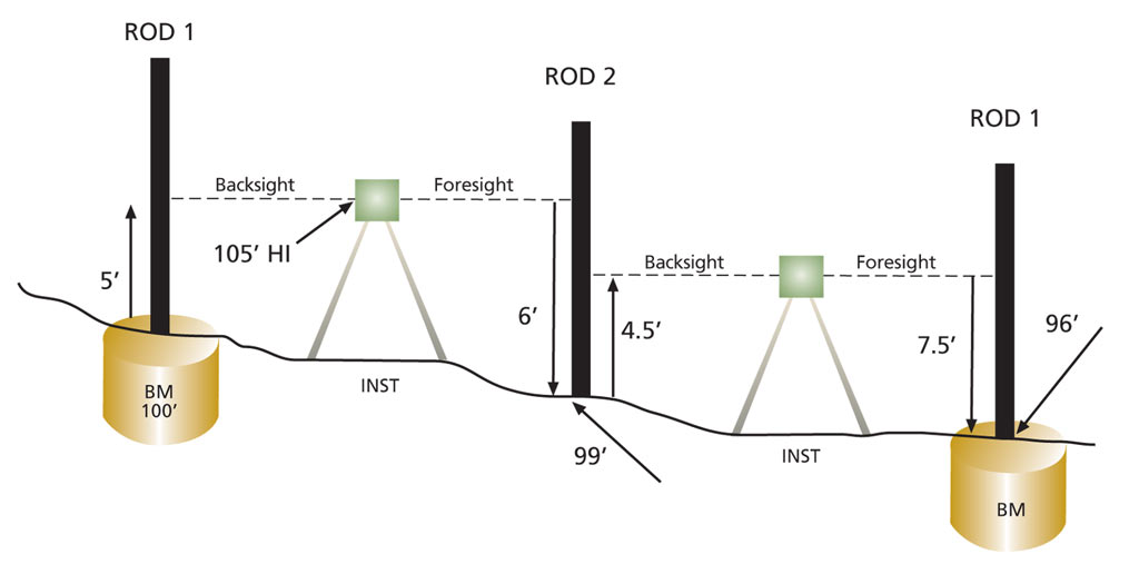
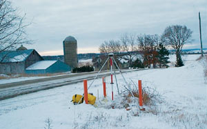
The goal of the WI–HMP is to develop an integrated, three-dimensional geodetic network that combines the horizontal and vertical monuments. Using GPS and leveling technology, Wisconsin is obtaining horizontal and vertical coordinates that have 2 cm accuracy. In addition to greater accuracy, the WI–HMP also eliminates inconsistencies between horizontal and vertical data, provides additional geodetic control by replacing bench marks that have been destroyed or are otherwise unsuitable for use with GPS, and provides a more dense network of geodetic monuments to maximize benefits of GPS technology for a wide variety of geospatial data users. The coordinates for this 3D network are being developed using both GPS and the latest conventional geodetic leveling techniques. Conventional leveling is the technique used to determine vertical coordinates for a series of monuments called bench marks. Bench marks are usually set in a series called a level line. Distances between bench marks along level lines are called sections. Traditionally level lines were set along transportation corridors, primarily railroad rights-of-way. In the WI-HMP, bench marks and GPS monuments are set in public rights-of-way and other public lands, such as parks, to the maximum extent possible. This helps assure that all users of the geodetic network will have ready access to the monuments for subsequent survey-related activities. For the Wisconsin Height Modernization Program, bench marks are set at approximately 3 km (1.8 mile) intervals along level lines. Level lines in Wisconsin are spaced in a rough grid of approximately 25 kilometers, which "run through" and include key horizontal monuments for which highly accurate horizontal coordinates have previously been determined using GPS. Procedures to collect elevation (vertical coordinate) data for sections of a level line have changed very little since the early 1900s (see drawing). In the simplest case, graduated vertical rods (calibrated for accuracy) are set up along a level line with rod 1 on a bench mark (with a known elevation) and rod 2 on a temporary mark (e.g., metal pin driven in the ground). The level instrument is set halfway between these two rods. The first reading is taken on rod 1 (backsight), and that value is added to the height of the bench mark to determine the height of the line of sight of the instrument. Then the instrument is turned, and a reading is taken on rod 2 (foresight); that value is subtracted from the height of the instrument to determine the height of the temporary mark. The instrument and rod 1 are then moved ahead, making rod 2 the backsight and rod 1 the foresight. This procedure (backsight–foresight) is continued along the section until another permanent bench mark is reached. All sections of a level line are observed in this fashion and must be observed twice (in opposite directions) to assure that no measurement errors have been made. Current leveling procedures use bar coded rods (similar to Universal Product Code scanning by retail stores), and the instruments take multiple shots for each measurement. Providing these additional bench mark monuments is especially beneficial because a large proportion of the more than 600,000 bench marks that have been set over the past 100 years has been destroyed, is unstable, or is unusable because of obstructions that make use of GPS problematic. The WI–HMP plan follows FGCS standards and specifications and includes the submission of coordinates to NGS for inclusion in the NSRS database of geodetic data. By submitting this data to NGS, the state is freed from the responsibility of maintaining a separate database containing geodetic control information. It also helps assure that this data is readily accessible from the NGS Web site to all data users throughout the country. Beneficiaries of Improved Accuracy of Vertical Coordinates
Why the great interest in more accurate vertical coordinates? The answer lies in the many uses and users of this data in a wide variety of applications. For example, an accurate geodetic network helps assure more accurate output from the Esri Parcel Data Model. The more accurate parcel layer will in turn produce a new cadastre fabric, the ownership data that drives many decisions about land use and resource management. Tools like ArcGIS and Survey Analyst 9.1 help link the survey and GIS data for users of this data. Since the Height Modernization Program began, numerous specific beneficiaries of the closer linkage of geodetic survey and GIS information have been documented. For example, both the 1998 study prepared for Congress and an independent analysis carried out by the Wisconsin Department of Transportation (WisDOT) concluded that modernization of height data would provide a number of specific benefits to federal, state, and local government projects and programs. These include
This benefit, of saving time and cost for field surveying activities, is so large that WisDOT was able to cost justify the entire WI-HMP plan based on transportation planning, design, and maintenance activities alone. For example, for planning and design purposes, WisDOT conducts substantial amounts of photogrammetry each year. As part of the quality control program, the digital orthophoto products are checked for accuracy. Before the WI-HMP was in place, it took 24 hours to conduct field checks necessary to verify the horizontal and vertical positions of checkpoints in a single 36-square-mile Public Land Survey System township. With WI-HMP completed, these same checks can be made in four hours. This 6:1 saving translates into annual savings of $300,000 when the WI-HMP is completed statewide. A second example results from the establishment of both horizontal and vertical positions on a group of photogrammetric targets that had been placed in the field for a highway design/mapping project. Techniques for establishing these positions, which took 240 hours to perform previously, were reduced to 40 hours by the WI–HMP, an 89 percent reduction in man-hours. The annual savings statewide from this single application will exceed $1 million to WisDOT. ConclusionPrograms, such as the Height Modernization Program in Wisconsin, are demonstrating that state and federal agencies can work cooperatively to produce significant benefits and that more accurate GPS elevation data linked with other GIS data layers can provide for a wide variety of GIS/land information system applications. For more information, contact D. David Moyer, honorary fellow, University of Wisconsin, Madison (e-mail: david.moyer@dot.state.wi.us), or Darin J. Henkel, Geodetic Specialists, LLC, Baraboo, Wisconsin (e-mail: djh.geospec@charter.net). |