Winter 2005/2006
Winter 2005/2006 |
|||||||
|
|
|||||||
Serves Geographic Intelligence On Demand
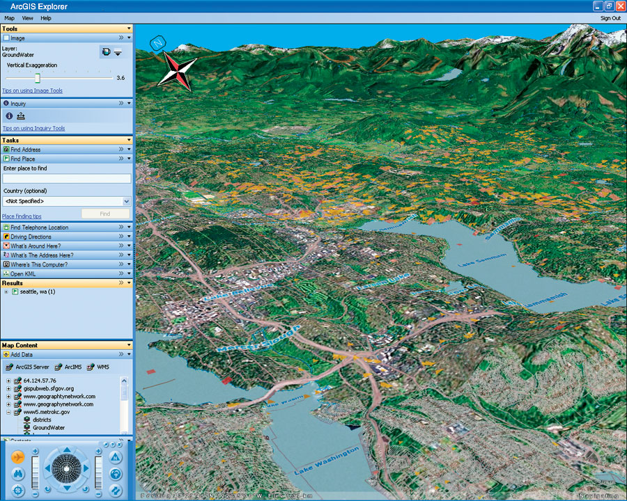
Announcing ArcGIS Explorer |
|||||
ArcGIS Explorer is a new geospatial information viewer, powered by ArcGIS Server. It offers a free, fast, and easy-to-use way to explore geographic information—in both 2D and 3D—while performing queries and analysis on the underlying data. ArcGIS Explorer integrates server-based geoprocessing applications with GIS datasets by accessing the full GIS capabilities of ArcGIS Server, including geoprocessing and 3D services. ArcGIS Explorer can also use data layers and services from ArcIMS and ArcWeb Services. In addition, ArcGIS Explorer supports Open Geospatial Consortium Web Map Service (WMS) and Google KML data, making it open and interoperable. With ArcGIS Explorer, users can explore data for the entire world in 2D and 3D seamlessly; fuse local data with data and services from ArcGIS Server, ArcIMS, Open Geospatial Consortium WMS, and Esri-hosted ArcWeb Services; perform GIS analysis using tasks (e.g., visibility, modeling, proximity search); answer geographic questions about the maps generated and share the results with others; and use maps and data from their own secure servers.
Navigation in ArcGIS Explorer is simple. It supports flying over the map view, rotating, tilting, continuous pan, and dynamic zoom. Users can also change the transparencies of the layers of information seen on the map and swipe any layer for rapid comparison of data. For example, users can swipe an aerial photo to compare how an area looked before and after a flood. ArcGIS Explorer is useful for people who collaborate and share information with others, as well as for individuals interested in exploring and learning about the earth. The final version is planned to be released in conjunction with ArcGIS 9.2. For more information on how a world of information can be discovered with ArcGIS Explorer, visit www.esri.com/arcgis-explorer. |