Winter 2005/2006
Winter 2005/2006 |
|||||||
|
|
|||||||
In Transcarpathia, Ukraine, GIS Aids Statistical Forest Inventory |
|||||||
|
By Petr Vopenka and Martin Cerny, Institute of Forest Ecosystem Research
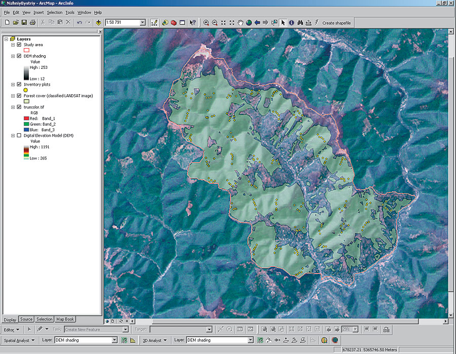
Transcarpathia, the southwest region of the Ukraine, stretches south of the Carpathian mountain ridge, north of the Romanian border, and east of Slovakia. The majority of the population lives in narrow lowlands in the south of the region along the Tisa River. This includes the Nizhniy Bystriy municipality and watershed, about 60 kilometers north of the regional center of Khust. Despite the fact that the mountains to the north of this region contain enormous amounts of natural resources, which can potentially be used to raise the living conditions of local inhabitants, many people from Nizhniy Bystriy travel annually to western European countries or to Russia for seasonal work. This is because local businesses and infrastructure are not sufficiently developed to tackle the area's high unemployment rate. To address this concern, the Swiss-Ukrainian Forest Development Project (FORZA) helped establish principles for well-functioning rural communities by designing the Watershed Development Plan (WDP). Part of WDP is the Statistical Forest Inventory (SFI) that assesses the potential of natural resources in a watershed. In July 2005, to determine whether the mountains contained enough quality timber to help grow the area's economy, an inventory was carried out by the Institute of Forest Ecosystem Research, Ltd. (IFER), in the 5,685 ha Nizhniy Bystriy watershed. IFER is an independent forest research institute located in Jilove u Prahy, the Czech Republic. As a first step toward designing the network of SFI plots, IFER used global Internet GIS data sources to obtain data needed to define the watershed and estimate the forest cover. Technology Selection
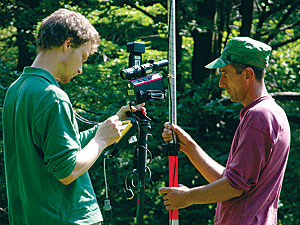
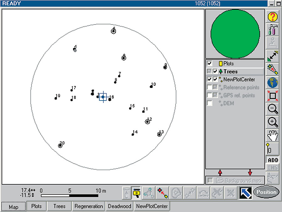
IFER used ArcInfo and IFER's Field Map, a forestry application based on MapObjects, to create the SFI in Nizhniy Bystriy. The Khust forest enterprise, which is responsible for the Nizhniy Bystriy watershed, is equipped with an ArcGIS workstation, allowing data gathered before or during SFI fieldwork to be used later by forest managers for further analysis and database building. In addition, each field team was equipped with a laser range finder, an inclinometer, and a GPS and electronic compass mounted on a monopod and connected to the field computer running data collection software. Because IFER had to respect financial and time constraints of WDP, the fieldwork took 20 working days by two field teams. MethodsIFER created the border of the watershed from a Shuttle Radar Topography Mission (SRTM) digital elevation model (DEM) using the hydrological functions of ArcInfo. The forest area was derived from Landsat satellite imagery. They classified the imagery by combining supervised and unsupervised classification methods with ArcInfo. Using these methods, it was possible to get basic information about the study area even before coming to the Ukraine. IFER performed the SFI measurements on a large number of relatively small inventory plots. The network of SFI plots was designed to representatively cover the area, but at the same time, the plots needed to be accessed with minimal time loss. They used ARC Macro Language (AML) script to create a network of SFI plots using ArcInfo. Plots were grouped in clusters of five, and these clusters, which covered local altitude gradient, were equally distributed in the forested area of the watershed. Each cluster represented one day of work for one field team. Results
IFER visited 200 plots during the field campaign, subjecting 2,249 trees to detailed biometrical measurements. Using field map technology, they stored the field team data in shapefiles directly in the field. Thus, the office work was reduced to downloading the data and recharging the batteries. Because SFI in Nizhniy Bystriy was focused on standing timber assessment, the main outputs are the timber volume estimations. The results showed that, although the majority of the watershed (87 percent) is covered by mature beech forest with a timber volume of 366 m3/ha, there are only 35 m3/ha of quality timber, and as such, the area has limited potential for timber production. This might be bad news for those who hoped for high potential of the forest regarding timber production, but the information is highly valuable for future watershed management planning. The SFI in Nizhniy Bystriy was funded jointly by the Czech-Ukrainian development cooperation project TechInLes and by the Swiss-Ukrainian development cooperation project FORZA. For more information about the Institute of Forest Ecosystem Research, contact Dr. Martin Cerny (e-mail: cerny@ifer.cz) or Petr Vopenka (e-mail: vopenka@ifer.cz) or visit www.ifer.cz. |