Winter 2005/2006
Winter 2005/2006 |
|||||||
|
|
|||||||
Mosquito Control Operations at Florida Keys Mosquito Control District Integrates GIS |
|||||||
|
The Florida Keys is a cluster of hundreds of islands interconnected by more than 40 bridges that stretch southwest In 1949, the Monroe County Anti-Mosquito District was created by a special act of the Florida legislature. The district has undergone two name changes and is now the Florida Keys Mosquito Control District (FKMCD, or "the district"). There are a number of mosquito-borne diseases that are of concern in Florida, particularly eastern equine, St. Louis, and West Nile encephalitis. With a subtropical environment, more than 40 species of mosquito, and an extremely high tourism rate, controlling mosquitoes is essential to the health and economy of the Florida Keys.
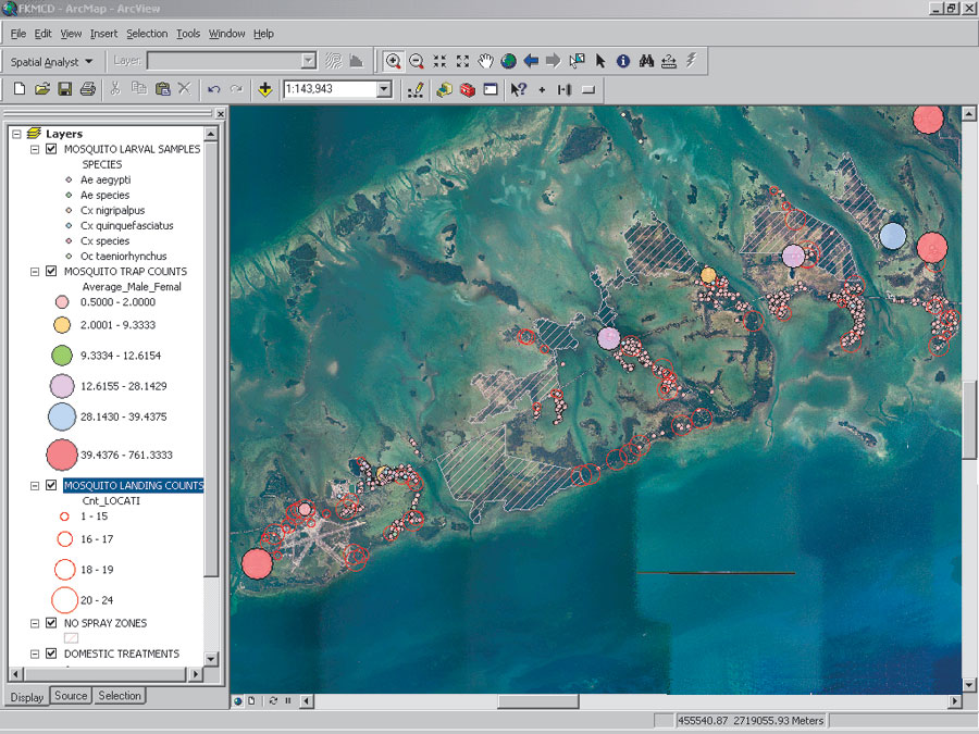
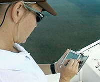
FKMCD has been at the forefront of modern technology in mosquito control for years. In 2003, it contracted CompassCom, Inc., to provide an automatic vehicle location system. The system allows staff in the office to monitor the movements of the mosquito control vehicles in real time. This has proved useful in FKMCD's adult mosquito spray missions, where an in-office dispatcher can ensure that the proper areas have been treated by watching the activities of the vehicles. FKMCD started using the Vector Control Management System (VCMS) by Advanced Computer Resources Corp. in 2000. This is a database and field collection system that was designed specifically for mosquito control agencies; users have the option of using Sybase, Oracle, or Microsoft SQL Server as the database platform. The system allows FKMCD to collect information about mosquito inspections and treatments in the field, as well as enter mosquito identifications and West Nile virus test results in the office. FKMCD realized the importance of incorporating GIS into the program. Understanding that a comprehensive GIS program would make analysis more efficient, the district began to develop a program based on the following set of requirements. Having the GIS data accessible in real time was not necessary, but FKMCD wanted to be able to easily retrieve data from the previous day's activities. As considerable training, money, and time went into the use of the VCMS program, it was also important to continue using the program's mobile software to collect data in the field. Finally, a multiuser system was required, as the district has three offices and multiple users. Based on these requirements, FKMCD decided on ArcSDE to provide the gateway between the database and its existing ArcView software. Designing the DatabaseThe first step in the process of developing the new GIS program was designing the database. FKMCD information technology and GIS staff met with the field supervisors and laboratory staff to gain a better understanding of what uses and products would be beneficial to their operations from a GIS standpoint. From this information, staff members were able to determine what data was needed to build the spatial layers.
In April 2005, FKMCD contracted with Esri Professional Services to create the geodatabase and the Visual Basic (VB) scripts that would pull data from the VCMS program to create the feature classes. There are two separate instances of the FKMCD Oracle database: one for the VCMS program and the other for the GIS program. Each morning, prior to staff arriving at the office, the VB scripts run and copy data from the VCMS instance of the Oracle database into the GIS instance of the database. A series of scripts is then executed, each one pulling fields from various tables, linking them to the spatially referenced table and creating feature classes that are saved in the geodatabase. The end result is readily accessible data. "When your ultimate goal is to be able to view and analyze data," states Shana Lowe, GIS technician, "it makes the process much smoother when you don't have to spend half the day creating the data. We have taken our GIS program from the data creation mode to the data analysis mode, which was the reason for the GIS in the first place."
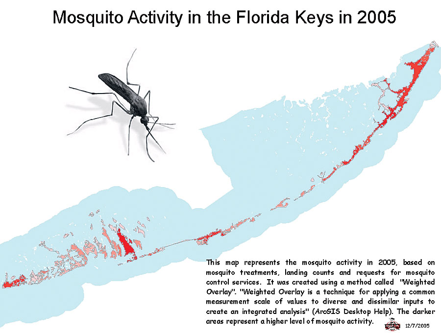
Along with the ability to quickly view activities and make maps, FKMCD has now taken its analysis to a whole new level—a spatial level. "Mosquito control is a science," Lowe continues, "and being in an environmentally sensitive area like the Florida Keys, it has to be a precise science. The ability to analyze our data on a spatial scale allows us to target our operational activities more effectively." With the new program in place, the GIS department now produces a monthly GIS report for the district's board of commissioners. This report includes maps of monthly activities, as well as examples of some of the analysis that is taking place. FKMCD will continue to examine its data with the GIS program. The goal of all this analysis is simple: better control of mosquitoes. "GIS has helped put a picture to a multitude of facts and figures," states Jennifer Fahey, domestic supervisor of the program that inspects and treats residents' yards. "Spatial representation of our data has helped us execute plans of control more efficiently than ever." By examining mosquito breeding patterns, efficacy of mosquito control products, species composition, and contributing climatic factors, the district will gain a better understanding of its practices and how to utilize its staff more effectively. For more information, contact Shana Lowe, GIS technician and biologist, Florida Keys Mosquito Control District (tel.: 305-292-7190, e-mail: slowe@keysmosquito.org), or John Karagiannis, Esri Professional Services (e-mail: jkaragiannis@esri.com). |
 of the mainland Florida tip and end just 90 miles from Cuba. The only living coral reef in the continental United States resides off these islands, making it one of the most popular fishing and diving spots in the world. The Florida Keys also has a rich and colorful history.