Winter 2005/2006
Winter 2005/2006 |
|||||||
|
|
|||||||
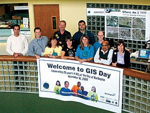
Operation GIS Day 2005 |
|||||||
|
What do Canada, the Czech Republic, India, Barbados, Peru, Iraq, and Mongolia have in common? Despite their cultural and geographic Although events and activities varied greatly from location to location, the mission remained the same no matter where a person went. Interactive sessions, special guest speakers, community expos, hands-on activities, GPS treasure hunts, and even GIS-inspired baking contests all worked together to convey the I Love Geography message to both adult and student audiences on GIS Day and throughout Geography Awareness week. Events were extremely well attended, and many boasted participation counts exceeding more than 1,000 attendees.
Hurricane Katrina and the Pakistan earthquake influenced GIS Day events significantly with many event planners focusing their presentations and demonstrations on educating the public about how GIS can be used to aid in disaster relief efforts. Whether mapping fish migrations in a nearby river, analyzing election tendencies across the country, or monitoring environmental hazards around the world, GIS technology can be used to explore and analyze local, national, and global phenomena. GIS Day provides the perfect forum to share these ideas and reveal how GIS technology can be used to improve life everywhere. Esri sends a heartfelt thank you to all of its international distributors, business partners, and users for participating in this annual effort to bring geography and GIS awareness to the citizens of the world! GIS Day OrganizerTwenty-five-year-old Ronnie Caluza, a December 2005 graduating senior at California State University, Sacramento (CSUS), majoring in geography, decided it was time for him to accomplish something as a leader and "take charge," so he took on the tremendous undertaking of organizing GIS Day 2005 at his university.
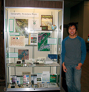
Having been chosen as one of the 2004 Esri User Conference student assistants, Caluza was no stranger to the hard work it takes to put on a large conference. Incorporating the lessons learned at the User Conference, Caluza started his GIS Day plans early and met with his friends and colleagues over the summer to see if they could participate in GIS Day by displaying projects or work done through their internships and connections to local GIS professionals. Many of his friends provided a variety of display booths and support from local GIS consulting firms and public agencies. Local UPN 31 weatherman Tom Loffman, a geography graduate from the University of California, Berkeley, and former CSUS meteorology professor, attended the event as a guest speaker. Event coordination required keeping track of many details and included tackling the issues of borrowing equipment (projectors and screens) from the university media services group, working with the campus librarian to design special Geography Awareness Week displays, and coordinating parking passes for GIS Day guests. Caluza helped publicize and build his GIS Day team by visiting all the junior-level geography classes (a required course for all geography majors) to announce GIS Day and recruit additional volunteers. He also worked with one of his professors to make participation mandatory for students in the Advanced GIS class. Caluza's GIS Day event was a huge success. California Department of Conservation employee and GIS Day exhibitor Virginia Humphreys commented on the overall success of the event saying, "One of things that we really enjoy about our job is outreach—anything that we can do to help educate the public on what we do with respect to land use is great. GIS Day at CSUS provided the perfect forum for accomplishing this goal." Maui Says "Aloha" to GIS DayFunded through grants from the U.S. Department of Labor, Education, and Agriculture, the Women in Technology (WIT) Project is the first workforce development project of its kind to encourage women and girls to pursue math, science, engineering, and technology education and careers. In an effort to attain these goals, Isla Yap, WIT project manager and Project EAST (Environmental and Spatial Technology) coordinator, and her WIT team decided to sponsor the first Maui GIS Day event. Open to the public, the event took place on a Saturday afternoon in November in the middle of the Queen Kaahumanu Shopping Center.
Computer specialists from the Pacific Disaster Center, as well as Project EAST students from five Maui high schools (Baldwin, Kihei, King Kekaulike, Lahainaluna, and Maui), were on hand to talk about and demonstrate their respective GIS projects. The Project EAST students were proud to share information about one of their current projects, which includes collaborating with the Maui Police Department to map all of the defibrillators, hiking trails (where accidents frequently occur), emergency shelters, and local surf spots on the island. The information collected by the students will be entered into the island's existing 911 GIS system and will eventually have the potential to help all Maui residents. The Maui Digital Bus, an educational mobile science and technology lab operated by local information technology firm Akimeka LLC, was also on display. The bus, which features $100,000 worth of digital cameras and microscopes, water-testing equipment, global positioning system devices, and laptop computers, was a huge hit with the visiting students. Members of the local 4-H Ladybug Club were on hand to help with the keiki (kids') table, which included a GIS Day coloring station, name tags, pencils, and stickers. Commenting on the uniqueness of the island celebration, Yap, who spearheaded the GIS Day event, says, "I had the event at our local mall because it is the gathering place on the island. I believe in most places a mall wouldn't work, but on Maui it does. Our GIS Day celebration allowed Maui residents to see firsthand how this innovative technology will drive more than 10 million jobs over the next 10 years, as well as how important it is to our daily lives." It's not too late to submit your GIS Day 2005 photos and success stories. Visit the GIS Day Web site at www.gisday.com to submit yours today. GIS Day 2006 is scheduled for Wednesday, November 15 (be sure to mark your 2006 calendar today so that you can celebrate again with us next year). |
 differences, on November 16, 2005, people in these countries, along with people and organizations in more than 70 other nations from around the world, shared much in common by participating in GIS Day's seventh annual celebration—joining together in one colossal geography-inspired assignment.