Winter 2008/2009
Winter 2008/2009 |
|||||||
|
|
|||||||
Fleets Stay on the Optimum Routes with ArcLogistics Navigator |
|||||
Highlights
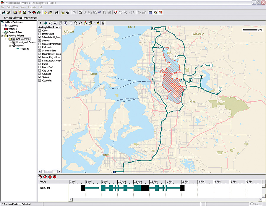
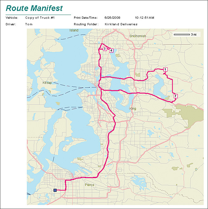
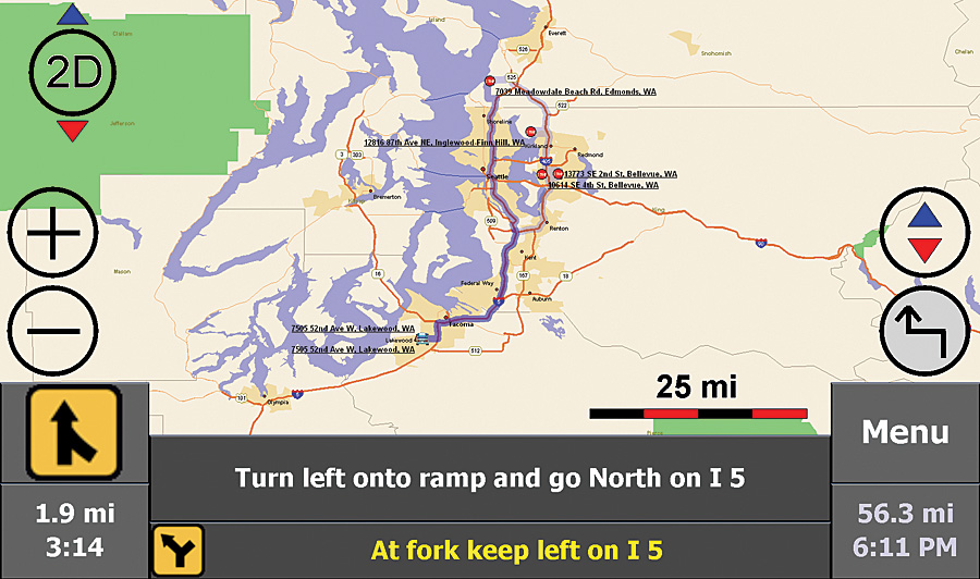
ArcLogistics Navigator, Esri's new in-vehicle navigation solution, helps keep mobile workforce and fleet drivers on the optimized schedules and routes created with ArcLogistics desktop.
This navigation application is specifically designed for trucking, fleets, and logistics and is tightly integrated with the ArcLogistics desktop solution. ArcLogistics Navigator extends the tremendous return on investment (ROI) capability of ArcLogistics desktop by allowing route planners and dispatchers to provide preoptimized stops to drivers so they follow the exact streets chosen for the route. This ensures that optimization and efficiency of fleets occur in the field as planned. Before using ArcLogistics Navigator, when route planners and dispatchers created routes with ArcLogistics desktop, they were satisfied with efficiently ordering stops using the software, but it was no guarantee that their drivers would actually be able to follow the prescribed streets to each stop. The most significant savings when creating an optimum route comes from ordering the stops with ArcLogistics desktop; these routes are derived by considering factors such as time windows, vehicle capacity, driver specialty, and the nature of the street network. In the past, as long as a driver was able to follow the stop sequence, but not necessarily the actual roads leading to each stop, the savings greatly outweighed the loss in efficiently following the prescribed streets. However, with today's economic pressures dictating the need for increased efficiency even more, organizations can realize an additional 10 to 15 percent in savings by helping drivers and the mobile workforce follow not only the prescribed stop sequence but also the exact streets identified in the route, as well as get back on plan quickly if they get lost. With ArcLogistics Navigator, route planners and dispatchers can equip their fleets with door-to-door driving directions while honoring logistics-specific road attributes that reflect their individual business operations. Routes created in ArcLogistics desktop are easily pushed to devices running ArcLogistics Navigator. With ArcLogistics desktop and ArcLogistics Navigator, fleet managers can provide drivers with barrier information, such as road closures, construction, or traffic incidents, as well as which roads should be used in route calculations based on the kind of road or vehicle type and size. The time and mileage spent because of missed turns and looking for stops are minimized because ArcLogistics Navigator gives audible turn-by-turn directions and constantly updates the vehicle's location on the on-screen map, preventing late arrivals and/or lost drivers. ArcLogistics Navigator also improves safety by freeing drivers from having to flip through paper map books, trying to find locations while driving. ArcLogistics Navigator allows
ArcLogistics Navigator runs on Windows Vista, Windows XP, and Windows Mobile devices (Windows Mobile 5 and 6). More InformationTo learn more about ArcLogistics Navigator, visit www.esri.com/arclogistics. |