ArcGIS API for iOS Now Available

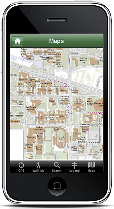
Students and faculty at the University of Oregon use the ArcGIS API for iOS.
Coming off a successful early adopter beta program, Esri recently released the ArcGIS API for the Apple iOS platform. ArcGIS API for iOS enables developers to build and deploy custom iPhone, iPod touch, and iPad applications. This API uses the powerful mapping, geocoding, geoprocessing, and editing capabilities that ArcGIS Server provides. It is designed to use Web services available from ArcGIS Server and ArcGIS Online. Users can access dynamic, tiled, and image map services; overlay graphics; search for and identify features; locate addresses; collect and update data; and perform GIS analysis. Users also have the ability to embed ArcGIS maps and tasks into their line-of-business applications. The API can now be accessed from the Esri Resource Center at no cost.
What Users Can Do with the API
With the API, users can
- Display and use maps that blend map services from ArcGIS Online and/or their ArcGIS Server.
- Execute sophisticated geoprocessing tasks and display their results.
- Search for and identify features.
- Create useful reports of features they've found.
- Collect locations by sketching on the map or using the GPS embedded in their iOS devices.
- Match addresses to specific locations.
What the API Includes
The API provides the following resources for use in iOS applications:
- Maps and Layers—The API supports the display of both dynamic and cached (tiled) map services. With ArcGIS API for iOS, users can display maps in any projection.
- Graphics—The API can enhance applications by allowing users to draw graphics or by providing informational pop-up windows when a user taps on a graphic feature.
- Tasks—It provides common GIS tasks such as querying, searching for and identifying features, finding addresses and places, geoprocessing, and collection.
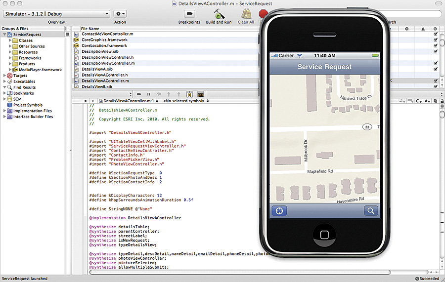
Code built using ArcGIS API for iOS.
The API enables organizations to create mobile solutions that extend to a wider market via the Apple App Store. Developers and Esri partners can also use the API to create applications for both external and internal use. The API includes native Objective-C libraries, sample applications, templates, samples, and help guides that can be used within the Xcode integrated development environment. In addition, there are a variety of community resources, including forums, blogs, and code galleries, available to help users get up and running quickly.
To get started using ArcGIS API for iOS, visit resources.arcgis.com/content/arcgis-iphone/api.
Please see "Mapping in a Mobile World" poster.
Also see "University of Oregon Uses ArcGIS API for iOS."