Conservation Data Sharing Web Site Off to a Fast Start
By James R. Strittholt, Executive Director, Conservation Biology Institute
 Data Basin is a Web-based conservation data sharing and learning system (databasin.org) launched this past summer by the Conservation Biology Institute [see "GIS-Based Web Site Unites Conservation Science and Practice," ArcNews, Summer 2010, Volume 32, No. 2, p. 34]. Since midsummer, Data Basin has seen a fourfold increase in registered users from diverse backgrounds and has undergone huge growth in the number of spatial datasets uploaded (more than 2,000), with the number of maps, galleries, and groups created by users steadily on the rise.
Users are finding the many technical and social features provided by the ArcGIS.com site-supported Data Basin easy to use and powerful in helping them achieve their conservation goals and objectives. For example, professor Janet Silbernagel from the University of Wisconsin, Madison, created a forest scenarios group in Data Basin to advance strategic conservation planning for the Upper Great Lakes region (United States). Dr. Fernanda Zermoglio has created a group to strengthen disaster risk management for Mozambique in response to climate change, and Elizabeth Mather and her fellow group members are using Data Basin to help the Western Reserve Land Conservancy in northeastern Ohio review and exchange spatial data.
From the Connectivity Center landing page, users access spatial datasets, tools, and working groups.
Users are publishing galleries to highlight collections of datasets and/or maps. Richard Nauman uploaded a gallery of 18 datasets on temperate rainforest distributions for various parts of the world. These datasets appeared as maps in a new book entitled Temperate and Boreal Rainforests of the World, edited by Dominick DellaSala and published by Island Press. Those who want to learn more about climate change projections for the Pacific Northwest can explore a series of datasets (credited to Chris Daly, Oregon State University) and maps from a gallery posted by Dr. Dominique Bachelet. They can also locate the latest protected areas datasets for the United States aggregated by the Conservation Biology Institute. Users can view these and other content-rich galleries in Data Basin or create their own.
Significant improvements have been made to the way datasets are branded, tagged, and credited, and users can more easily determine the peer review status of each dataset. Data Basin users are now being encouraged to upload their own datasets to the system. Links to external map services, enhanced searches, improved metadata and map pages, improved group functions, and the ability to share content outside Data Basin are also among the new functions.
The Data Basin team is also very excited about offering a select number of simple yet powerful analytic tools to users. For example, the Conservation Biology Institute recently deployed a prototype model called Benchmark Builder, developed by researchers at the University of Alberta, that aids in the selection of new ecological reference sites that can serve as fully functional protected areas throughout the boreal regions of Canada. Other analytic tools under development focus on helping users avoid environmental risk, evaluate green energy impacts, and plan and design wildlife corridors.
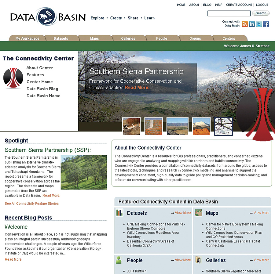
Data Basin recently launched its newest center, the Connectivity Center, that focuses on the opportunities and challenges pertaining to connecting with wild nature. Here, users will gain direct access to some of the most useful spatial datasets, tools, and working groups focused on this important conservation topic. Some of the initial efforts featured in the Connectivity Center include recent modeling that identifies potential wildlife corridors in California and Colorado and ongoing multistakeholder conservation measures in the southern Sierra region of the United States.
Perhaps the most exciting new development in Data Basin is the debut of a series of new Gateways—specific content and tools developed and branded for specific user groups or institutions. Data Basin's first gateway is sponsored by the Forest Stewardship Council (FSC). The gateway is intended to directly support forest certifiers and others interested in applying the FSC Controlled Wood Standards for sustainable forest management—those that balance social and environmental considerations. Additional gateways are also under development, including one for the Inter-American Biodiversity Information Network that will involve linking five data networks throughout Latin America using Data Basin as the integrating technology.
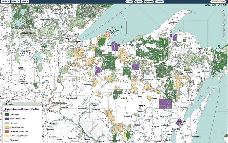
Protected areas for a portion of the Upper Great Lakes region of the United States.
In the months ahead, a number of new advances are scheduled. The global demand for Data Basin has prompted us to offer the site in multiple languages, and that work is currently under way. Geographic search functionality, more visualization tools (e.g., animation), more analytic tools, and more social networking functions will also be coming soon. One of the most exciting new developments will be the integration of Data Basin with the growing number of conservation-focused citizen science initiatives, empowering a new group of people to participate in and help find solutions to conservation issues in new ways.
The future is exciting, and the Conservation Biology Institute invites you to become a member to explore, create, share, and learn. When you do, please provide us with feedback, enabling us to better serve you so you can better serve the planet.
For more information, visit databasin.org or contact Jim Strittholt, executive director, Conservation Biology Institute (e-mail: stritt@consbio.org; tel.: 541-757-0687, extension 1) or Tosha Comendant, Data Basin project coordinator, Conservation Biology Institute (e-mail: tosha@consbio.org, tel.: 707-266-4270).