Tricorders—The Next Tool for Geographic Learning?
"Geo Learning"
![]() A column by Daniel C. Edelson,
A column by Daniel C. Edelson,
Vice President for Education, National Geographic Society
If you're of a certain age, you probably find yourself looking around and remarking on how much today's world looks like the world that Gene Roddenberry imagined in the original Star Trek series. OK, we don't have transporters or warp drives. But we do have computers you can talk to, two-way video communications, and devices that work like communicators and tricorders.
 There is a lot of discussion these days about what impact these Star Trek technologies might have on education. In just the last two weeks, I attended a one-day summit on the promise of wireless technologies for education and a two-day workshop on the use of mobile devices for citizen science.
For geoliteracy, I think these devices offer amazing opportunities to move learning outside the school building, and we've been designing software at National Geographic that students will be able to take into the world on handhelds that will enable them to record observations, combine them with observations of others, and analyze them for geospatial patterns. However, an inescapable challenge of learning in the real world is that the real world is complex and unpredictable. Sometimes it is too complex and unpredictable to enable you to be sure that you can teach specific relationships or skills through real-world experiences.
Tricorder or augmented reality?
One solution to this problem is to create virtual worlds that eliminate the messiness of the real world. For example, you can create a simulated world that students interact with on a computer screen where all the water quality probes are properly calibrated and the relationship between water quality and ecosystem health follows predictable patterns. Unfortunately, these simulations sacrifice the experience of moving around and using actual devices for the benefits of predictability.
However, in recent years, I've been hearing about some very clever people who have been designing what they call "augmented reality" environments to get the best of both worlds. Here's an example:
Researchers from the Missouri Botanical Garden and Massachusetts Institute of Technology (MIT) are working with upper elementary and middle school teachers to design games in which students move around in the real world but interact with simulated characters on the screen of a handheld and use the handheld to make observations and measurements that are generated by a simulation. Some of the scenarios that they have explored in their games include watershed studies, food web investigations, and a cemetery-based scavenger hunt where students "meet" people who had lived in their community through minibiographies crafted from historic census records.
I asked Bob Coulter, the director of the project at the Missouri Botanical Garden, what playing one of these games feels like, and he described it like this:
Imagine you have already learned a bit about watersheds, point and non-point source pollution, and some basic measures of water quality. As part of your study, you now have the opportunity to investigate a water pollution problem in the park down the street. To start, you watch a short video of a local water quality expert on your GPS-enabled handheld. After the expert introduces your challenge, the handheld guides you to relevant sites where you can "sample" the water and make other observations.
The handheld screen displays your position on an aerial photograph as you move toward your next stop, indicated by an icon on the screen. At each location, a simulated expert poses provocative questions and encourages student investigators to observe salient features. With limited time to complete your investigation, you have to draw on what you already know and what you learn from the simulation to make wise choices.
The advantage of this kind of augmented reality experience over "ordinary" reality is that students' experiences can be designed to provide the optimum amount of complexity and challenge for their stage in the learning process. Middle school students can operate in a world where everything follows predictable patterns. College students can operate in a world with sensor error and statistical anomalies. They can also carry learning resources, like field guides, with them in the field, and they can communicate with each other in real time.
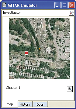
The advantage over virtual reality is that students are able to move around on real terrain and develop real-world skills, like coordinating between an overhead map and their on-the-ground view. For designers, augmented reality enables them to take advantage of all the attributes of the local setting without being limited by them at all. The project at the Missouri Botanical Gardens is taking advantage of the MIT Augmented Reality (MITAR) authoring tools, created by Eric Klopfer and his colleagues, which allow teachers to create their own learning games for their own students and their own locale.
Right now, this is all still in the experimental stage. The researchers are working out how to blend real and simulated worlds and help teachers design effective learning activities. Once they have figured all these things out, though, these Star Trek technologies are going to take real-world geographic learning to a whole new level.
Follow Daniel Edelson on Twitter at NatGeoEdelson.