ArcUser Online
Big Benefits for Small Organizations
Automating map production saves time and money
By Shree Rajagopalan, Esri Production Mapping, Business Development, and Karen Richardson, Esri Writer
This article as a PDF.
Adopting workflows that standardize and automate the creation of cartographic outputs from a GIS benefit not only large enterprises that create thousands of map products but also smaller organizations that regularly create map books, atlases, or other cartographic products for both internal and external customers.
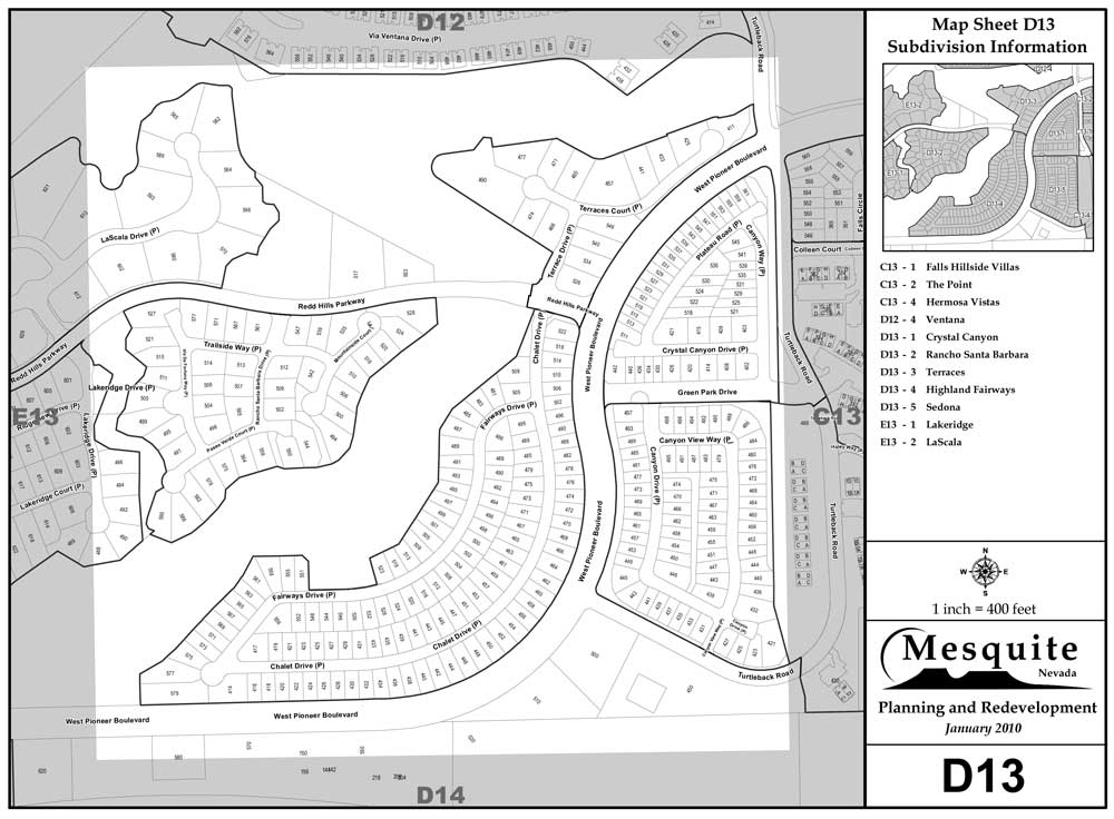
GIS staff in Mesquite, Nevada, now create a sophisticated map series product in two days instead of three (or more) weeks.
Mesquite, Nevada, a city with a population of slightly more than 21,000, found cost savings by implementing ArcGIS and Esri Production Mapping. The city first published its Address Map Book in 1996 in CAD format. Although the Address Map Book was appreciated by end users, producing it was extremely labor intensive. Each year, the map book took three weeks or more to complete. Because it had become the standard reference guide for local utilities, land developers, real estate professionals, and outdoor enthusiasts, the city wanted to produce the book more quickly and easily.
The city has been using Esri GIS since 1995. Mesquite began using Esri Production Mapping in 2008 to create the Address Map Book because it offered the cartographic functionality not available in CAD. This included selecting features in the area of interest for each map page, dynamically placing text on the map page, and producing dynamic inset maps for each page. Using Production Mapping, the city could create the three-section Address Map Book illustrated with basic reference graphics and tables for each city grid tile and detailed graphics for the city's 145 subdivisions.
The Address Map Book, a sophisticated map series product, is now created by the GIS staff in two days instead of three or more weeks using the city's GIS. There is no need for duplicate CAD or other legacy files, so these files can now be archived and removed from the server, which promotes more efficient server management and file organization structure.
With Production Mapping, map book templates can be easily modified to serve the specific needs of the police, fire, and public works departments. The city has been able to partially offset its annual software maintenance costs by charging a modest fee for printed or digital deliverables. Nearly 300 printed copies of the Address Map Book were requested during 2009, and the city made digital copies available in 2010. Delivering quality products is increasing the recognition for the GIS program. Using Esri Production Mapping has resulted in significant time savings for Mesquite.
When creating map products is a central service provided to an organization, it is important that the software used to create those map products fits in with the information technology department. Esri's ArcGIS platform with Production Mapping is based on accepted standards which ensures a high level of interoperability across platforms, databases, development languages, and applications.
Instead of visiting the county offices of San Mateo, residents can download county maps as PDFs from the Web site.
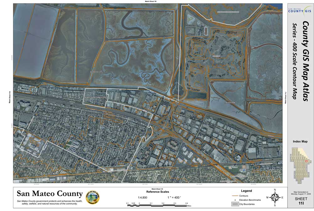
The county of San Mateo, California's Information Services Department (ISD) assists approximately 20 departments within the county. San Mateo County GIS, a group in ISD, maintains accurate geographic data that is used by county employees.
County GIS produces map atlases that have two predefined scales based on a grid system. Each map atlas contains between 40 and 160 map sheets. The map products include 1:800-scale basemaps, 1:400-scale aerial maps, and 1:400-scale contour maps. Until the 1990s, these map products were created using non-GIS technology purchased at the county office. Although the county adopted enterprise GIS in the early 2000s, large-scale map atlas production was not standardized and remained a cumbersome process that required staff to build and maintain several workspaces for each map product.
The county decided to move to a Web-based system but wanted to have a standardized map product first. County GIS engineers evaluated Production Line Tool Set (now known as Esri Production Mapping). The user interface for generating map atlases was more intuitive than the map plotting utilities previously used. With Esri Production Mapping, map products were standardized and their production streamlined. The county now builds a workspace for one map product and reuses the information for the others. A single layout can be used as a template to batch generate multiple maps rather than manually creating individual layouts—a significant time savings.
County GIS now provides its map products over its Web site, www.co.sanmateo.ca.us/ portal/site/gis. The products are updated on a semiannual basis. Instead of visiting a county office, people who want county maps can download PDFs from the Web site and print them.
Esri Production Mapping helps organizations of any size create map products ranging from producing map books to advanced high-end cartography in a shared work environment that improves the quality and value of both geospatial data and cartographic products. Database-driven cartographic production—automating maps and charts based on the information stored in the GIS—makes Production Mapping a powerful tool for achieving cost savings by managing and publishing accurate data and cartographic products more efficiently. For more information, visit esri.com/productionmapping or e-mail productionmapping@esri.com.