ArcUser
Winter 2012 Edition
More SoVI Mapping
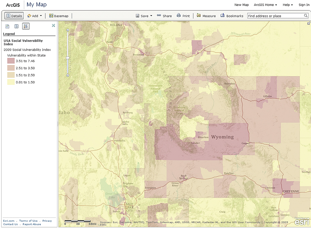 The Social Vulnerability Index (SoVI) for the United States provided the basis for modeling social vulnerability in Burkina Faso. At arcgis.com, you can explore social vulnerability down to the census block level for 2009 using the USA Social Vulnerability Index map.
The map, created by Esri, summarizes risk for states and counties. At scales greater than 1:3 million, vulnerability is calculated on the state level. At scales less than 1:3 million, scores are calculated for each county. Although this web service provides a simplistic view of social vulnerability, it shows which areas have a greater potential for damage caused by disaster events. Other SoVI maps have also been contributed to ArcGIS Online from various organizations addressing risks to specific areas or at different levels of geography. To view this map and others that deal with SoVI, search on SoVI at arcgis.com.
To learn more about recent methods and metrics for calculating social vulnerability, visit www.sovius.org.