ArcUser
Winter 2012 Edition
New Information Channel
Android app gets evacuation information to residents
By Matthew DeMeritt, Esri Writer
This article as a PDF.
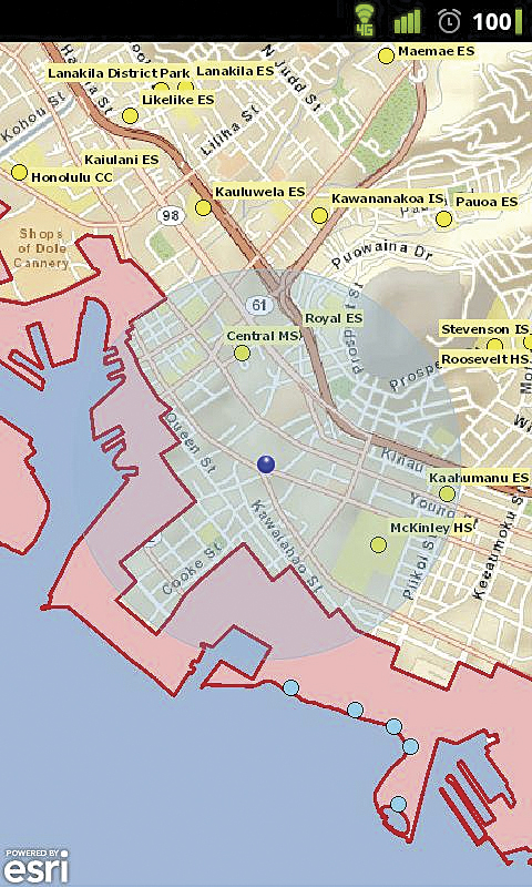
The app taps into the Android device's GPS and displays the user's current location.
When the 2011 Tohoku earthquake, one of the strongest ever recorded, struck the coast of Japan, it sent a tsunami Hawaii's way.
In a sense, Hawaii had dodged a bullet. The March 11, 2011, earthquake transferred most of the tsunami's energy toward Japan's coast rather than toward Hawaii. The wave that Hawaii experienced was 1 meter high (compared to Japan's 10-meter wave) but still caused millions of dollars in damage to docks and seacraft but—fortunately—no deaths.
The tsunami alert sent many Hawaiians scrambling to find out if they were in a tsunami evacuation zone or where the nearest shelter was located. Requests to Honolulu's government website created a logjam that disabled the site.
During a government meeting to assess the tsunami's toll, Honolulu technical staff raised the issue of public access to critical evacuation zone maps during times of high demand on the county server.
"One of the GIS analysts mentioned that their site [Honolulu.gov] went down following the alert because too many residents were trying to find information related to the tsunami at once," said Kyle Shimabukuro, a systems analyst for City and County of Honolulu. "That spurred discussion about why the bottleneck happened and how we could avoid it in the future."
Staff eventually concluded that the emergency maps in local phone books also were not sufficient to disseminate critical information about tsunami evacuation zones immediately following a seismic event. Because a large percentage of Hawaiians exclusively depend on cell phone service for their telephone needs, many residents simply don't have phone books.
To avert a similar crisis in the future, systems staff at Honolulu created a tsunami evacuation zone app built with Esri's ArcGIS Runtime Software Development Kit (SDK) for Android to serve as a critical information channel. "It took an event like this to point out the obvious problem," said Shimabukuro. "Being an Android phone owner, I knew that a large majority of those seeking information from the web had smartphones and that Esri had already created a variety of mapping solutions for them."
Theoretically, a large percentage of requests could be transferred to a simple mapping app, similar to the ones Esri had already created, so Shimabukuro went looking for a way to make a custom app for Hawaii's Android phone owners. Because City and County of Honolulu had already integrated ArcGIS throughout its departments, Shimabukuro was familiar with Esri technology and its online customer support channels. He started his research at Esri's ArcGIS Resource Center and it immediately paid off. There he saw the beta version of the ArcGIS Runtime SDK for Android available for free download.
"Seeing the beta of the API confirmed my hunch that an evacuation zone app was within reach," said Shimabukuro. "After a simple registration, I downloaded the API as well as information on how to build apps and add functionality. It was all well documented and easy to find."
Esri's approach to customer support involves giving users access to example apps and preconfigured templates for developers to build on. Rather than having to start from scratch, the application available with the Android SDK gives developers a starting place for adding code and testing functionality during the development process.
"It's good to know that documentation could provide the answers I needed, but having the sample apps to immediately reference saved me much time in not having to start from the ground up," said Shimabukuro. "The examples gave me a logical starting point to pick and choose the kind of functionality our app should have."
Shimabukuro could easily add and remove code as needed and attach a variety of available map services using the runtime SDK. "I downloaded many libraries to see what each one did and incrementally built the app using that process, which would have been much harder without having access to the example apps and seeing how they operate," he noted.
During development, Shimabukuro had envisioned using the smartphone's onboard GPS to verify whether the user was in an evacuation zone and generate driving directions from there. "The idea of exploiting the GPS technology already available on Android devices and producing something more than static maps was exciting," said Shimabukuro. "In addition to displaying the address of a given point, I was also able to pass that address to Google Navigation, an external navigation app, to give driving directions."
The final product, which includes full integration with GPS and a handy navigator, exceeded Honolulu's original objectives for the app. Honolulu has successfully promoted it to residents with nearly 1,000 installs. Shimabukuro plans to integrate additional services as they become available. ArcGIS Runtime SDK for Android is scheduled for official release before the 2012 Esri International User Conference.
For more information on the Honolulu Tsunami Evacuation Zones app or to see it in action, visit the download site in Android Market. For more information, contact Kyle K. Shimabukuro at kshimabukuro@honolulu.gov.