ArcUser Online
Spring 2011 Edition
Cloud GIS
Fast, reliable support for disaster response
By Keith Mann, Esri Writer
This article as a PDF.
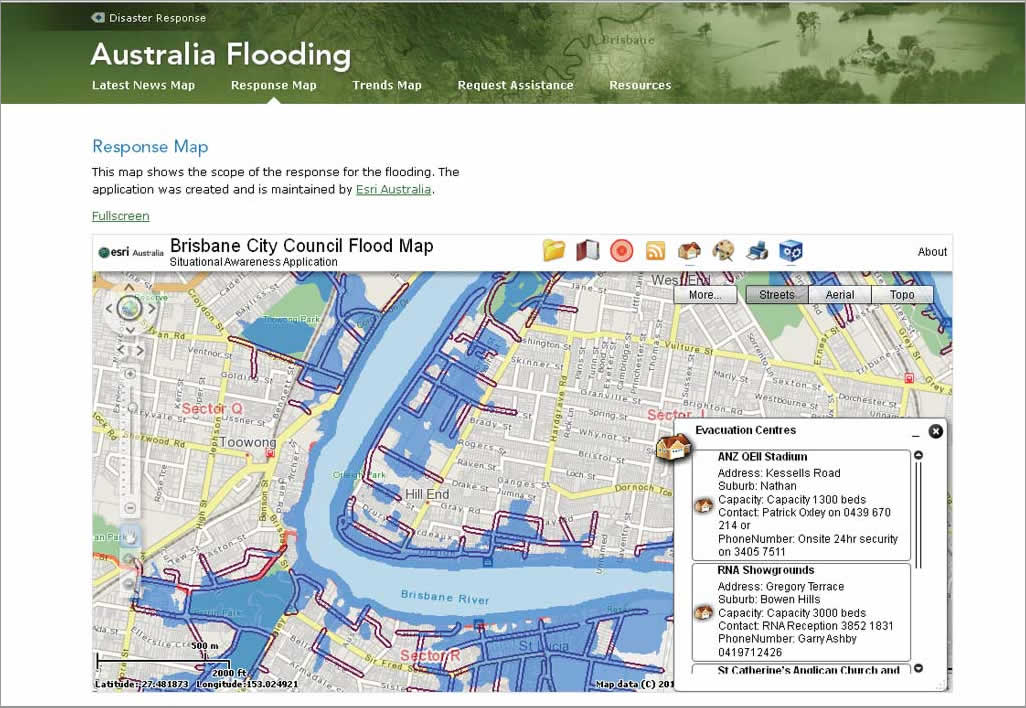
In response to catastrophic flooding in Queensland, Australia, ESRI Australia created a cloud-based web mapping application for supplying information that meets the needs of responders and the public.
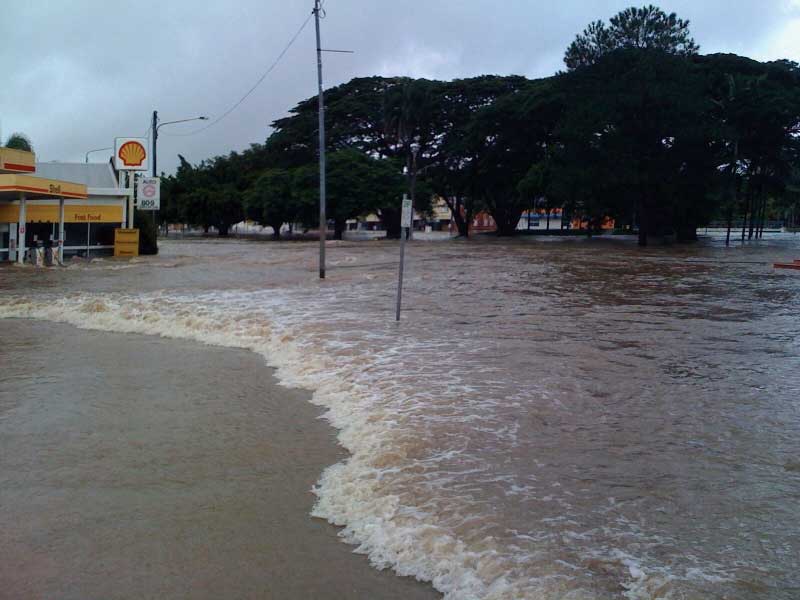
Three-quarters of the state of Queensland, Australia, was declared a disaster zone as a result of flooding that began in late December 2010. Flooding endangered residents and inundated homes, businesses, and farmland. Agencies responding to the disaster and residents of affected areas needed quick access to current information on the evolving situation.
Ben Somerville and Nick Miller of ESRI Australia Pty. Ltd. worked through the night to get the Brisbane City Council (BCC) Flood Common Operating Picture (COP) application up and running with the latest, most accurate information. "We were asked to create the application at 7:30 Tuesday night," Somerville said. "We went to the crisis room, gathered the data, and were back at the office an hour and a half later. Moving the data via FTP to the cloud took the longest—nearly six hours. While that was happening, we created a local version of the COP app that we could move to the cloud. At 7:00 a.m. Wednesday, the web mapping application was operational."
This story played out many times during many disasters in 2010—including the Deep Horizon oil spill in the Gulf of Mexico and earthquakes off the coast of the Maule region of Chile and near Port-au-Prince, Haiti. GIS and IT professionals quickly put together a GIS-based web mapping application in response to an overwhelming demand for information about each event. Traffic to these websites has demonstrated that the public is just as interested in timely, accurate, interactive maps as emergency responders and government officials.
Initially, the mapping application was configured for internal use by state government emergency services agences. Said Somerville, "As soon as the app was published on the BCC website, it quickly went viral."
The key to the success of these types of apps is cloud GIS, a tightly integrated system of components and content that can be deployed off premises within a matter of hours and administered remotely.
During a major emergency, GIS professionals, such as Somerville and Miller, don't have the time or resources to pull existing equipment and software offline and repurpose them to support a single web application able to serve tens of thousands of visitors daily. What they need is access to a clean machine that is configured and ready to go within a few minutes. They also need massive enterprise resources that can instantaneously handle spikes in demand but also automatically scale down as web traffic decreases.
In these recent disasters, the central hub for publishing and disseminating GIS services has been ArcGIS Server on Amazon Elastic Compute Cloud (EC2). Amazon EC2 is a web service that provides resizable compute capacity in the cloud. In addition to its use for emergency operations, many organizations use a combination of on- and off-premises deployments of ArcGIS Server. In most cases, the off-premises (or cloud instances) complement—but do not replace—the organization's on-site deployments.
By far the most observable use of cloud GIS is to support high-volume web mapping applications, such as the Brisbane City Council Flood COP. Apps of this type must automatically and seamlessly support high traffic demands and also perform well under duress. Instances can be stopped, started, or terminated as necessary.
Cloud GIS is also often used to off-load massive spatial analyses and processing so that the local computing infrastructure isn't impacted. When processing is complete, the instance can be stopped or terminated and the resulting data product moved to an on-premises server.
Three-quarters of the state of Queensland, Australia, was declared a disaster zone as a result of flooding that began in late December 2010.
Another primary use of cloud GIS is developing and testing enterprise applications outside the production environment. Developers can easily access an enterprise server, build and deploy services and applications, and share those products with usability testers and other developers. Once again, the server instance can be discarded when it is no longer needed.
There are three main advantages to using a cloud instance of ArcGIS Server for each of these purposes.
First, there is no software to install. Anyone can simply acquire an Amazon Machine Image (AMI) through Esri. The AMI comes with ArcGIS Server installed and configured along with ArcGIS Desktop, ArcSDE on Microsoft SQL Server Express, and 100 GB of attached storage.
Second, no additional on-site hardware need be acquired or maintained. Because ArcGIS Server on Amazon EC2 requires no special hardware except a connection to the Internet, GIS or IT personnel don't have to worry about impacting on-premises infrastructure or requisitioning, receiving, assembling, and supporting additional hardware.
Third, enterprise-level services, such as autoscaling and elastic load balancing, can be added to the configuration to automatically spin up new instances of ArcGIS Server during demand spikes and efficiently distribute capacity across healthy instances. As an event winds down or changes focus (from response to recovery, for example), these cloud services can be reconfigured to accommodate the organization's needs.
By deploying ArcGIS Server in a cloud environment, emergency responders can use as many or as few computing resources as necessary without committing to a long-term purchase of hardware or other IT infrastructure. More important, they can quickly set up fast, authoritative web mapping apps—within hours in most cases.
While the initial requests for a mapping app may be coordinated through federal, state, and local government emergency management professionals, there appears to be an increasing demand for high-quality, authoritative web mapping applications by the general public and media. In the future, expect to see more public-facing web mapping applications powered by cloud GIS used to not only support emergency operations but also feed the public's demand for trusted information.
Three-quarters of the state of Queensland, Australia, was declared a disaster zone as a result of flooding that began in late December 2010.
In response to catastrophic flooding in Queensland, Australia, ESRI Australia created a cloud-based web mapping application for supplying information that meets the needs of responders and the public.