ArcUser Online
Spring 2011 Edition
Over Time, Over the Globe
Landsat imagery archive made broadly available
This article as a PDF.
The Landsat imagery archive contains the longest continuous global record of the earth's surface. It is an invaluable resource for dealing with the complex environmental challenges the world faces.
Now, an array of image services and a new viewer developed by Esri combine to make 30 years of Landsat imagery more accessible to specialists and nonspecialists alike. This fulfills the promise made by Department of the Interior (DOI) secretary Dirk Kempthorne in 2008 to make all Landsat scenes available for free.
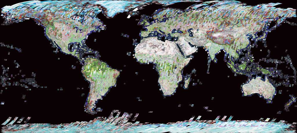
Landsat 7 World Mosaic 12/31/2000
Sensor: L7 ETM+
Landsat imagery courtesy of NASA Goddard Space Flight Center and US Geological Survey
In the intervening years, Esri and DOI have worked closely to make the eight terabytes of imagery data available as more than 20 dynamic, multispectral, multitemporal image services. The data available includes the Landsat Global Land Survey (GLS) datasets, which provide the best worldwide imagery data for measuring global change. With these services, users have dynamic access to all the spectral and temporal information in this massive imagery archive. With access to this data as online image services, users benefit from significantly reduced imagery storage and management requirements.
As Esri announced last year, this imagery is furnished as standard services available from ArcGIS Online. Users will be able to build web maps using this information and share their analyses for better understanding and collaboration. Esri also provides web maps on ArcGIS Online that show how these new services can be used and explains the measurement of change over time and space using the Landsat data. Because these services are also multitemporal, they can be used for performing change analysis that can span 30 years in ArcGIS Desktop or ArcGIS Online applications.
The dynamic image services result from on-the-fly processing of the original Landsat scenes by ArcGIS Server Image extension so all data contained in this imagery is immediately available for use in maps and analyses. Processing for source images can be specified for an area of interest. The services are available in different standard band combinations that include
- False-color (bands 4,3,2), which is useful for vegetation studies and crop growth monitoring
- Natural color with atmospheric penetration (bands 7,4,2), which is best suited for analysis of urban study areas
- Vegetation analysis (bands 5,4,3), which provides the most information for agriculture and forest management applications
In addition, Esri created an easy-to-use web-based Landsat viewer for visualizing, analyzing, and detecting change using these image services. Built with ArcGIS API for Flex, the application interface gives on-click access to a variety of information products. Users can quickly zoom and pan to anywhere in the world. Information screens introduce the data furnished through the application.
The Landsat viewer contains fast, easy-to-use change detection tools that enable users to conduct multitemporal image analysis of change through image differencing. The Landsat viewer automatically calculates this information based on user selections and displays the resultant information on a change detection map where users can further interact with the data.