ArcUser
Summer 2012 Edition
Here's Looking at You
40 years of earth observation
This article as a PDF.

(1972, 1987, 2002)
Lake Chad, once the sixth-largest lake in the world, has shrunk to 1/20th its size in the 1960s.
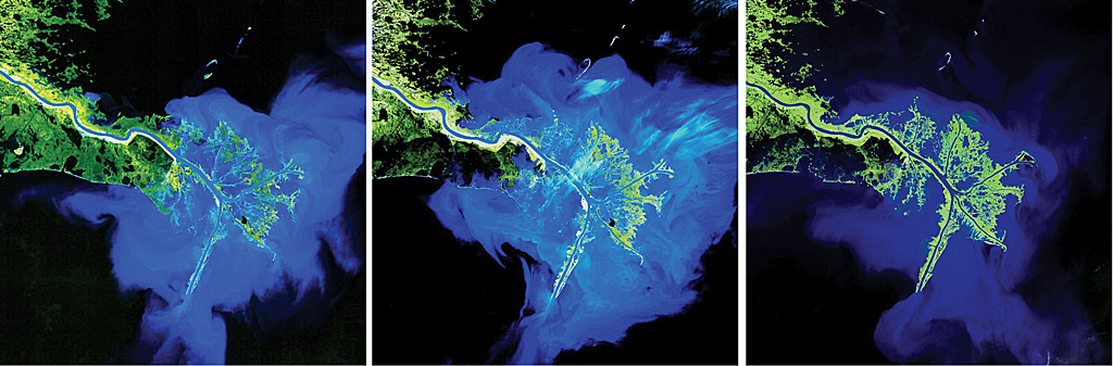
(1972, 1986, 2003)
Changes to the shape of the Birdfoot delta at the termination of the Mississippi River are the result of sediment deposition.
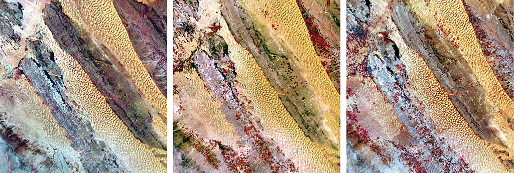
(1973, 1989, 2003)
An area in the central portion of Saudi Arabia shows the effects of center pivot irrigation.
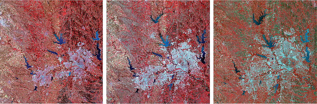
(1974, 1989, 2003)
This series of images documents the growth of the Dallas-Ft. Worth area of Texas.
Space missions of the 1960s, inspired by the impulse to explore the universe, also engendered a desire to learn more about the earth.
This eventually resulted in the launch of Landsat 1, originally known as Earth Resources Technology Satellite (ERTS), in 1972, which began a systematic inventory of the earth's resources that marks its 40th anniversary this year.
Landsat 7, the current earth observation satellite, has been called "the most stable, best characterized earth observation instrument ever placed in orbit." Its 30-meter, calibrated, multispectral resolution, coupled with the 185-kilometer-wide swath of imagery it captures, provides enough coverage in every season with sufficient detail to be useful for scientific and practical applications. Initially, its lower cost data made it affordable for research teams in academic institutions. Now it is free.
Thanks to nearly a half century of data collection, scientists now have a baseline knowledge of earth that is proving invaluable in evaluating environmental change and characterizing the effects of people on the landscape. It has also led to a better understanding of large-scale phenomena such as coral reef degradation or glacier loss. This data has become a rich data resource for agriculture, forestry, natural resource exploration, and other industries.
In 2009, all Landsat data from all missions was made free, leading to a 60-fold increase in downloads. Esri and the Department of the Interior (DOI) worked closely to make all Landsat Global Land Survey (GLS) scenes available as more than 20 dynamic, multispectral, multitemporal image services that were released on ArcGIS Online in 2011. In addition, Esri created an easy-to-use web-based Landsat ChangeMatters viewer for visualizing, analyzing, and detecting change using these image services.