ArcUser
Summer 2012 Edition
Making Good Things Happen
At the 2012 Esri DevSummit
By Monica Pratt, ArcUser Editor
This article as a PDF.
"We are here for you entirely this week," said Jim McKinney, ArcGIS program manager and master of ceremonies for the Plenary Session of the 2012 Esri Developer Summit (DevSummit). McKinney noted that members of 30 Esri software development teams migrated to Palm Springs, California, for the event, held March 26–29, to spend one-on-one time with developers, "building community and making good things happen."

Esri president Jack Dangermond joined master of ceremonies Jim McKinney, ArcGIS program manager, to open the Plenary Session.
The 2012 DevSummit, "the conference for developers, by developers," had a record turnout: 1,700 developers, partners, and GIS professionals from all over the world gathered at the Palm Springs Convention Center to meet with more than 300 Esri development staff members. As in previous years, the event's goals were to align development efforts, share best practices, and develop working relationships.
Of the developers assembled, 30 percent came from outside the United States. The majority (60 percent) work for businesses. They are coding in .NET, Python, and Java and working on web, mobile, and desktop applications.
Not only were there more attendees this year, but the event itself grew. In response to developers' requests, a day was added, the number of technical sessions was more than doubled, the number of preconference sessions was quadrupled, and the showcase and demo theaters were significantly expanded. To make sure developers could see popular presentations, attendees could Tweet requests to repeat sessions that were packed.
Speed Geeking, a speed-dating-like event, gave attendees a taste of the agenda topics being presented.
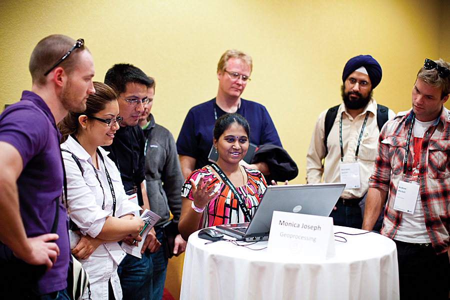
A new conference event, Speed Geeking, set a playful and high-energy tone for the summit as well as helped attendees decide which topics among the conference's 72 sessions would prove most useful to them. The event used a speed-dating format. Groups of 8 to 10 attendees gathered around tables where Esri staff members told them about an implementation of Esri software, a cool sample, or an Esri service. A squeaking rubber chicken signaled the end of each five-minute session, and attendees moved on to the next table.
Biggest Server Release Since ArcGIS 9.2
Why do developers take a week out of their lives to come to DevSummit? Certainly building relationships with peers and Esri staff and learning how to become more productive are common reasons, but the overriding motivation for most developers is finding out what Esri is doing now and where its development strategy is going.
ArcGIS 10.1, currently in prerelease, was the focus for much of the plenary and technical sessions. ArcGIS for Server is the centerpiece of this release. On both Windows and Linux, performance has been improved, and every service runs faster.
ArcGIS for Server has a completely new architecture that is simpler to install, configure, and manage. Now a native 64-bit application, it is a pure web services GIS server, and once installed, everything is done through HTTP calls. However, the REST specification for services has not changed, so applications written using the existing APIs are forward compatible to the new server. Although the completely rewritten ArcGIS Server Manager comprehensively handles sites, services, and security, server administration can also be scripted using any scripting language that understands HTTP.

A squeaking rubber chicken signaled the end of each five-minute presentation by an Esri staff member.
Integration with Server
Although there are improvements throughout ArcGIS for Desktop, because changes to ArcGIS for Server are so central to this release, improvements to deployment from desktop to server were a focus of development efforts.
A demonstration showed how easily a map service can be published from the desktop to ArcGIS for Server running in the Amazon cloud. Data stored anywhere can be pushed up to the server and shared using wizard-based systems that perform several hundred analyses on a service to flag any issues before it is published for use in web maps and on devices.
Providing actionable information to end users by bringing GIScience into mapping was a major goal of this release. Many of the issues that previously hindered publication of geoprocessing services are now handled behind the scenes. At 10.1, it is much simpler to create and publish geoprocessing services so that spatial analysis can be incorporated into web applications.
GIS as a Service
ArcGIS Online, Esri's cloud-based system that provides GIS as a service, is available at arcgis.com for use on smartphones, tablets, and desktops. Since its launch in July 2009, more than 200,000 maps and applications have been created. On an average workday, the site receives five million hits (exclusive of requests for basemaps).
Local data can be used as tiles or feature services and used with the extensive foundation data (basemaps) and services (such as geocoding) at arcgis.com. These resources are constantly enhanced. Recently, Esri added 15 million square kilometers of new imagery to the service. ArcGIS Online is also the source for APIs for web (JavaScript, Flex, and Silverlight) and devices (tablets, phones, and desktop) as well as configurable viewers and application templates.
Using ArcGIS Online, developers can build custom applications that use hosted services that don't require installing hardware or software. They can also integrate content from ArcGIS for Server and register services, enabling centralized search and discovery, and easily administer users, content, and security.
ArcGIS Online will be available in organizational and enterprise plans. Alternatively, ArcGIS Online is available as a software product, Portal for ArcGIS. Officially released at DevSummit, Portal for ArcGIS is used on premises with ArcGIS for Server.

Summit keynote speaker Steve Riley challenged developers' assumptions about the nature of their work as he leaped from the stage and roamed among the audience.
Being More Productive
In the area of developer tools, both existing and new with ArcGIS 10.1, Esri's approach focuses on improving developer productivity. "You don't have to write tons of code to make a great app" is the mantra.
Preconference seminars and technical presentations during the conference emphasized how to get more done using the web APIs, templates, and viewers that Esri has created for JavaScript, Flex, and Silverlight. "We have taken a lot of the hard work out of developing web applications, so all you have to do is abide by some coding rules," said Andy Gup, technology lead at Esri.
The announcement of a printing service that generates high-quality PDF maps was one of the high points for many web developers. Brandon B. Brown (@brandonbbrown), self-described "practitioner of GIS and lover of all things geographic," Tweeted "Bombtastic sweetness of new printing options in the web APIs #devsummit well done sirs, well done."
Going Native
To facilitate native application development, Esri created a runtime core written in C++ that delivers high performance but is compact. GIS runtimes for iOS, Android, Windows Phone, Windows Mobile, Windows, and Linux have been developed using this core and are accessed via APIs and software development kits (SDKs) Esri developed for these platforms for use by .NET, Java, and Objective-C developers. This enabling technology is fully integrated with ArcGIS on the web and desktop and encourages developers to think in terms of developing for devices rather than for mobile or desktop.
The new architecture for desktop developers runs on Windows and Linux and is available for 32-bit and 64-bit execution. It uses an asynchronous programming model so applications can remain responsive while operations are executed in the background. ArcGIS Runtime SDK for Java will also be available.

The 2012 DevSummit had a record turnout, with 1,700 developers, partners, and GIS professionals from all over the world.
Members of the mobile development teams demonstrated applications built with the SDKs for Android and iOS devices that integrate organizational data through a new class, agportal. These applications incorporate services and use different components of individual devices, such as GPS, or other applications in the device's ecosystem, such as mail or address book applications. These SDKs also let developers build applications that let users stay productive offline while maintaining smooth and responsive performance.
Core runtime developments slated for off-cycle release include geocoding and network routing on mobile devices disconnected from the network and 3D visualization and spatial analysis across all platforms. Configurable applications that use widgets to deliver functionality are being created by Esri to help end users be more productive. Using the SDKs, developers can create specific widgets for their end users. New supported platforms include Windows 8 with the Metro Style touch experience and ARM processor support. In response to developer requests, Esri will also have an ArcGIS Runtime SDK for Mac and a Cocoa API for Mac Developers.
ArcGIS Runtime SDKs and an optional ArcGIS Online plan will be included in the existing Esri Developer Network (EDN) subscription. A new type of subscription, the EDN Enterprise subscription, will contain everything a developer needs to build enterprise-level applications.
"Everything You Think You Know Is Wrong"
For the keynote speech, the focus shifted from Esri software development to IT trends. Summit keynote speaker Steve Riley challenged developers' assumptions about the nature of their work as he leaped from the stage and roamed among the audience. He warned that the cloud has changed everything in their world and they must adapt or die. Riley has spent 23 years in IT, specializing in information security. He worked for Amazon Web Services and Microsoft before joining Riverbed, where he is the chief technology officer.
Riley's definition of the cloud was simple: "If you are still paying for it when it isn't switched on, it isn't a cloud." Scalability is the key to understanding this new landscape. Servers are now disposable horsepower. "If you need more performance, you throw more servers at it. You could never do that before." In the cloud, troubleshooting changes from hours and days spent diagnosing the problem to a few minutes killing off a problem service and spinning up another.
Change is constant, and failure is inevitable, so developers need to assume failure and build backward to account for it. New issues have joined familiar ones. Moving data could become a bigger issue than security. This observation struck a chord with an audience that knows that GIS is all about managing large datasets.
But security issues have not gone away. There are bad guys out there, they are out to get you, and developers should account for them in the system design. The real challenge with security is adopting a new style of thinking in a cloud era. "When a server is just one line in a shell script," its physical location is not what determines its security, said Riley. Security models should now be based on substantive service-level agreements, auditable security standards, and procedures that encrypt and sign everything.
To survive and thrive, developers need to make sure they remain relevant. The cloud is the way to make Esri data more available to users, and it will become essential to the way services are delivered. Developers need to embrace it.
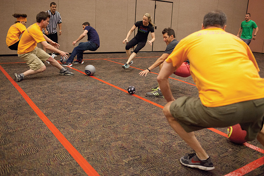
Competitors at the Dodgeball Game, a DevSummit tradition, vied for free tickets to next year's event.

Competitors at the Dodgeball Game were cheered on by a lively crowd.
Fun and Games
The conference wasn't all sessions and presentations. There was plenty of time for socializing in a relaxed atmosphere. An informal event held poolside at the hotel on the second evening, Meet the Teams, introduced Esri software teams to conference attendees. Wednesday night featured lots of food and the Dodgeball Game, a DevSummit tradition. Vying for free tickets to next year's summit, teams—with names like Tame the Python and the Ballbarians—faced off before a lively crowd.
Bidirectional Communication
Developers had many opportunities throughout the week not only to learn how accessible and powerful the technology is but also how their feedback can shape the applications that are constantly being deployed via the web. "We constantly need input from you," said McKinney. "We can make course corrections very quickly in our APIs and our SDKs, so talk to us."
Esri actively seeks feedback, not just at the summit, but throughout the year. Developers need tools and support to be productive and successful. DevSummit provides a place and time to reconnect and reinforce that relationship. "We get our satisfaction through your success. Really. It's kind of a weird statement, but we get really jazzed when we see you guys building great stuff," said McKinney.