ArcUser
Summer 2012 Edition
The Top 10 for ArcGIS 10.1 for Desktop
This article as a PDF.
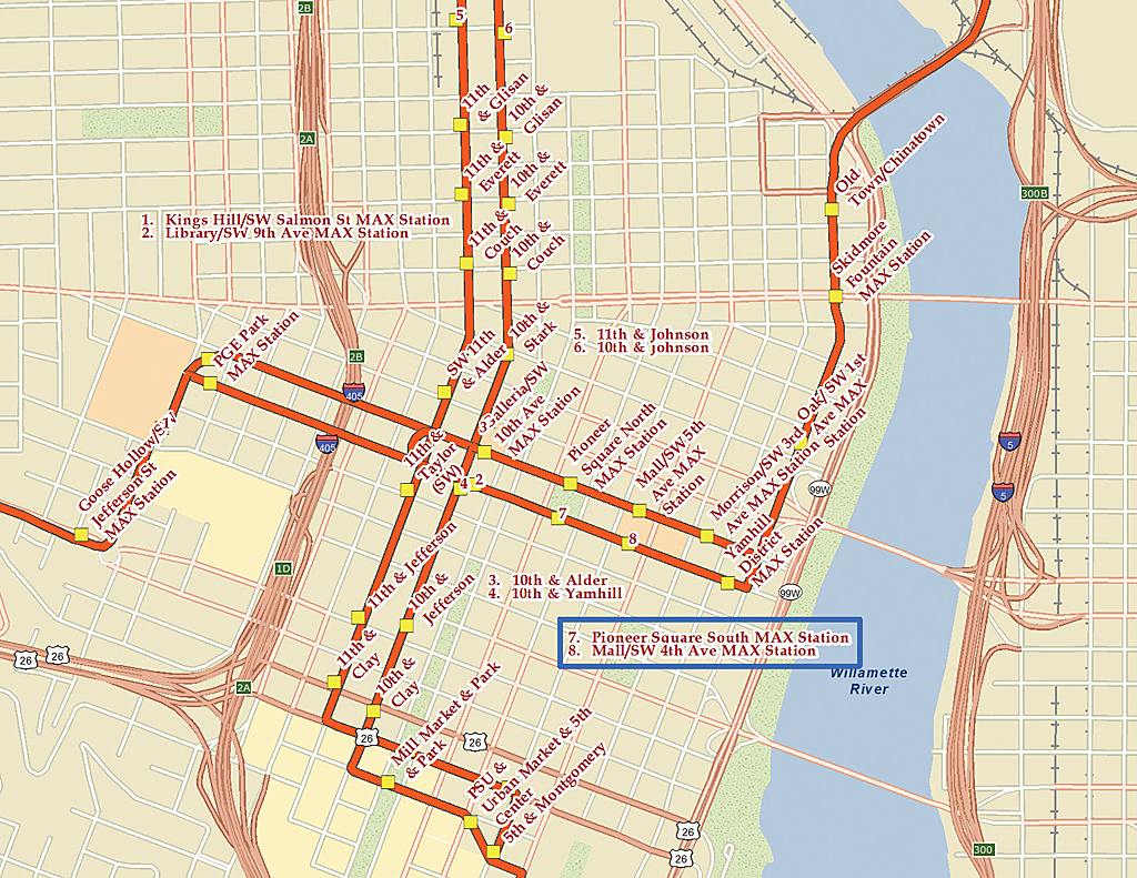
Key numbering, one of the options with Maplex, creates a numbered list of labels in congested areas of a map. Maplex now comes with all license levels.
As the foundation for deploying GIS across an organization and on the web, ArcGIS for Desktop continues to play an important role in the ArcGIS system. With ArcGIS for Desktop, GIS professionals build high-quality cartographic maps, manage data, and perform analyses. These are the top 10 improvements for ArcGIS 10.1 for Desktop.
Number 10: Locating Projections
Using Search, quickly locate any of the 4,634 projections in ArcGIS 10.1 for Desktop. Search enhancements include searching for a spatial reference by name, well-known ID, and spatial extent. For example, to find a coordinate system for Sacramento, California, typing "NAD 1983 California" will return only projections that meet these criteria.
Number 9: Tracking Feature Editing
In a multieditor geodatabase editing environment, it is important to know who created or modified a feature and when it was modified, particularly when users are making edits through a feature service. Enable editor tracking from a table or feature class context menu or by using the new Editor Tracking geoprocessing tool. Editing information is maintained by the application. Access to features through a feature service can be restricted by enabling ownership-based access control on the feature service when it is published.
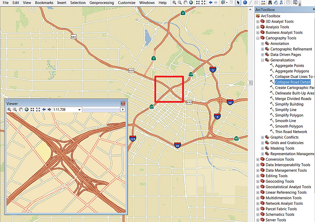
Collapse Road Detail, one of the new generalization tools, provides the right level of detail for roads as the map scale changes.
Number 8: Geotagging Photos
At ArcGIS 10.1, the locations of photos captured using GPS-enabled digital cameras, mobile devices, or smartphones can be imported to ArcGIS as point features that can be managed, modified, and analyzed using the geoprocessing tools in ArcGIS. The Geotagged Photos to Point tool makes it simple to display geotagged photos on a map. It reads the x-, y-, and z-coordinate information from JPEG and TIFF photo files with valid Exif (exchangeable image file format) metadata and writes the coordinates and associated attributes to an output point feature class.
Number 7: Loading GPS Data
The GPX To Features tool for 10.1 makes it easier to take GPS data from the field and load it directly into ArcGIS by converting the point information inside a GPX file into features for display on a map. GPX is a de facto standard for saving GPS waypoints, tracks, and routes.
Number 6: Converting KML Files
ArcGIS 10.1 for Desktop has tools for converting Keyhole Markup Language (KML) to an ArcGIS data format that can be viewed, edited, and analyzed. The KML To Layers tool for 10.1 supports the inclusion of the symbols, labels, and HTML pop-ups coming from KML files.
Number 5: Making Multiscale Maps
Additional geoprocessing tools and functionality for working with large datasets help create great maps at different scales. Two new generalization tools in the Cartography toolbox, Collapse Road Detail and Delineate Built-up Areas, provide the right level of detail for roads and buildings as the map scale changes.
Number 4: Simplifying Geodatabase Administration
A new user interface for administering enterprise geodatabases shows connections and locks. A simplified Database Connections dialog box requires less input to make a connection and can connect to any supported database, whether or not it contains an enterprise geodatabase. The new Create Database Connection geoprocessing tool in the Workspaces toolset of the Database Administration toolbox takes the same inputs as the Database Connections dialog box and also allows definition of the version to use when connecting to a geodatabase.
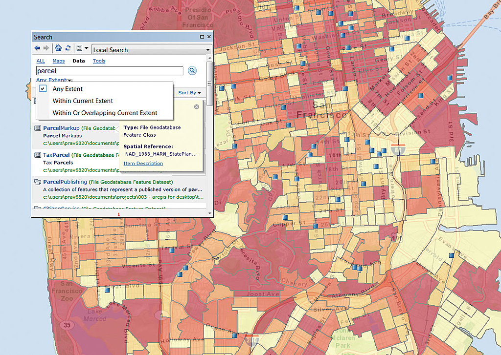
Use the new Search to quickly locate any of the 4,634 projections in ArcGIS 10.1 for Desktop.
Number 3: Improving Labeling
Advanced Maplex labeling capabilities are now included at all ArcGIS for Desktop license levels. Maplex supports key numbering, which creates numbered lists of labels in congested areas of a map. Features near the junctions of features and edges of the data frame can be labeled, and label text for linear features that straddle lines can be placed using other Maplex options. This version also supports Python in label expressions.
Number 2: Using Dynamic Legends
Legends become dynamic at ArcGIS 10.1 for Desktop. Only items in the current map extent are displayed in the legend. This is useful when working with large datasets with many classes and supports Data Driven Pages and web map printing. New legend fitting strategies include word wrap, column wrapping, and dynamic text sizing. Optionally, feature counts for legend items can be displayed.
Number 1: Simple Sharing with the Share As Menu
The new Share As menu makes web enabling maps, data, and tools a straightforward process. From ArcGIS 10.1 for Desktop, choose File > Share As > Service to invoke a wizard-driven dialog box that takes the map from the desktop and publishes it to ArcGIS for Server or the cloud seamlessly. The workflow is the same whether a map, data layer package, or geoprocessing model is being shared.