|
The Magazine for
Esri Software Users |
|
|||

|
Learning with GIS
GIS is a tool not only for students, but for educators and administrators as well. The process of learning about GIS is itself beneficial to students. For students from elementary through graduate school, GIS engages many learning styles and provides a framework for all types of academic subjects. GIS continues to be a powerful research and presentation tool for both students and faculty at the college and university level. GIS has also become a job skill that is in demand. Professionals working in many fields recognize that GIS training is a valuable career asset. They are pursuing GIS education provided by degree and certificate programs and through courses taught in the classroom or over the Web. Finally, school administrators on all levels can use GIS as a management tool. A New Way to Learn GIS introduces students to a new way of seeing, thinking, and interacting with the world around them. Using GIS, students explore course content in a way that enhances logical, mathematical, linguistic, spatial, and interpersonal intelligences. Developing GIS projects improves critical thinking skills such as analyzing, synthesizing, and evaluating. 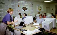 Learning about GIS in a structured setting is beneficial not only in developing computer literacy but also provides training in the process of research including gathering, preparing, storing, and analyzing data and presenting the results of analysis using a variety of methods. These are skills valuable in both academic and business settings. Learning about GIS in a structured setting is beneficial not only in developing computer literacy but also provides training in the process of research including gathering, preparing, storing, and analyzing data and presenting the results of analysis using a variety of methods. These are skills valuable in both academic and business settings. GIS provides a framework for learning other academic disciplines. In addition to interacting with data in a new way, students learn teamwork because GIS projects typically require a high level of cooperation. The importance of GIS to education is being recognized throughout the world. The Ministry of Education and Training in Ontario, Canada, has licensed ArcView GIS for every school in that province. Students at more than 800 high schools will have access to this technology. Whether on the elementary or the graduate school level, GIS is a natural delivery vehicle for science course work. Some of the very first GIS applications developed were in this area, and much innovative work in expanding the capabilities of GIS and integrating GIS with other technologies has been developed by those conducting scientific research. Government organizations have developed outreach programs that use GIS as a tool for sharing science with the public and particularly students. The National Aeronautics and Space Administration provides many educational resources including training for teachers in the use of imagery and GIS. These educators use GIS to help students understand the complex interaction between the earth and its human population. GIS is also a tremendous tool for teaching nonscience subjects. Business schools have recognized the spatial nature of much of corporate data. The number of business courses using GIS has risen dramatically in recent years. As an example, the California State University, Fullerton, School of Business Administration and Economics is using GIS for courses on international marketing, domestic marketing, and management science/information systems on the undergraduate and graduate levels. At the university level, more than 100 different academic disciplines use GIS as a research tool. Because approximately 80 percent of data contains a spatial component, researchers in agriculture, architecture, business, natural resource management, natural sciences, public health and medicine, education, engineering, law, library science, military science, physical sciences, and social sciences benefit from using GIS. Nearly 800 universities are doing research using GIS. With funding from the National Science Foundation (NSF), Houston Community College System (HCCS) 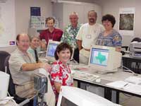 faculty members have produced 35 GIS laboratory exercises that support course work in agriculture and the environment, urban development and facilities management, marketing, coastal management, emergency management, utilities, and community development as well as modules on mapping using GIS and GPS. The developers of these exercises have worked to make them realistic by using workplace data sets and consulting with GIS practitioners in those fields. All the exercises developed by HCCS are delivered via the Internet. faculty members have produced 35 GIS laboratory exercises that support course work in agriculture and the environment, urban development and facilities management, marketing, coastal management, emergency management, utilities, and community development as well as modules on mapping using GIS and GPS. The developers of these exercises have worked to make them realistic by using workplace data sets and consulting with GIS practitioners in those fields. All the exercises developed by HCCS are delivered via the Internet.The tremendous growth of the Web combined with innovation in GIS Internet technologies has made the Web the delivery mechanism of choice for many institutions. The Esri Virtual Campus offers courses in GIS theory, software, and applications in natural resources, business, and state and local government, in addition to free modules that provide an introduction to Esri software and GIS use in a variety of industries. Organizations of all types and sizes can offer a robust, affordable GIS education through Esri Virtual Campus subscriptions. Subscriptions give organizationwide access to all Esri Virtual Campus courses for a low annual fee. New courses are constantly added and are automatically included in the subscription at no extra charge. For more information, visit the Esri Training and Education Subscriptions or contact an Esri sales representative. In-Demand Job Skill As GIS technology becomes integrated in an increasing number of industries, GIS literacy provides training for many careers. Administration of justice supplies an example of how the integration of GIS will change the career paths of professionals in nonscience fields. The growth of GIS use by law enforcement agencies has created a new demand for GIS professionals in the criminal justice system. There are employment opportunities for GIS specialists in crime analysis, forensics, crime profiling, correction supervision, and courtroom presentation. The number of professionals using GIS as a part of their job in the United States is approaching 500,000, with a similar number of GIS users in the rest of the world. Perhaps 10 percent of this number, or 50,000, are working with GIS on a full-time basis. These numbers are growing at about 15 percent per year. Given these figures, the job market demand for people with GIS training is about 75,000 per year. Most of these people will be using GIS as a part of their job. Though many people will have only one course in GIS, there is a need for perhaps 7,500 graduates a year with two or more courses in GIS. Presently, approximately 50,000 students at American universities are getting at least one course in GIS each year. Esri and its authorized training facilities provided software training for more than 22,000 students in the United States last year, and more than 30,000 individuals enrolled in GIS courses offered on the Esri Virtual Campus during the same period. The demand for graduates with intensive GIS education, obtained either through certificate programs or advanced degrees, is very large. Currently, this need is largely addressed through GIS certificate programs. The approximately 200 certificate programs in the United States turn out about 4,000 graduates each year. These programs typically require a student to complete 12 to 30 semester or quarter units and tend to focus on very practical issues such as the management of a GIS or the use of specific software. Though many students and professionals are working toward master's degrees in geography, planning, landscape architecture, forestry, civil engineering, environmental science, or another discipline in order to get advanced education in the use of GIS technology, there is a great demand for people who hold master's degrees in GIS. The shortfall of individuals with advanced degrees in GIS in the United States is estimated at 3,000 to 4,000 graduates per year. The demand overseas is even greater due to the lack of appropriate programs in many parts of the world. Worldwide, approximately 3,100 colleges and universities are involved in some way with GIS, with 1,400 of those institutions located in the United States. Though the number of institutions appears large, most of these schools are offering only one course in GIS. A searchable online database of academic GIS programs is available from the Higher Education industry section of the Esri Web site. An Administrative Tool In addition to its use in research and industry, GIS can be used as an administrative tool in such areas as marketing, fund-raising, and infrastructure management. California State Polytechnic University in Pomona, California, used GIS to focus the search for donors needed to fund the construction of a new business building. In order to raise the millions needed for the project, fund-raisers needed to contact every potential donor located within a 25-mile radius of the university. Staff systematically searched for businesses within the search area with annual sales of at least $5 million using ArcView GIS and ArcView StreetMap and identified 152 businesses that fit the profile. Management of school facilities can also be enhanced by using GIS. Facility management and planning staff at Pennsylvania State University use GIS for decision support. Using a Web browser and Esri software, the university's planners have immediate access to all types of data on the university's infrastructure that can help them optimize space utilization while keeping costs down. Schools are also exploring the use of GIS for tracking freshmen admissions, planning growth, tracking crime incidents, and managing telecommunications networks. Elementary and secondary school administrators use GIS as a planning tool to draw school district boundaries, route buses, and predict enrollment. Esri business partners have developed applications that help administrators balance the characteristics of districts and forecast enrollment levels. Getting GIS in the Curriculum Esri distributes a variety of instructional materials for learning about GIS including lessons, demos, data sets, and extensions for ArcView GIS. Information about these resources is available from the Schools and Libraries page of the Esri Web site. The ArcView for Schools and Libraries Bundle includes videos, a booklet, poster, and resource CD-ROM. Esri offers site licensing and LAB KIT programs to meet the needs of colleges and universities of all sizes. Visit the Higher Education pages for more information. Software workbooks and case studies from Esri Press can also be purchased at the Esri Web site. The U.S. Community Atlas project sponsored by Esri is another way to engage students in active learning through the use of GIS. 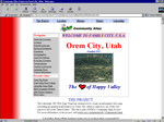 Students and teachers participating in the project are using GIS to investigate and define their own communities. Any school in the United States, U.S. territories, and U.S. government schools overseas can participate. Classroom groups create a profile of their community and post to the Community Atlas Web site. Students and teachers participating in the project are using GIS to investigate and define their own communities. Any school in the United States, U.S. territories, and U.S. government schools overseas can participate. Classroom groups create a profile of their community and post to the Community Atlas Web site.This issue of ArcUser magazine features two articles describing how GIS is being used to help students think more critically and develop problem solving skills. Curriculum developed by the Center for Image Processing in Education (CIPE) helps students in grades six through 10 learn about science, mathematics, and technology. The lessons involve mapping data. In the optional GIS version, students uncover the answers to exercise questions by exploring data using ArcExplorer. CIPE also conducts professional development workshops that teach educators. The City of Phoenix, Arizona, has developed a GIS program called AuThenTiCITY that involves youth in community problem solving. Students examine their community, identify issues, and develop recommendations that make a positive contribution to the community. They use GIS to analyze data and present findings to community leaders. Celebrate GIS Education GIS education now has an official holiday. Esri has joined with the National Geographic Society, the Association of American Geographers, and the University Consortium for Geographic Information Science (UCGIS) in sponsoring GIS Day, a worldwide event dedicated to sharing the benefits of GIS. During the inaugural GIS Day, held on November 19, 1999, more than 2.4 million children and adults in more than 90 countries learned about GIS. This year's GIS Day will be held on November 15, 2000, and the goal will be to reach three million people. Organizations that wish to participate in this event can register online at www.gisday.com. The rapid growth of GIS use in society has created a demand for education on the use of GIS in many industries and for research. At the same time, there is a growing recognition that GIS can enhance students' experience in learning almost any academic subject. Perhaps most importantly, GIS helps develop students' critical thinking and problem solving skills so they will become more involved in their community and more responsible global citizens. For more information on K-12 programs, contact Charlie Fitzpatrick, K-12 Education Specialist Tel.: 651-994-0823, ext. 8349 E-mail: cfitzpatrick@esri.com or George Dailey, K-12 Education Specialist Tel.: 214-599-0895 E-mail: gdailey@esri.com For information on GIS and higher education, contact Ann Johnson, Community College Coordinator Tel.: 909-793-2853, ext.1-1793 E-mail: ajohnson@esri.com
|