July - September 2003
July - September 2003 |
||||||||
|
|
||||||||
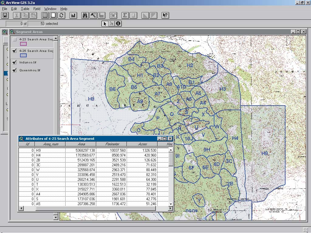
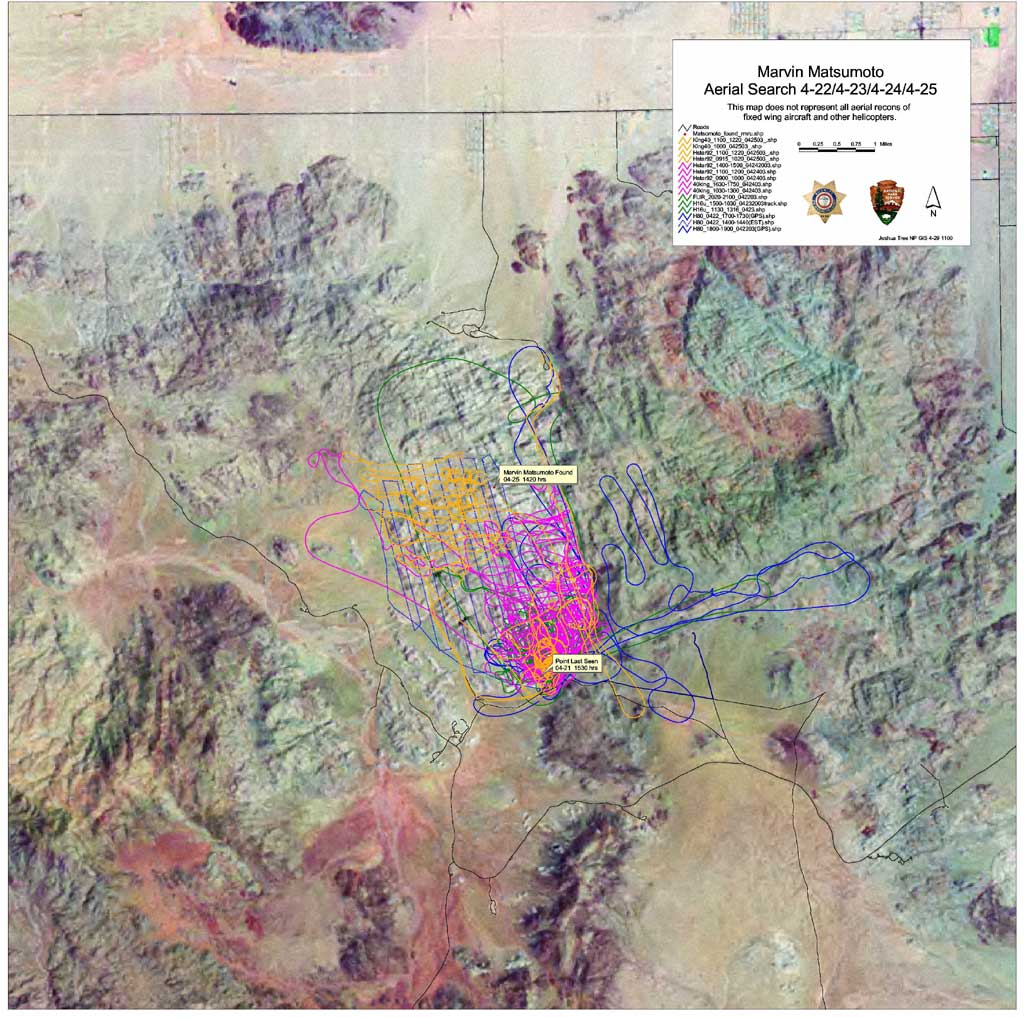
The search for a 60-year-old man in Joshua Tree National Park is one of the first search and rescue (SAR) incidents in which GIS and GPS were used effectively from the initial response phase to the discovery of the subject. On April 21, 2003, Marvin Matsumoto and his 16-year-old son, Mark, were returning from a hike when they decided to split up. Their plan was to travel in opposite directions along a one-mile loop trail near Barker Dam and meet in the middle of the dam. Barker Dam is located in a rugged section of the park known as the Wonderland of Rocks. This 20-square-mile maze of house trailer sized boulders can easily disorient even an experienced hiker who is unfamiliar with the terrain. As a consequence, the Park Service has conducted numerous SAR operations in this area. Unfortunately, some operations have resulted in body recoveries. This was Matsumoto's first visit to the park. He had no food, water, flashlight, or other survival provisions with him and was wearing only blue jeans, a white t-shirt, smooth-soled deck shoes, and a ball cap. A cold front had moved into the area sending overnight temperatures plummeting into the upper 30s accompanied by winds of more than 40 mph. The SAR operation for Matsumoto was immediately deemed a high priority. During the next five days, the most extensive search in Joshua Tree National Park in almost 20 years was carried out. Just prior to the Matsumoto search, Joshua Tree National Park hosted the GPS for the Incident Command System training course. Held April 7–11, the course drew 35 participants from Maine, Georgia, Colorado, Montana, Oregon, Wisconsin, Arizona, Idaho, Texas, New Mexico, and all over California who came to learn new and innovative ways to use GPS and GIS to map wildland fires. The aerial mapping exercise, a highlight of the course, teaches students the intricacies of digital mapping from a helicopter. As part of the exercise, students learn how to convert GPS track files to a shapefile using the DNR Garmin ArcView extension developed by the Minnesota Department of Natural Resources. The course not only teaches students GPS navigational skills but also how to collect accurate data that conforms to national mapping standards and use GIS to display data. GIS played an important role during the search. Captain Steve Elenburg and Engine Operator Shad Murphy, two firefighters from Joshua Tree who had just completed this course, put their new skills to good use in the Matsumoto search. They flew numerous daily reconnaissance flights and quickly converted this data to shapefiles.
Printing larger D-size maps of the search progress required using the plotter located 28 miles away in the GIS lab at park headquarters. The plotter at park headquarters operated almost nonstop, printing out the topographic maps of the primary and outlying search areas. Field team members appreciated the full-size color maps with Universal Transverse Mercator (UTM) grids that were far more useful than the reduced fourth-generation black and white copies with washed out contours that they usually received. On the fourth day of the search, a GIS trailer and GIS technical specialist were ordered from the California Governor's Office of Emergency Services to eliminate travel time. This was done in anticipation that the amount of resources available during the weekend would be doubled. Search resources included helicopters-some equipped with infrared detection sensors, fixed wing aircraft, search dogs, mounted posse members, and trackers. Due to the difficult terrain, many teams were also equipped to handle technical, high-angle evacuations. Continued on page 2 |