July - September 2005
July - September 2005 |
||||||||
|
|
||||||||
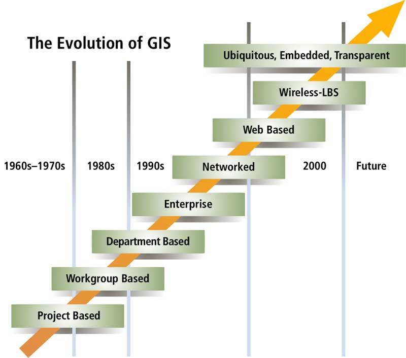
Domestic security is the single most important concern for most executive managers. It encompasses the awareness, prevention, protection, response, and recovery from a range of natural and man-made threats and hazards. Full-cycle accountability means that outcomes, not processes, are now the objective. As a result, government agencies are increasingly being called upon to be accountable for results-from staff to management to executive management to elected officials and, ultimately, to citizens. Creating more with less also includes finding ways to enhance outcomes to create new value. One strategy is to focus on making communities more desirable to attract quality businesses and new residents, which helps to build the tax base. These are strategic, not tactical or transactional, objectives. The focus is on achieving results that advance policies and governance. To address these objectives, executives require information, not just data; understanding, not just reports; and they need this support in context and in real time. The knowledge required to support these strategic perspectives is inherently locational (spatial) and analytical (statistical, financial, and predictive) in nature. The Intersection of SAS and Esri TechnologyEsri and SAS technologies evolved independently but are similar. Both are integrating, analytical, and strategic technologies that are complementary, not competing. The convergence of Esri and SAS technologies offers extraordinary opportunities for producing strategic intelligence frameworks that connect disparate, but indispensable, threads of spatial and nonspatial data across different information systems and business units. These frameworks create broader knowledge and understanding within organizations for decision makers at all levels. GIS can become a central and transparent part of business information systems that manage asset, financial, human resources, project, and customer relationship management information. At the same time, advances in mobile computing and wireless communications offer the potential for access anytime and anywhere to location-based information and decision support. The combination of Esri and SAS technologies can create "The Fifth Dimension of GIS," which includes spatial data and application services and spatially enabled business and analytic intelligence. In the future, GIS will transcend the enterprise and spatial data and tools will be ubiquitous, embedded in business systems, and transparent to most users. Bringing the power of spatial analysis to bear to measure past performance and results (business intelligence) and predictive modeling and future impacts (analytic intelligence) will help guide decision making. SAS and Esri technology will increasingly intersect in two discrete dimensions—business and data system interoperability and analytics and performance management. Business and Data System InteroperabilityNotwithstanding its universality of purpose and function, there has been little deep integration of GIS with the business systems used by government even though many business systems rely on the same or very similar data. Traditionally, the principal driver for data sharing, integration, and interoperability has been the cost of data acquisition and maintenance. However this is changing. Increasingly, business system integration; Web/data/application services; simplified system administration; and operations, asset, financial, and human resource management are the driving forces. The SAS Intelligence Value Chain, an end-to-end intelligence architecture, complements and augments Esri-based GIS. A part of Value Chain, a process called extract, transform, and load (ETL), enables nonspatial data to be drawn, cleansed, and validated from almost any kind of data store from mainframes to relational databases to business systems to spreadsheets. This enhanced data is then optimized for business and analytic intelligence. Value Chain is supported throughout by an Open Metadata Architecture that records and manages data from the source to target uses. This metadata layer also enables cleansed and enhanced data-or one version of the truth-to be pushed back into the source system. By itself, GIS can manage a wide range of locational and related nonspatial data. Together, SAS and Esri technology can be leveraged to manage, mediate, and publish spatial and nonspatial data to and from many business systems and legacy databases. Analytics and Performance ManagementBoth SAS and Esri technologies offer exceptional analytical capabilities, albeit in decidedly different realms. Esri provides a wide range of spatial and other analytics out of the box. SAS is the leading provider of traditional statistical, financial, modeling, and optimization tools. Together, SAS and Esri offer an extraordinarily powerful understanding of past events, the ability to monitor current circumstances, and tremendous insight into future outcomes. While SAS's analytics can maintain a locational aspect (e.g., statistics organized by district), it does not easily encompass a spatial or geographic dimension. Esri offers that spatial dimension so that metrics can be established and measured at a fine unit of analysis. For example, most transportation agencies manage roadways, related assets, and business events by locations that are represented as both linear and point features. An accident happens at a single location (point) on the roadway while pavement is managed along a length of roadway (linear). Transportation planning models are often based on an area that may or may not conform to well-defined administrative boundaries. GIS brings these otherwise disparate units of analysis together. Spatial analytics bring unique and otherwise unavailable richness to decisions. For example, population trends drive traffic pattern models, which may relate to a very specific stretch of road, perhaps as specific as the road between two intersections. Decision makers can anticipate road usage and design for future traffic conditions at the most relevant unit for the roadway. SAS can enhance traditional GIS modeling by incorporating advanced analytics into environmental modeling and bringing financial analytics to bear on asset management decisions, reporting, and sourcing funding. Continued on page 2 |