July - September 2006
July - September 2006 |
||||||||
|
|
||||||||
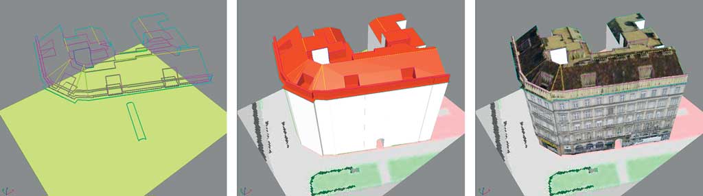
The three-dimensional model of the City of Vienna currently consists of a multipurpose digital city map known as MehrZweckKarte (MZK), a digital terrain model, several hundred thousand three-dimensional buildings, and an underground train network. The digital city map and terrain model are managed in ArcSDE. The three-dimensional buildings and the underground train system are modeled and managed in the CityGRID system from Geodata IT GmbH. Esri's multipatch data format allows three-dimensional models to be accessed using ArcSDE. Multipatch is a shape type stored in an Esri shapefile that uses a type of geometry to represent the outer surface of features that occupy a discrete area or volume in three-dimensional space.
The City of Vienna also uses ArcSDE to manage elements of MZK, the digital terrain model, and the supply line cadastre. This 2.5-dimensional geodata is mainly used in ArcGIS. Presently, approximately 100 workstations are equipped with ArcGIS. The city's geoinformation technicians wanted a three-dimensional solution for buildings and subterranean structures that was compatible with the existing system. The CityGRID system (www.citygrid.at) was the solution. This system was implemented in several stages beginning in 2003. Using this system, geodata is topologically processed and the result saved in a three-dimensional database so that modeled objects can be continuously updated. Generating the City ModelIn the first phase, the aboveground roof scenery of the city model was established by completing the existing geodata using photogrammetric aerial restitution. This task required only two employees from the surveying department. In contrast, the tasks associated with MZK
At the same time, the city's 500,000 buildings represented by simplified flat roof models and 25,000 buildings represented by detailed roof shape models were available. On demand, the roof shape models in a scene can be textured quickly using photographs that were taken on the ground. In 2005, an ArcGIS interface was developed. Using this interface, various items can be derived including
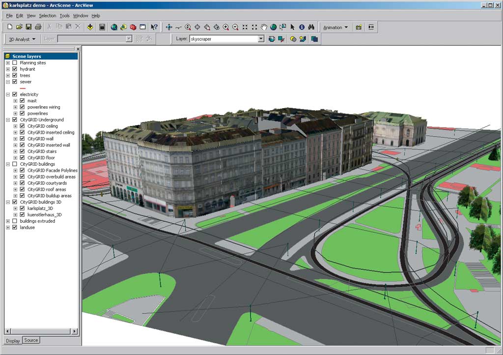
The city model can be used with the two-dimensional geodata in ArcGIS and three-dimensional data in ArcScene and ArcGlobe. Using the City Model for Noise Protection
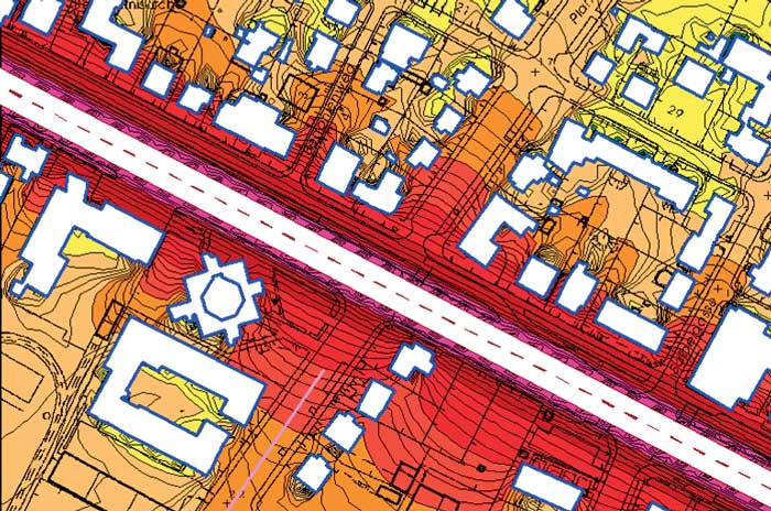
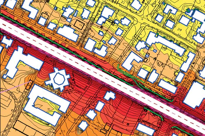
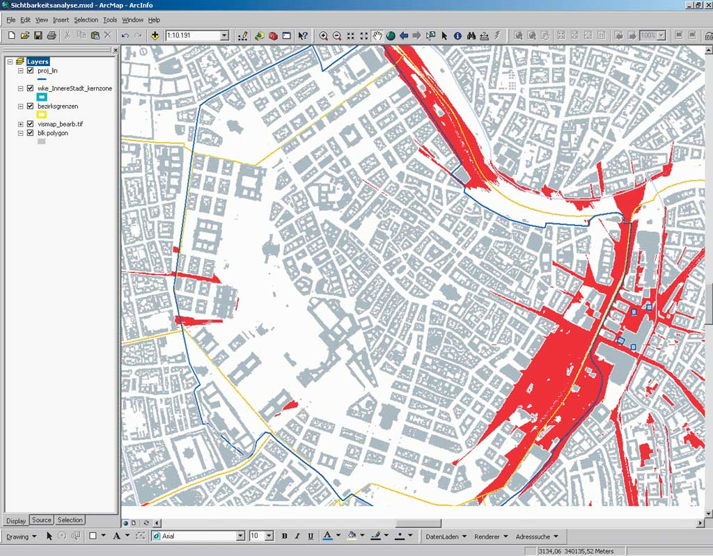
The aboveground three-dimensional city model is used primarily by noise protection officials and city planners. The entire city model is required for simulating noise propagation over a wide area. The city's noise protection departments are responsible for documenting existing noise pollution in noise maps and simulating the effect of building restrictions and protection measures. Topography and buildings affect noise propagation. A three-dimensional model of the city is therefore essential for calculating noise pollution in a city. For a typical noise protection department project, using the city model represents a time savings of more than 90 percent as compared with the time needed for preparing the geometric input needed when calculating noise using an expert system.
When using three-dimensional data as input to noise protection systems, the city model must be provided as a block model in shapefile format. A simplified roof can be included as a prism on top of the building if attribute information on the average height of the eaves and ridge height is available. Information on road areas and areas with foliage is stored in MZK. This is used to identify differences in acoustical absorption for these areas. Continued on page 2 |