July - September 2006
July - September 2006 |
||||||||
|
|
||||||||
The San Francisco Public Utilities Commission (SFPUC) has launched a major program called Only Rain Down the Drain that seeks to reduce these pollutants at their sources through a series of public outreach, inspection, and monitoring initiatives. Educating residents on the importance of keeping contaminants out of the storm water system is a key aspect of the program that SFPUC coordinates and implements using mobile GIS technology. The majority of San Francisco's 20,000 street drains are actually catch basins connected to a combined sewer system. There storm water and sanitary wastewater flow into common pipes that are routed to treatment plants. A catch basin is equipped with a sump, or deep pit, designed to trap heavy debris such as leaves, sticks, grease and other potential pollutants and keep them from reaching the treatment plant. City workers clear the sumps on a regular basis. "It's far less expensive to trap pollutants at the catch basin than it is to separate them at the treatment plant," said Lewis Harrison, SFPUC's Water Pollution Prevention program manager. Harrison explained that a smaller number of street drains in the city carry storm water directly to streams and rivers and, eventually, to the San Francisco Bay. Pollutants that get into these storm drains inflict greater damage to the environment because the contaminated water passes through the pipes completely untreated. In both cases�catch basins and storm drains�SFPUC wants citizens to understand the serious consequences of dumping anything other than rainwater into them. Adopting Mobile GIS TechnologyIn early 2005, SFPUC began installing plastic curb markers on every catch basin and storm drain. The markers read, "No Dumping: Only Rain Down the Drain," and include a phone number that residents could call to report illegal dumping or drain backups. Prior to this program, SFPUC had made the decision to leverage its enterprise GIS with mobile technology. The curb marker program presented SFPUC with its first opportunity to take GIS into the field.
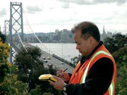
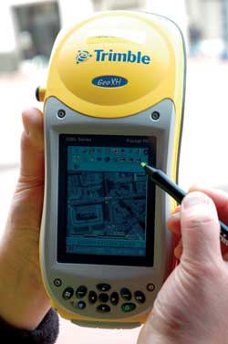
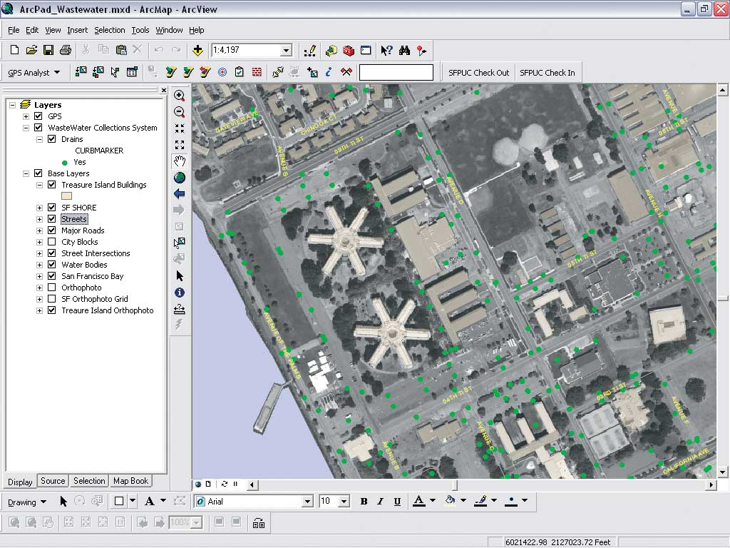
SFPUC maintains an enterprise GIS running on ArcGIS and ArcSDE and uses ArcIMS to extend its 200-plus layers of data to personnel working at facilities across the city. Many offices and departments within the commission perform planning and management operations in the GIS environment. SFPUC wanted to expand the digital workflow to include field activities as well. Esri business partner VESTRA Resources of Redding, California, supplied a complete mobile GIS package that included Trimble GeoXH and GeoXT integrated handheld GPS data collection receivers running ArcPad and Trimble's GPScorrect Extension for Esri's ArcPad software support. In addition, VESTRA recommended the purchase of the Trimble GPS Analyst extension for ArcGIS to create a seamless workflow between the enterprise geodatabase and handhelds in the field. Mobile GIS technology was selected because it offers the potential to improve operational efficiencies in two ways. First, field crews can take digital data, including location maps and infrastructure schematics, with them into the field on the handheld GPS devices. This helps field crews find features quickly and look at digital reference documents on-screen to get work done more rapidly. Second, field crews can enter notes on the condition of infrastructure and note storm drains that are damaged or need cleaning. Entering this information electronically in a mobile GIS device and uploading it later into the enterprise GIS allows for automatic generation of work orders that get maintenance performed right away. "SFPUC realized the value of GIS-enabling field crews, having them verify features in the field while they are physically standing in front of the asset and entering that information into ArcPad software. This is a big advantage to have data created digitally instead of using paper notebooks and having to perform data entry back at the office," said John Jarnagin, who was a GIS analyst for VESTRA and the project manager at the time. (He is now with Azteca Systems.) "Everyone agreed it would be beneficial for crews to electronically flag an asset in the GIS data so the appropriate department could take a look at a potential problem." SFPUC purchased six Trimble handhelds that could be shared among multiple bureaus. The decision was made to use the handhelds to manage the placement of the curb markers and inventory the location and condition of the storm water collection system. Accurate location coordinates had never been mapped for the catch basins and storm drains. Through the new program, having this information in the GIS enables the city to more easily find the exact storm drain where illegal dumping has been reported. Mapping Curb MarkersVESTRA suggested SFPUC adopt a new approach to GIS data management to safeguard data integrity in the era of mobile GIS applications. "With so many people accessing the GIS data, we suggested that each department select a data steward who is solely responsible for managing the
In the curb marker program, the SFPUC Wastewater Enterprise Collection Services Division (CSD) typically performs marker installation, inspections, and field data collection. Before each day's work, the CSD data steward uses the GPS Analyst extension within ArcGIS to define the geographic area assigned to the field crew and clips out the relevant data layers for loading into the handheld. Continued on page 2 |