July - September 2007
July - September 2007 |
||||||||
|
|
||||||||
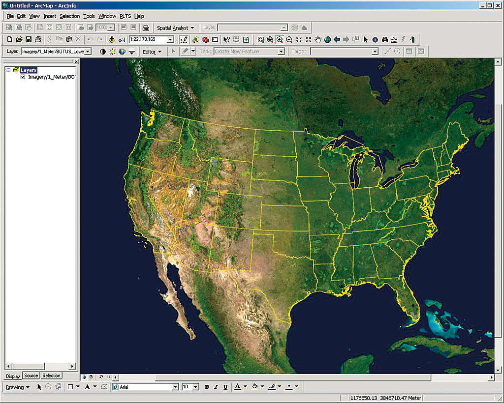
For years, the United States Department of Agriculture (USDA) Forest Service struggled to provide its 10,000 GIS software users, located in offices across the nation, with the imagery they needed. To improve the delivery of imagery, the Forest Service recently implemented ArcGIS Image Server. Now imagery can be delivered to regional, forest, and field offices within seconds. Prior to the ArcGIS Image Server implementation, the Forest Service had limited imagery that included Landsat satellite imagery and digital orthophoto quadrangle (DOQ) imagery of Forest Service land and digital elevation models (DEMs). Each of the nine regions was responsible for getting imagery of its own area and managing it, and some offices did not have the resources to obtain this imagery. "We had some people who were managing well, while others starved," said Mike Morrison of the Forest Service. "We were looking for something that would move us up to an enterprise-level imagery management system. We wanted to resolve storage management problems and be able to very quickly stream imagery to field offices. That's when we started looking at ArcGIS Image Server."
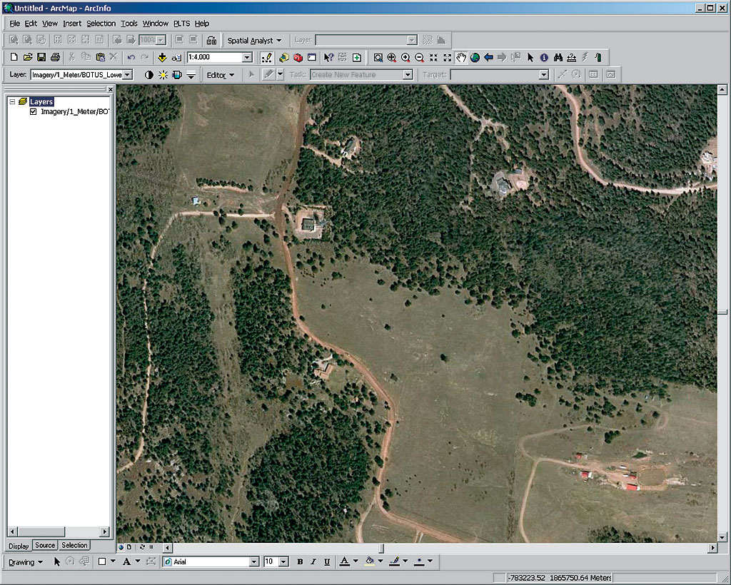
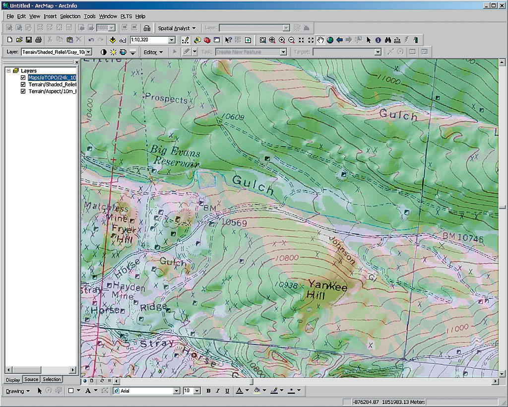
Making the imagery accessible to staff in the regions had been the greatest challenge the Forest Service faced. Many staff members lacked sufficient storage capacity. Those who were able to load imagery into their computers via hard discs or CDs often had to immediately remove it after viewing. Now, the agency can quickly and seamlessly serve large amounts of imagery throughout its enterprise via an intranet, eliminating the need for users to download large files to their computers. The ArcGIS Image Server implementation is in Salt Lake City, Utah, at the Forest Service's Remote Sensing Applications Center (RSAC) where Morrison, the training and technology awareness program leader for RSAC, manages the image software program deployment for the Forest Service. Now Serving New Imagery OnlineWith its new GIS server-based technology, the Forest Service now provides four main types of image services: NationWide Select, eTOPO, Forest Service Regions, and shaded relief. There are approximately 28 image services that are published via ArcGIS Image Server. NationWide Select image service has the most recent, high-resolution 1-meter orthophotography available for the lower 48 states. This service utilizes overviews of eSAT 15-meter satellite imagery from Esri business partner i-cubed along with Moderate Resolution Imaging Spectroradiometer (MODIS) satellite imagery from the National Aeronautics and Space Administration (NASA). Also from i-cubed, eTOPO provides enhanced digital topographic raster maps at varied scales. Additionally, the Forest Service is using i-cubed's DataDoors archival and retrieval software to expedite imagery processing and delivery. The Forest Service Regions image service includes a soft-copy primary base series, which is a georeferenced raster image of the Forest Service topographic map and digital raster graphics (DRGs). These datasets are at 1:24,000 scale and are available for the areas the Forest Service administers. The Regions image service also includes the secondary base series (Forest Visitor Maps); both products are produced by the Forest Service's Geospatial Service and Technology Center (GSTC). The shaded relief image service includes DEMs of various parts of the United States at 10-, 30-, 60-, and 200-meter resolution (depending on location). This data, when combined with other imagery, enables users to create three-dimensional effects.
The Forest Service's most popular imagery is 1-meter color National Agricultural Imagery Program (NAIP) imagery. After some additional processing, this high-quality imagery is included in the NationWide Select imagery from i-cubed and allows users to easily detect changes in landscapes. Users typically view imagery using ArcGIS Desktop although some consume it as a Web Map Service (WMS). A Ripple EffectIn addition to dramatically enhancing its delivery of imagery to field offices, the Forest Service has improved collaborative planning and information sharing with other agencies. Historically, the agency obtained mapping data and aerial photography of Forest Service lands but that data stopped at agency boundaries, which often caused problems when joint planning projects were undertaken with other agencies. Now, those agencies can access the image data for not only Forest Service land but also for land beyond those borders. In Oregon, the Service First partnership with the Bureau of Land Management is an example of this kind of project. GIS-based server technology has provided cost savings across agencies and standards at a multiscale level. Just as the Forest Service is feeding imagery down to the local level, regional offices are now feeding their unique imagery up to the Forest Service to enhance the imagery data at the RSAC level. One of ArcGIS Image Server's unique features is the ease with which it facilitates integrating new imagery into existing services. "ArcGIS Image Server meets our main goal of creating and maintaining a seamless one-meter product that covers all of the ground in the lower 48 states and parts of Alaska at a different resolution," says Morrison. "It allowed us to get the areas we manage, as well as adjacent areas that are beyond our land, into a system that was easily accessible by our users. We're really pleased with that." For more information about this implementation, contact Bentley Patterson, Esri, at bpatterson@esri.com or 303-449-7779, ext. 8251. |