ArcUser
Fall 2011 Edition
A Foundation for Ocean GIS
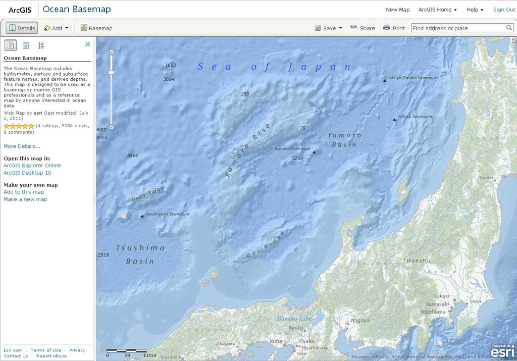
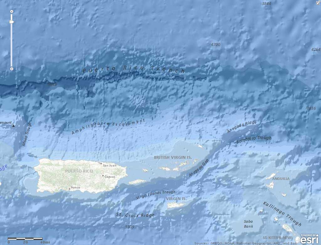
The Ocean Basemap contains more information about the ocean than any existing terrestrial basemap service, including bathymetric data, marine water body names, undersea feature names, and derived depth values in meters.
Esri creates ocean basemap service
This article as a PDF.
On World Hydrography Day 2011, Esri officially released the world's first ocean basemap as a cached map service available on ArcGIS Online. The first basemap of its kind, the Ocean Basemap was designed by Esri to support a variety of maritime and hydrographic GIS applications. Esri maritime managers Beata Van Esch and Rafael Ponce recently sat down with Esri's Matthew DeMeritt to discuss the importance of the basemap and how the data in it was obtained.
Matthew DeMeritt: What specifically is the Ocean Basemap, and what kind of data does it contain?
Beata Van Esch: The Ocean Basemap is a free map service at ArcGIS Online designed to be used by marine GIS professionals and as a reference map by anyone interested in ocean data. Think of it as the negative of a land map—a basemap of the coastal regions and ocean seafloor rather than dry land masses. It contains more information about the ocean than any existing terrestrial basemap service, including bathymetric data, marine water body names, undersea feature names, and derived depth values in meters. Much of the detailed data is along the coastal regions, which are the most surveyed parts of the ocean. Generally, the data gradually gets coarser the farther you venture into the ocean.
Rafael Ponce: Because most of the world's oceans remain poorly surveyed, the main need for the data is around the coasts, where human activity and commerce are concentrated. What we want to do is represent that small percentage of mostly coastal data—but also deeper areas—as accurately as possible.
DeMeritt: There are many basemaps for terrestrial GIS, such as topo, aerial, and streets, and yet there are so many maritime fields that use GIS as well.
Ponce: Yes, with the oceans covering so much of the earth, you can imagine all the potential applicability of GIS to the ocean. Ocean GIS is integral to oceanography and hydrography and very important to any other science that interacts with the ocean. In fact, it's just as important in resource exploration and extraction as land GIS. Oil and gas, for example, aren't just located in the crust on dry land but are just as abundant in the continental shelf under the seabed off the coasts. This becomes even more relevant if you consider the rights over natural resources in the subsoil that gives the UN [United Nations] Law of the Sea in the extended continental shelf. In marine geology, it's just as crucial a tool as land GIS is to terrestrial geology. That's one of the main reasons we wanted to create a comprehensive backdrop of the ocean. It was long overdue. You see, for example, that NOAA [the National Oceanic and Atmospheric Administration] incorporated the service into its National Geophysical Data Center map viewer soon after we released it.
"Anyone can begin using the Ocean Basemap by simply going to arcgis.com and choosing it from the Basemap Gallery for display in the ArcGIS Online map viewer.
DeMeritt: When did the subject of an ocean basemap come up in your department?
Ponce: We began thinking about it seriously when Esri created the Community Maps program and we saw the success of that project. We thought, "Why not have something similar for the marine community?" We had the technology in place to develop and promote such a basemap to be used by the hydrographic and maritime communities, so it just made sense.
Right now, we have built the basemap at the global scale. As we go into the national and local levels, that's where we seek contributions. Esri has built a foundation for developing that kind of comprehensive, information-rich basemap. For that, we require authoritative content. We want to approach hydrographic offices around the world, mainly because they officially produce bathymetric information. Of course, we have other institutions, universities, and research institutes that also produce bathymetric data. Their data is important, too, but we mainly want that quality-checked data from national hydrographic offices. Sometimes you receive a lot of data from a research institute or a research vessel, but because their main objective isn't collecting bathymetry, it can have gaps or what we call noise. You have to consider many different aspects to correct the depth measurements such as sound velocities that bend the signal. The temperature across the water column must be measured to straighten it out and make it perfectly vertical. Hydrographic offices rigorously make those corrections and calculations.
DeMeritt: What does putting together a project like this entail?
Van Esch: First, we want to be sure we're getting authoritative data, and second, we've got the proper permissions in place to use the data. On the production side, we've got cartographers working on the construction of the map, adding data as it comes in. As the project manager, I work to ensure we meet the product's objectives and that we stay on task and on schedule with our next release.
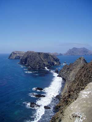
Much of the detailed data in the Ocean Basemap is located along the coastal regions, which are the most surveyed parts of the ocean. Shown here: The shoreline on East Anacapa Island off the California coast. (Photograph courtesy of NOAA/Claire Fackler, CINMS)
Ponce: As adviser and stakeholder, I preside over the map's development. I also draft value propositions for hydrographic offices so they can see the benefit of contributing their data. Understandably, they don't want to share it so easily. Many hydrographic offices belong to the military and produce classified information. We legally assure them that we are not going to share it with anybody and we are not going to make the actual data available to the public. The information in the Ocean Basemap isn't something users can query; it's simply a cached cartographic representation of the seabed to be used as a basemap. It's not vector data that they can use. At the same time, we want to enable potential users or actual users of this data to retrieve the source and perhaps contact them directly if they want to work with the actual data. In the end, the Ocean Basemap helps promote the services of hydrographic offices when users realize they might need to perform deeper analysis on actual datasets.
DeMeritt: How can people start using the Ocean Basemap?
Ponce: Anyone who wants to make maps using the Ocean Basemap can go to arcgis.com and call it up in the ArcGIS Online map viewer. It's in the Basemap Gallery along with the terrestrial backdrops.
DeMeritt: What future plans does Esri have for the Ocean Basemap?
Van Esch: For our next release, we plan to have 500k [500,000] down to 72k [72,000] to enhance what we already have available in US waters, and further in the large scales, off the west coast of the US. From there, depending on the timing of the contributors, we would like to incorporate more detailed ocean content in other parts of the world.