October - December 2002
October - December 2002 |
||||||||
|
|
||||||||
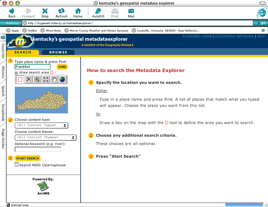
Over the past few years there was much discussion regarding the establishment of a Kentucky geospatial data clearinghouse but most implementation options were resource intensive, not dynamic, and offered little in terms of user experience. Representatives from the Governor's Office of Technology and the Kentucky Geographic Information Advisory Council (GIAC) recognized the need to make the clearinghouse a reality. In April of 2002, a core group consisting of KYOGI, KGS, WRIS, and NREPC met to discuss what it would take to make a clearinghouse happen. Collectively, they decided that ArcIMS Metadata Services, newly available with the release of ArcIMS 4, should be leveraged to establish a clearinghouse. Several state agencies were actively maintaining metadata for the geospatial data available on the Web, and much of this work was being done using the ArcCatalog application in ArcGIS and other FGDC-compliant metadata tools. In addition, there were several ArcIMS services up and running and a wide array of static map images that could be included. Bringing all this rich content together under one metadata service was the solution and Kentucky's Geography Network (KYGEONET) was born. Once Esri's St. Louis regional office learned the Commonwealth wanted to expand data sharing using ArcIMS Metadata Services, Esri offered the on-site technical staff who would assist in setting up services. In preparation, ArcIMS 4 and ArcSDE 8.2 were loaded on dedicated Compaq ProLiant servers running Microsoft IIS 4.0 and Microsoft SQL Server 7.0. An introductory Web page at http://kygeonet.ky.gov/ that greets visitors to the site and acts as a front end to the Metadata Explorer Web page (http://kygeonet.ky.gov/metadataexplorer/) was designed.The required SDE instance was created and Metadata Services were started in ArcIMS 4. KYGEONET was up and running! During the last week of May, Esri staff helped set up the Metadata Explorer JavaServer Pages (JSP) application and customized the gazetteer service specifically for Kentucky. Customizing the Metadata Explorer application so that it had a Kentucky flavor was simple. Using Adobe Photoshop 7 and Macromedia FreeHand 10, appropriate graphics were designed and alterations to the JSP pages were made using Macromedia Dreamweaver MX. These changes gave the site a Kentucky identity without compromising functionality. At this point, KYGEONET was registered with the Geography Network (http://www.geographynetwork.com/). The site was eventually selected as a featured clearinghouse site. A user guide containing information on publishing to KYGEONET is available as an Adobe portable document format (PDF) file to interested parties. After reviewing the guide, users remotely connect to the metadata server using ArcCatalog 8.2, locally select the item to publish, review the metadata to ensure all required fields have been populated, make a thumbnail image using a tool available at the site, and simply copy the item to the appropriate content theme folder on the metadata server. The service parses a subset of the metadata XML file to perform a validation on required fields and keywords prior to being written to the metadata SDE instance. Indexing occurs each time an item is published to the service. Most issues that publishers have encountered relate to errors that occur when entering keywords or geographic extent values.
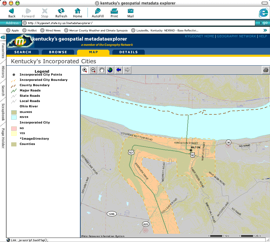
Within four hours, 12 items were published to the service-four ArcIMS services with associated HTML viewers and eight downloadable datasets. By the end of the following week 44 items were available and several state, regional, and local agencies had committed to becoming publishers. By mid-July, more than 70 items were available including a growing number of static map images. Now, a wealth of geographic information can be located using the Metadata Explorer Web page to search by keywords, geographic extents within Kentucky, content type, and content theme. In late July, a press release by the Governor's office formally unveiled the Kentucky Geography Network. Media coverage raised awareness of the site, and citizens, educational institutions, professionals in many disciplines, and anyone interested in the unique geography of Kentucky were invited to explore its contents. At a presentation made on August 13, 2002, at the annual Kentucky GIS Conference, an invitation was extended to the entire GIS community to publish items to the site. The reception was overwhelming! An important note is that all publishers to the KYGEONET maintain their own Web pages and/or FTP sites for distribution of data and detailed metadata. This gives publishers control of both the data and metadata components current at their own site, with their own identity, and under their own direction. A public FTP server donated to KYGEONET by the Kentucky Department for Fish and Wildlife hosts data for cities, counties, educational institutions, state agencies, and other entities that don't have data serving capabilities. Esri's St. Louis regional office staff are pleased they were able to help implement KYGEONET. "We are very excited about the KYGEONET Web site. It represents the culmination of years of database investment by the Commonwealth of Kentucky that is now being shared with the citizens of the state via this portal. This framework for sharing geographic information eliminates enormous duplication and redundancy and ensures that the information needed for GIS applications across the state is up to date and well documented. We are very pleased that Kentucky is taking a leadership role in providing public access to these rich data resources," said Stephen Kinzy, regional manager for Esri-St. Louis. Kentucky is now positioned to expand data sharing to many levels through the use of ArcIMS Metadata Services. There is a growing and committed publishing community, many interested parties utilizing the service, and best of all (from a GIS user perspective) doing metadata is now much less painful and the results are rewarding for all! For more information, please contact
Kentucky Water Resource Information System 375 Versailles Road Frankfort, Kentucky 40601 Tel.: 502-573-0260 Fax: 502-573-0157 Web: kent.anness@mail.state.ky.us |