October - December 2002
October - December 2002 |
||||||||
|
|
||||||||
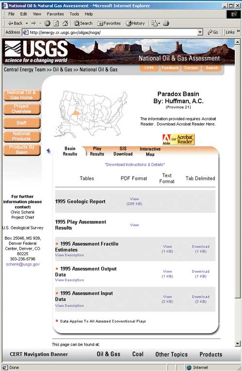
The U.S. Geological Survey (USGS) Central Energy Resources Team (CERT) in Denver, Colorado, is providing National Oil and Gas Assessment (NOGA) results online. High demand for the 1995 National Oil and Gas Assessment results and the fact that it is the first entirely digital comprehensive oil and gas domestic assessment available prompted CERT to develop a Web site to deliver the oil and gas plays, cells, tables, and geologic reports to the public. NOGA Online includes an ArcIMS application that allows interactive viewing of the assessment data and results. CERT has begun the process of reassessing oil and natural gas resources of priority basins in the United States. New assessment results will be made available at this site on an ongoing basis. The USGS is a world leader in the natural sciences demonstrating both scientific excellence and responsiveness to society's needs. The USGS Energy Program serves the United States interests by providing reliable scientific information that aids in the management of energy resources. Research is conducted to assess the energy resources of the U.S. and the world. One of CERT's major objectives is to evaluate and develop science-based assessment methodologies and, using these methods, produce assessments of domestic oil, gas, and coal resources. National Assessment Background InformationIn 1995, the USGS completed the National Assessment of Oil and Gas Resources. This assessment scientifically estimated the amount of oil and gas that could be added to U.S. proved reserves. It consists of a set of conclusions based on the best information and theory available to the USGS for onshore areas and beneath State waters. For this national assessment, resources and potential reserve additions were evaluated regardless of political or economic considerations. The 1995 National Assessment of Oil and Gas Resources is the first comprehensive domestic assessment available in digital format. The first version was published on CD-ROM in 1995. An updated CD-ROM was released in 1996. The terminology used in the 1995 National Oil and Gas Assessment and the NOGA Online Web site is intended to represent standard definitions and usage of the oil and natural gas industry and the resource-assessment community and is briefly defined in the accompanying article, "NOGA Terminology." Within the last year, CERT made all 1995 NOGA data and geologic reports accessible through the NOGA pages at the CERT Internet Web site. NOGA OnlineAssessment data can be retrieved from the Internet Map Application and other Web pages by selecting a province from the NOGA home page using the map interface or pulldown menu. NOGA Online provides nearly 5,000 datasets for viewing, downloading, and interactive analysis. ArcIMS ApplicationIn addition to reports, tables, maps, and downloadable data, users can analyze the assessment data via the Interactive Map Application developed using ArcIMS. The NOGA Online map application is a single interface that provides the following:
As of May 2002, NOGA Online provides map services for 38 provinces (basins); additional data from the 1995 Oil and Gas Assessment are being processed into interactive map services and will be provided upon completion. The NOGA home page provides links to the Internet Map Application page and any of the province pages. Clicking on the Internet Map Application link opens a page that allows the user to choose a province map from a pulldown menu. The Interactive Map Application utilizes ArcIMS tools that allow users to
Within the map application, the user can access related information from drop-down menus or open another map. By clicking on the Get Assessment Results drop-down menu, the user can view the geologic report and assessment results tables within the map application as PDFs, text, or downloadable tab-delimited files. The Additional Maps drop-down menu lists all provinces currently available as Internet Map Services. The user can access another province by selecting it from the list or can retrieve information associated with layers such as the play assessment results, GIS data, or metadata. There are also links to the sources of the base cartographic layers. Continued on page 2 |