October - December 2006
October - December 2006 |
||||||||
|
|
||||||||
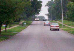
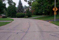
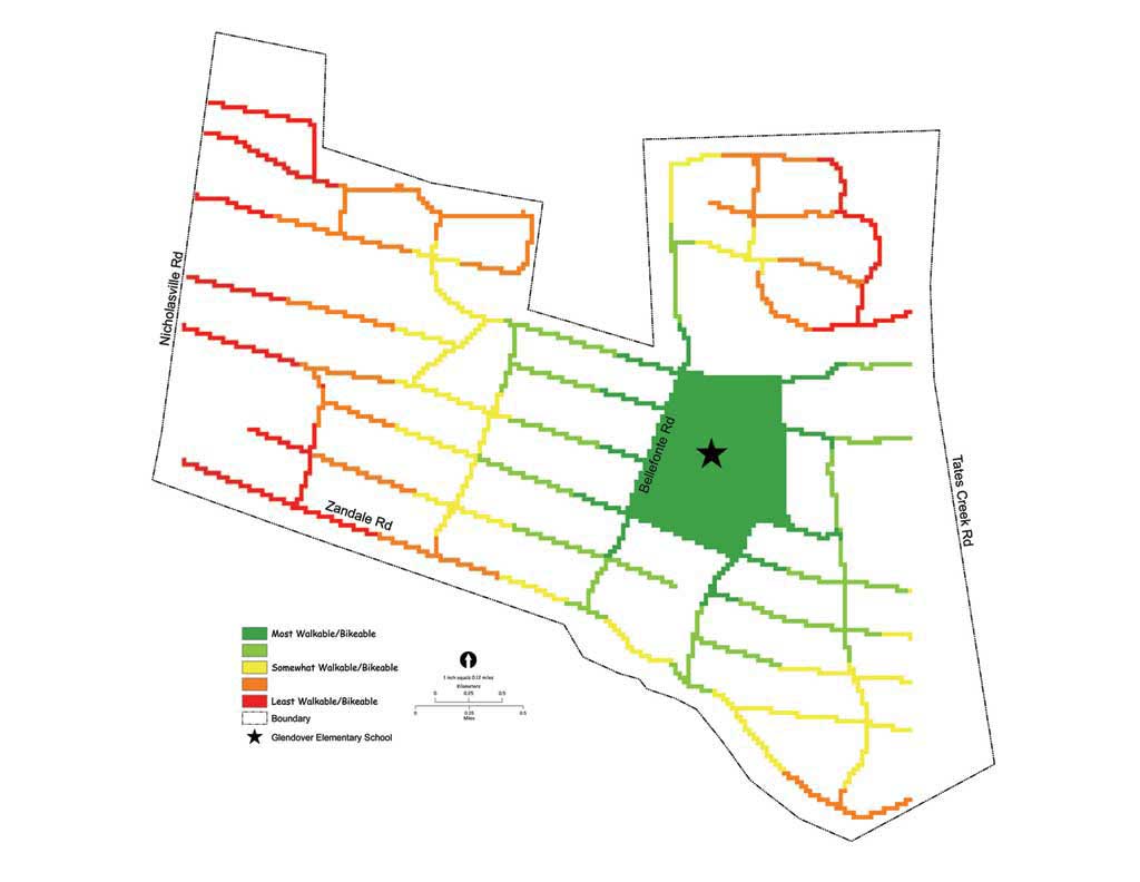
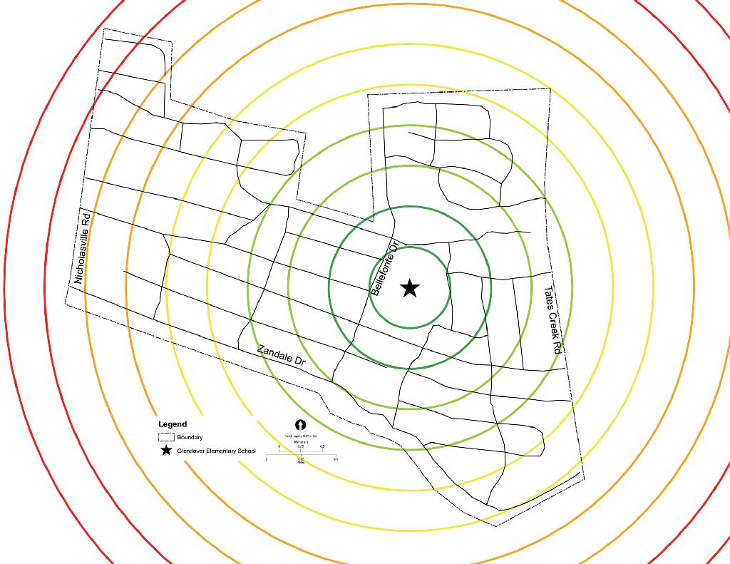
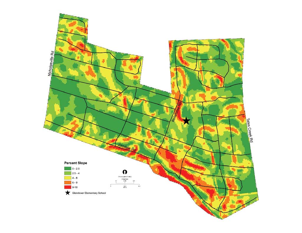
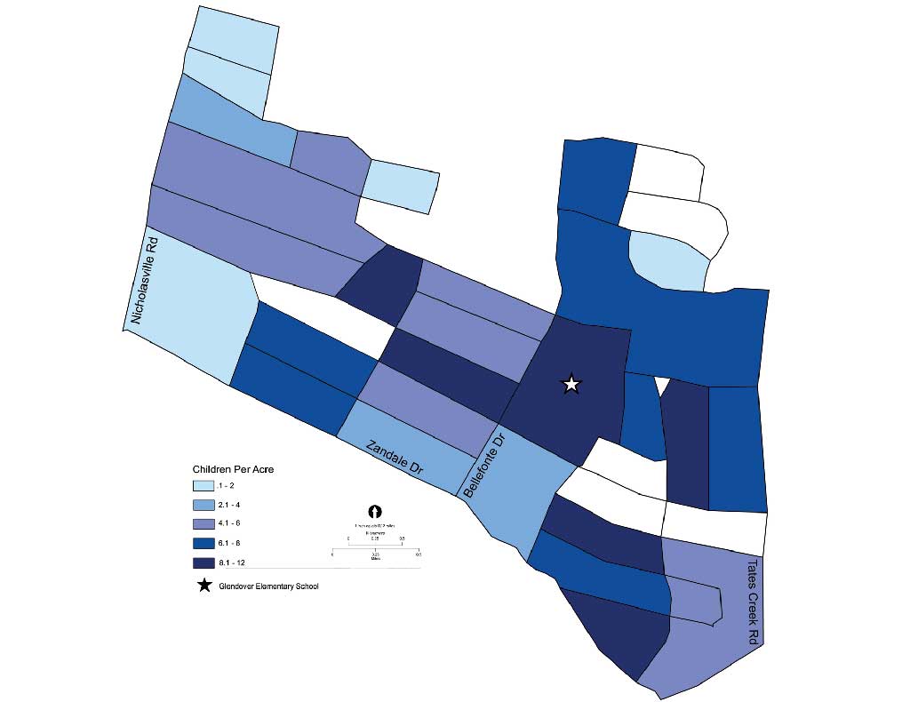
By applying GIS analysis, University of Kentucky undergraduate landscape architecture students have found ways to make it safer and easier for children to walk to school. Concerns with the growing childhood obesity epidemic, increased costs in driving children to school, and fostering the perception that it is more normal to drive rather than to walk to destinations have made walking to school an issue. With ArcView 9.1 and the ArcGIS Spatial Analyst extension, these students identified dangerous walking and bicycling areas, proposed design safety solutions, and evaluated alternatives for improving adverse conditions. The immediate safety, as well as the long-term health, of children walking to and from schools has become an important topic of discussion in communities. The doubling of the childhood obesity rate over the past 30 years has raised concerns about short- and long-term health costs. The Centers for Disease Control and Prevention and the Dietary Guidelines for Americans 2005 recommend that children and adolescents frequently participate in at least 60 minutes of moderate-intensity physical activity, preferably on a daily basis. A short recess period during school does not provide enough physical activity for a growing child. One way to increase physical activity is to incorporate it into the child's daily school commute. However, neighborhoods have often been designed with the automobile exclusively in mind. Consequently, children walking or bicycling to school is not always a safe alternative to the car or school bus. Project DescriptionDuring four weeks in fall 2005, a team of five undergraduate landscape architecture students started a project to learn how suitable a neighborhood was to children walking or riding a bike (i.e., walkability and/or bikeability). They conducted a walkability/bikeability audit of an existing neighborhood that was used in developing and evaluating design options that would increase the overall walkability and bikeability of the neighborhood. The study area location covered approximately .60 square miles and contained neighborhoods built from the early 1900s through the 1960s. Arterial roads bound the study area on two sides and have religious and commercial land uses. A collector road on the third side has mostly residential land use, while the fourth side is bordered by an arboretum and residential facilities for the University of Kentucky. The study area destination was an elementary school located near the center of the study area.
From a teaching standpoint, this is a particularly good location for the project. It was developed over several decades spanning World War II and provides opportunities to see how planning attitudes toward vehicular and nonvehicular transportation have been manifested in the landscape. Typically, older neighborhoods have sidewalks on both sides of narrower streets with smaller intersections and no cul-de-sacs, while areas built more recently have wider streets, no sidewalks, and a nonconnecting street pattern. Walkability and Bikeability AuditInitially, team members held a brainstorming session to consider what makes a neighborhood walkable and bikeable. As young designers, students are encouraged to draw upon their own experiences when approaching design issues. After developing an initial list of ideas, the team assigned readings and performed an independent literature review to investigate how other people and organizations have approached similar studies. The team developed a neighborhood audit for streets and intersections that used the Likert Scale rating system. A Likert Scale is a qualitative rating system that is often used to measure judgments. Ratings are indicated along a continuum, in this case on a scale of 1 through 5, indicating the quality of the street or intersection in terms of safety or ease of movement.
Each street segment and intersection was assigned a unique identification number and was rated for walkability and bikeability after on-site visual inspection. Basemaps were prepared from geospatial data available at no cost from the Kentucky Geography Network to aid in field data collection and subsequent analyses. After the study area was audited, a sample set of streets and intersections was audited again to test the reliability of the audit tool and the team's rating assignment consistency. One team member entered the ordinally scaled qualitative audit data as attributes for a shapefile. The shapefile was used for initial audit visualization and analysis. The hardware used for the data encoding and subsequent analysis was a Compaq laptop with a 2.4 Intel Celeron processor with 1,024 MB of RAM and a 40 GB hard drive. The laptop was configured with a dual screen for efficiency. The data was backed up and shared using a 120 GB external hard drive and the University of Kentucky's network and data servers. Continued on page 2 |